Low pressure appears near the East Sea

Thanh Hà |

The new low pressure near the East Sea appeared on the afternoon of March 25, the Philippine Atmospheric, Geophysical and Astronomical Services Administration (PAGASA) said.

The latest storm and low pressure information from PAGASA said that at 2:00 p.m. on March 25, local time, a new low pressure near the East Sea had formed within the Philippine Forecast Area (PAR).

According to available estimates, at 3:00 p.m. the same day, the new low pressure formed about 905 km east of southeast Mindanao, Philippines.

The US Navy's Joint Typhoon Warning Center (JTWC) said that the low pressure is named Invest 96W and is located southeast of Mindanao, Philippines.

JTWC forecasters said that the newly appeared low pressure is unlikely to strengthen into a storm within the next 24 hours. The current low pressure has a maximum sustained surface wind speed of about 30 km/h, with a minimum sea level pressure of nearly 1005 hPa.

Previously, in the storm forecast bulletin published on March 24 for the forecast period from March 24 to April 6, PAGASA stated that during the forecast period, there is no possibility of a tropical depression or storm in the PAGASA PMD forecast area.

Last week, PAGASA spokeswoman Ana Liza Solis said that there is a forecast of 0 to 1 tropical storm affecting the Philippines in April.

She also added that PAGASA forecasters said that there is a possibility of 8 to 14 storms appearing in the forecast period from April to September.

Of which, April 2025 is expected to have 0 to 1 storm, May is forecast to have 1 to 2 storms, while July, August and September are forecast to have 2 to 3 storms/month.

For the 2025 typhoon season, Solis said the number of typhoons is above average, between 16 and 19.

Cac nha du bao bao Philippines nhan dinh co the co 0 den 1 con bao hinh thanh trong thang 4 nam nay. Anh minh hoa: Xinhua
Philippine typhoon forecasters say there could be 0 to 1 typhoon forming in April this year. Illustrative photo: Xinhua

According to PAGASA, there are more tropical storms entering the Philippine PAR forecast area than any other place in the world. An average of 20 typhoons appear or enter the region each year, of which about 8 to 9 make landfall in the Philippines.

The peak of the Philippine typhoon season is from July to October, with nearly 70% of the typhoons forming during this period.

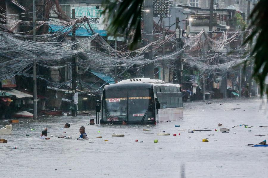
According to GMA Network, the 2024 typhoon season in the Philippines is an unprecedentedly intense typhoon season in history, with the emergence of 6 consecutive typhoons within 30 days.

Super typhoon Pepito (international name Man-yi) is the strongest of the year with peak winds of 195 km/h, making landfall in Panganiban, Catanduanes, Philippines on November 16, 2024.

This is the 24th storm of the season and the 6th to hit the Philippines in just one month, a clear difference from the average in November, which typically has just one super typhoon.

The intense phase of the 2024 typhoon season in the Philippines began with Typhoons Kristine (international name Trami) and Leon (international name Kong-rey) in late October 2024.

After that, a series of consecutive fierce storms appeared in November, Typhoon Marce (international name Yinxing) with strong winds of up to 240 km/h, super typhoon Ofel (international name Usagi) causing high tides and Typhoon Nika (international name Toraji) leading to very heavy rain.

Thanh Hà
RELATED NEWS

Forecast of the time when cold air will have the strongest impact

|

Strong cold air causing temperatures to drop sharply, strong winds of up to level 11 will end the heat wave in China.

The 2025 storm season is dominated by ENSO, an unpredictable trend

|

The number one storm of the 2025 Atlantic hurricane season will be named Andrea. Subsecutive storms are Barry, Chantal and Dexter.

Forecast of the possibility of low pressure near the Philippines strengthening into a storm

|

The latest storm forecast shows a low pressure area appearing near the Philippines from March 23.

Temporarily suspend tourism activities at Trang waterfall after tourist death

|

Phu Tho - Toan Thang commune authorities request the management unit to temporarily suspend tourism exploitation at Trang waterfall to review safety conditions.

Road congestion leading to the bridge in Da Nang, people face difficulties when traveling

|

Da Nang - Technical opening to traffic from the end of March 2025, but Quang Da bridge has not yet been able to operate due to congestion on the access road. Local people are worried about traffic unsafety.

Answer key for the English subject of the 2026 high school graduation exam, full set of exam codes

|

Suggested answers for the 2026 high school graduation exam in English are fully and detailedly updated on Lao Dong Newspaper. Readers are invited to watch.

Answer key for History subject of the 2026 high school graduation exam, full set of exam codes

|

Suggested answers for the full set of 48 History subject codes of the 2026 high school graduation exam are fully and quickly updated on Lao Dong Newspaper.

Thai Princess passes away after more than 3 years in a coma

|

Thai Princess Bajrakitiyabha, who was in a coma for more than 3 years, has passed away at the age of 47, according to the royal family's announcement.

Forecast of the time when cold air will have the strongest impact

Thanh Hà |

Strong cold air causing temperatures to drop sharply, strong winds of up to level 11 will end the heat wave in China.

The 2025 storm season is dominated by ENSO, an unpredictable trend

Thanh Hà |

The number one storm of the 2025 Atlantic hurricane season will be named Andrea. Subsecutive storms are Barry, Chantal and Dexter.

Forecast of the possibility of low pressure near the Philippines strengthening into a storm

Khánh Minh |

The latest storm forecast shows a low pressure area appearing near the Philippines from March 23.