
33 roads flooded after the biggest rain since the beginning of the year
The heavy rain on the evening of September 10th once again shows the increasing pressure on the HCMC drainage system.
According to the Traffic Management and Technical Infrastructure Center (Ho Chi Minh City Department of Construction), there are 33 roads and 2 areas flooded. Some sections of To Ngoc Van and Nguyen Duy Trinh streets are flooded 40-45cm deep.
In Thao Dien area and Thu Duc market area, many roads such as Quoc Huong, Duong Van Cam, Ho Van Tu are flooded about 30cm. The An Phu intersection underpass is flooded from 0.8 - 1m.
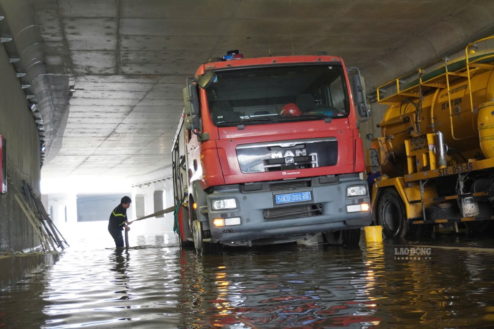
According to the Department of Construction, after expanding administrative boundaries, Ho Chi Minh City currently has 159 frequent flooding points, including 76 points in the old Ho Chi Minh City area, 52 points belonging to the old Binh Duong and 31 points belonging to the old Ba Ria - Vung Tau.
Low terrain, located in the downstream area
According to the Department of Construction, Ho Chi Minh City after the merger has an area of about 6,778km2, stretching from the high terrain area in the North to the low downstream area in the South and the estuary area.
In which, the old Ho Chi Minh City area has a low terrain, commonly from +0.5 to +1.6m; about 65 - 75% of the area is below elevation +1.5m.
This is the downstream area of the Saigon - Dong Nai river system, with a dense network of rivers, canals, and ditches and affected by East Sea tides. Therefore, the city not only has to drain rainwater but also bear pressure from upstream flows and tides.
Urbanization loses water storage space
The rapid urbanization process is causing natural soil to increasingly be replaced by roads, houses and works. The increased area of concretization means that rainwater is difficult to penetrate the soil, quickly becoming surface flow and concentrated in sewers and canals.
Leveling the water surface, narrowing canals and raising the foundation locally also changes the flow direction, causing water to concentrate faster in low-lying areas.
Subsidence causes the city to gradually sink
According to the Department of Construction, the old Ho Chi Minh City area has an average subsidence rate of about 2cm/year; many places subside 2 - 5cm/year, some areas can reach 7 - 8cm/year. The total subsidence level is commonly 20 - 30cm in 10 - 12 years, some points exceed 50cm.
Lower ground reduces the slope so that water flows naturally to sewers and canals. Works that were once designed at a certain height are therefore gradually losing "room" to prevent flooding.
Extreme rain meets high tide
Heavy rain in a short time may exceed the designed capacity of the drainage system. Meanwhile, high tides reduce the drainage capacity to the river.
According to the Department of Construction, when the tide exceeds +1.80m at Phu An and Nha Be stations, water may flood the discharge gates. Therefore, in the same rain, if encountering high tide, the water will recede slower, causing deep and prolonged flooding.
Unsynchronized drainage system
Ho Chi Minh City currently has more than 7,200km of culverts, 319,000 manholes, 1,671 discharge gates, nearly 500 tide-preventing valves and about 971km of canals and ditches.
However, the system is formed through many stages, with different standards and scales. In some places, the main culvert has been renovated but the branch culvert has not met the requirements; there are new canals built in sections; discharge gates and tide control works are not always connected according to a complete basin.
Planning, investment and project progress have not kept up
Ho Chi Minh City has had drainage planning since 2001 and irrigation and tide control planning since 2008. Many projects have been effective, but many projects have been deployed for a long time or have not been completed throughout the route.
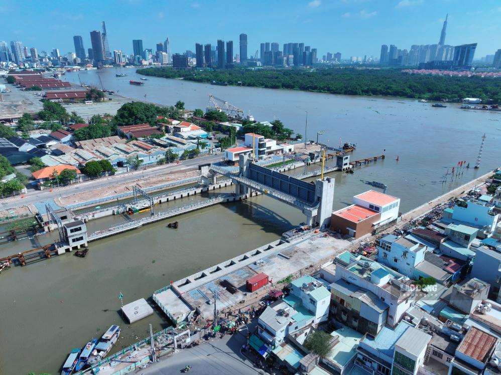
The nearly 10,000 billion VND tide prevention project with 6 large culverts is an example. The project is expected to protect about 570km2, but the progress is prolonged, and some items are still unfinished.
Meanwhile, local budget sources, according to the assessment of the Department of Construction, only meet about 30% of investment needs. Limited resources make it impossible to handle many "links" of the system simultaneously.
Management, operation and maintenance have not kept up
Drainage work involves many sectors and units; while data on rain, tides, canal water levels and project operation have not been fully connected in real time.
Along with that, garbage covering the mouths of sewers, canals and ditches, narrowed flows or degraded works also reduce drainage capacity.


