Air pollution is one of the urgent problems, many solutions have been proposed to help the air quality index reach the safe threshold. In particular, since September this year, the Department of Environment has coordinated with the National Telecommunications Administration to use unmanned aerial vehicles (UAVs) to monitor the situation of straw burning in the suburbs and spreading dust from large construction sites in Hanoi. The results were immediately transferred to the local authorities for handling and announcement on mass media.
The reporter had an interview with Mr. Vu Huu Liem - Director of the Center for Agricultural, Natural Resources and Environment Monitoring (National Telecommunications Administration, Ministry of Agriculture and Environment) about the operation of UAVs to detect pollution points.

Sir, air pollution in Hanoi in recent times has been assessed as quite serious. Recently, the National Telecommunications Administration has coordinated with the Department of Environment to deploy UAVs to monitor polluted spots. Can you share more about this method?
- Air pollution in Hanoi has been a hot issue in recent times, and has received great attention from society. In response to such an urgent request, the Ministry of Agriculture and Environment has assigned the Department of Environment as the focal point, coordinating with the National Telecommunications Administration to deploy the application of UAVs in monitoring pollution sources.
Our Agricultural, Natural Resources and Environment Monitoring Center participates in this mission with the strength of remote sensing technology, combined with UAV flight solutions - a technology that is quite new in Vietnam but has high practical application.
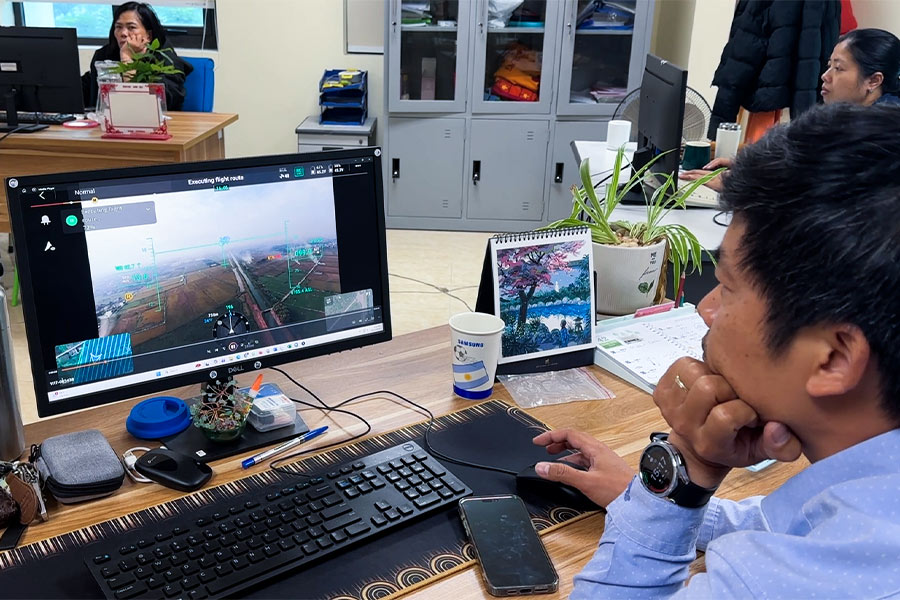
The UAV system is equipped through the Project "Enhancing the capacity to monitor resources and the environment", including drones and specialized data collection equipment.
How specifically were UAVs used in the recent air pollution monitoring, sir?
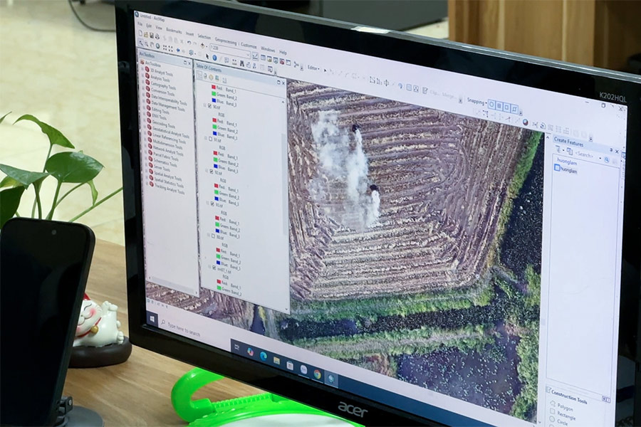
- We have used UAVs to monitor air pollution points due to straw burning, agricultural by-products burning, and spontaneous waste burning around the Hanoi area. According to statistics from the Department of Environment, there are three key areas that often generate smoke and dust, directly affecting residential areas and major traffic routes.
Combining satellite images for an overview, with UAVs will provide detailed images at the scene to help determine very accurately the location and time of pollution to provide timely information to the management agency.
Previously, we also applied UAVs to monitor water pollution in the Bac Hung Hai river system. However, air monitoring has other characteristics, requiring faster and more flexible handling.
How many UAVs does the Center currently have and how is the operation organized?
- Currently, the Center has a UAV system with photography flight equipment and Lidar scanning equipment. In particular, RGB photography flights are often used for their intuitiveness, energy saving, and are suitable for monitoring air pollution.
The flight crew consisted of 3 main operators and 2 supporting personnel. The flight time of each flight is about 3545 minutes, depending on weather conditions. We have arranged replacement batteries so that we can fly continuously in the form of a day roll.
However, flight operations depend largely on weather conditions and flight safety assurance. At some points, we have to temporarily suspend or wait for a license from the authorities on airspace management.
We organize flights during peak season when straw burning and bypass products occurred a lot. We combine investigation of the scene and flight to get accurate results to report to the authorities, thereby promoting air environment management in the recent past.
With the large amount of data collected, will the processing be difficult, sir?
- The amount of data is huge. Each flight can create thousands of photos, with a capacity of up to hundreds of GB. This requires strong data processing and computer infrastructure capabilities.
To serve the immediate management, we prioritize the quick extraction of images of typical polluted spots, along with local coordinates to immediately send to the Department of Environment. Deep processing and building specialized datasets require more time and resources.
Do UAVs need to install additional specialized sensors to monitor air pollution, sir?
- Currently, image collection using UAVs has met the requirements of monitoring emission sources quite well. However, in the future, if equipped with additional sensors such as infrared, heat sensors, and environmental sensors, we can detect combustion sources even after the fire is out, or monitor at night more effectively.
This is the direction we are researching, learning international experience to gradually improve the system.
Thank you for sharing!


