
In recent days, from early morning, many people in Xuan Mai commune have proactively brought land use right certificates, citizen identification cards and documents related to the cultural house to carry out data scanning and updates.
Under the guidance of professional staff, youth union members, village officials and support forces, the comparison, verification, and standardization of information are carried out quickly and conveniently.
According to the plan, the peak period will be implemented from July 15 to August 30, 2026, focusing on reviewing, collecting, standardizing, digitizing and updating cadastral records, land registration records, certificate issuance records, and land change records. At the same time, verifying land user information according to personal identification codes and updating data to the "digital land plot" platform. This is an important step to build a land database to ensure the criteria of "right - sufficient - clean - living", effectively serving state management and resolving administrative procedures on land in the coming time.
To ensure the implementation progress, Xuan Mai Commune People's Committee has mobilized the participation of the entire political system.
Working groups were established with the coordination of professional officials, village heads, youth union members, mass organizations and many forces being mobilized.
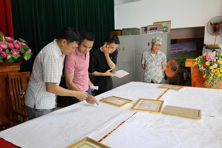
With the motto "going through each alley, knocking on each house, checking each plot", the working groups not only work at the village cultural houses but also directly go to each household to verify information, guide people to complete dossiers and update data.
In particular, for cases of elderly people, people with disabilities, sick people or those in special circumstances who cannot come to the village cultural house, working groups proactively go to their homes to support reviewing and updating information. This flexible approach both creates favorable conditions for people and ensures that no cases are missed in the data standardization process.
Through records in many villages, the majority of people expressed their agreement and support for the State's policy and highly appreciated the sense of responsibility of the team of officials and forces participating in the campaign. Being specifically guided right in residential areas helps people save time, reduce travel costs and easily complete missing information.
To make the campaign effective, Huong Son Commune People's Committee also requested households, individuals, organizations and businesses in the area to actively coordinate with working groups in the process of reviewing, collecting and updating land data.
Accordingly, land users need to proactively provide copies or create conditions for members of the working group to scan and photograph Certificates of Land Use Rights, Citizen Identity Cards and documents related to the origin of land use as required.
The full and timely coordination of people and organizations is identified as one of the important factors, contributing to ensuring the accuracy and synchronization of data after being updated to the system.
For land plots that have not been granted Land Use Right Certificates, the Commune People's Committee requests people to urgently carry out declaration and registration of land for the first time according to the guidance of professional officials.
At the same time, people are encouraged to use the VNeID application to provide information and photocopies of Land Use Right Certificates according to instructions, thereby contributing to shortening the time to collect dossiers and speeding up the process of digitizing land data in the area.
In the process of implementation, the commune's working groups will conduct reviews to ensure no cases are missed. All land plots in the area, including residential land, agricultural land and non-agricultural land, must be inspected, identified, positioned, and accurately identified, and fully updated on cadastral maps and land database systems.
According to the plan, the completion and cleaning of data for land plots with information in the database must be completed before July 30, 2026. For the remaining areas without data, the collection, review and update will be completed before August 30, 2026.


