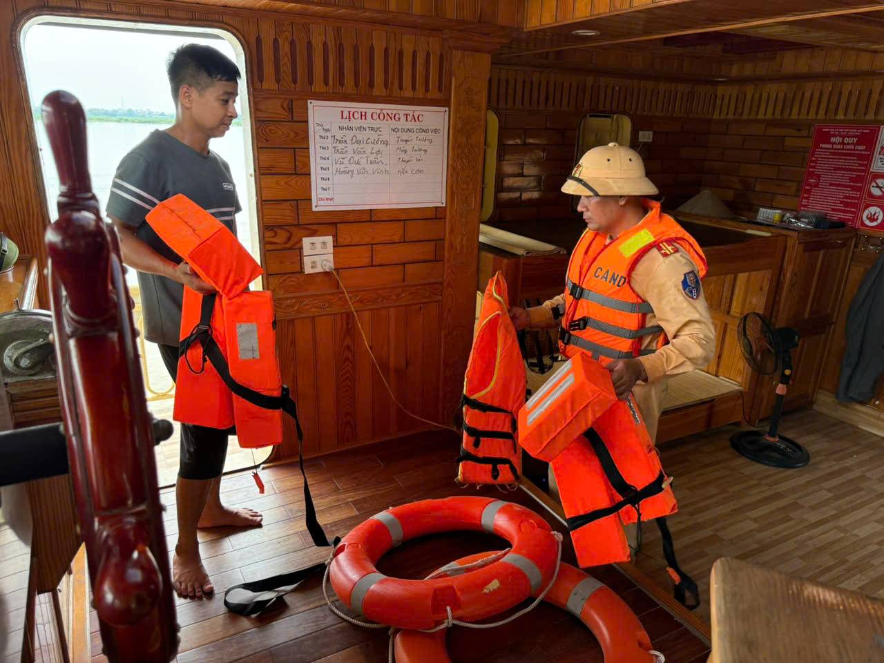
On July 21, the waterway traffic police force under the Traffic Police Department (CSGT) - Hanoi City Police simultaneously deployed activities to respond to storm No. 3.
At some ferry terminals and fishing village areas in Bat Trang commune, Waterway Traffic Police Team No. 2 and the commune police inspected and reminded people not to be subjective, proactively reinforce vehicles, build floating houses, ensure safety of life and property when the storm makes landfall.
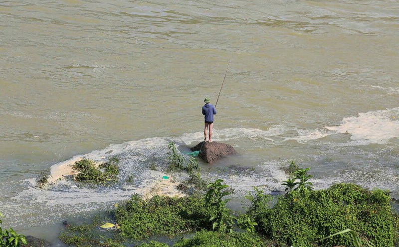
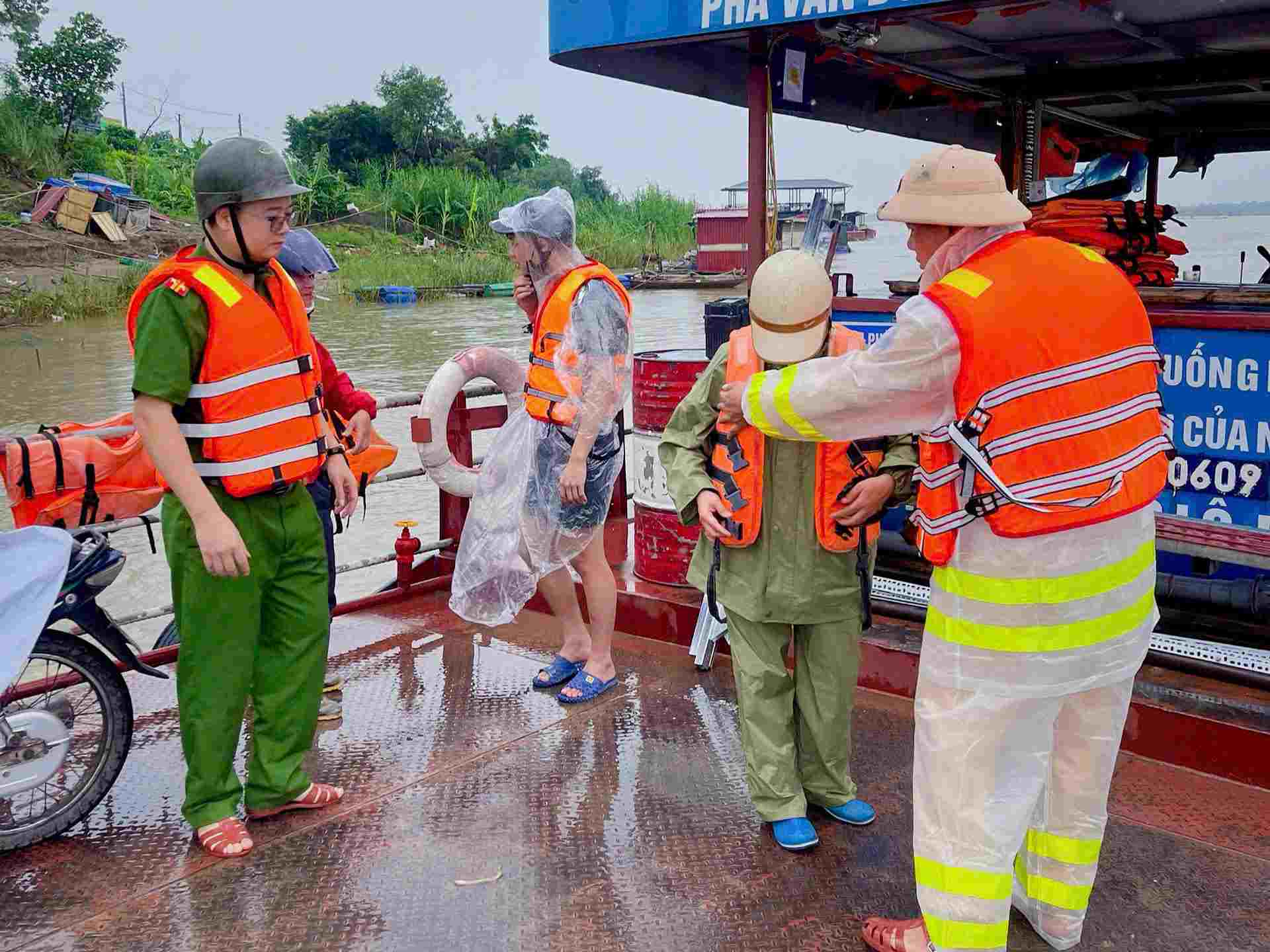
At some ferry terminals and areas where people fish along the Red River in O Dien and Lien Minh communes, the Waterway Traffic Police Team No. 1 and local police inspected and focused on passenger terminals, floating houses, inland waterway vehicles, and riverside works.
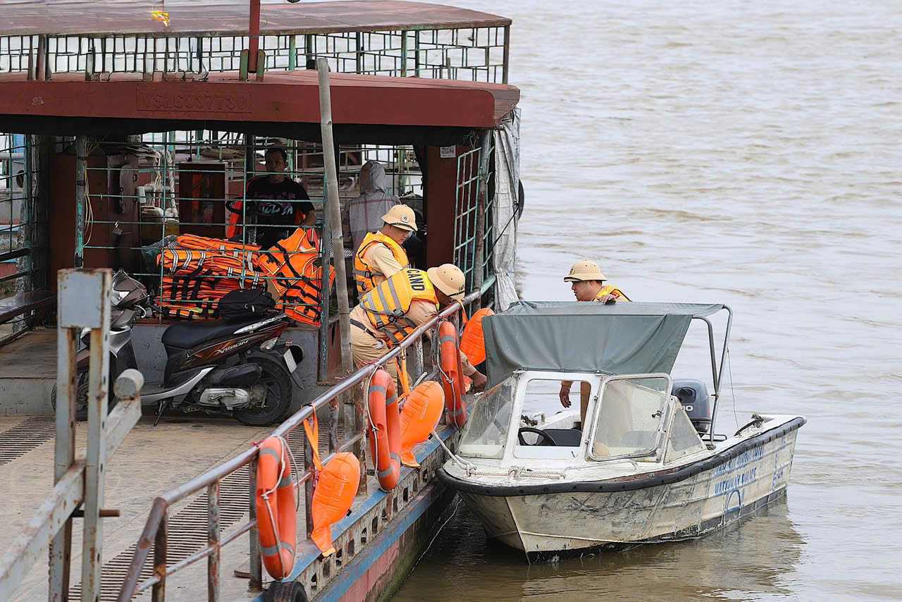
Through the survey, the authorities discovered that some vehicles were anchored unsafely, the electrical system was installed without standards, and warehouses for goods near the riverbank and trees were at risk of falling.
Notably, in O Dien commune, there are still a number of households living on the water surface of the Red River. The authorities arrived to distribute leaflets, instructing them to absolutely not stay on their vehicles when there are strong winds and heavy rain; and proactively move to shore safely when requested by the authorities.
"The forces will continue to review, inspect and propagate so that organizations and individuals raise awareness, proactively respond to natural disasters, minimize damage before, during and after the storm passes," said Lieutenant Colonel Phung Quang Hung - Captain of Waterway Traffic Police Team No. 2.
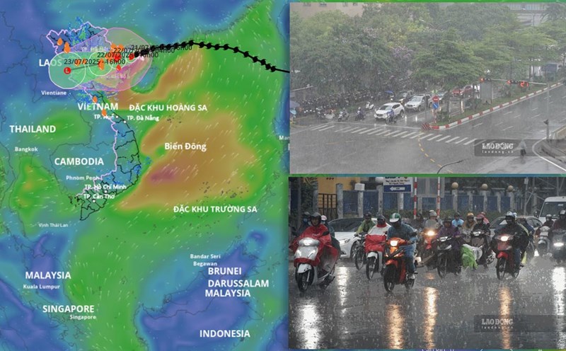
Latest update from the National Center for Hydro-Meteorological Forecasting, at 1:00 p.m. on July 21, the center of storm No. 3 was at about 21.1 degrees north latitude; 109.1 degrees east longitude, about 120 km from Quang Ninh, 260 km east of Hai Phong, about 280 km from Hung Yen, about 310 km east-northeast of Ninh Binh. The strongest wind near the storm center is level 9-10 (75-102 km/h), gusting to level 12. The storm is moving west-southwest at a speed of 10-15 km/h.
It is forecasted that in the next 12 hours, the storm will move west-southwest at a speed of about 10-15 km/h and is likely to strengthen. At 1:00 a.m. on July 22, the center of the storm was at about 20.7 degrees north latitude; 108 degrees east longitude, in the northern Gulf of Tonkin. The strongest wind near the storm center is level 10-11, gusting to level 14.
The dangerous area at sea is north of 18.5 degrees north latitude; from 106 degrees east longitude to 112 degrees east longitude. The risk level of natural disasters due to storms is level 3 for affected areas including the northwest sea area of the northern East Sea, the Gulf of Tonkin, coastal waters of provinces from Quang Ninh to Ninh Binh.
It is forecasted that in the next 24 hours, the storm will continue to move west-southwest at a speed of about 10-15 km/h. At 1:00 p.m. on July 22, the center of the storm was at about 20.3 degrees north latitude; 106.6 degrees east longitude, in the sea from Hai Phong to Thanh Hoa. The strongest wind near the storm center is level 10-11, gusting to level 14.
Due to the influence of the storm, from the evening and night of July 21, coastal areas from Quang Ninh to Nghe An will have winds gradually increasing to level 7-9, near the storm center level 10-11, gusting to level 14. Deep inland areas of provinces and cities such as Hai Phong, Hung Yen, Ninh Binh and Thanh Hoa have strong winds of level 6, gusting to level 7-8. Winds of level 10-11 can cause trees, electric poles to fall, and roofs to fall, causing very heavy damage.