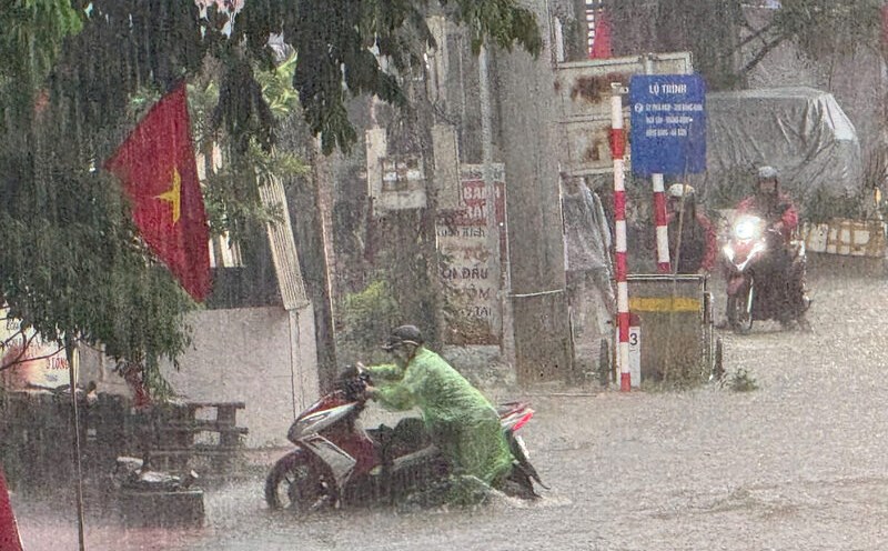
According to information from the meteorological station, in the past 24 hours (as of July 10), the whole Cao Bang province has experienced rain, moderate to heavy rain accompanied by thunderstorms and light winds. Some areas recorded very heavy rainfall, especially at Mong An station up to 109.4 mm, Thai Hoc 91.8 mm, Yen Lac 61.6 mm, Truong Ha 61 mm, Yen Tho 50.8 mm. Other localities such as Tinh Tuc and Vinh Quang also recorded over 25 mm of rain, while the remaining places recorded under 20 mm.
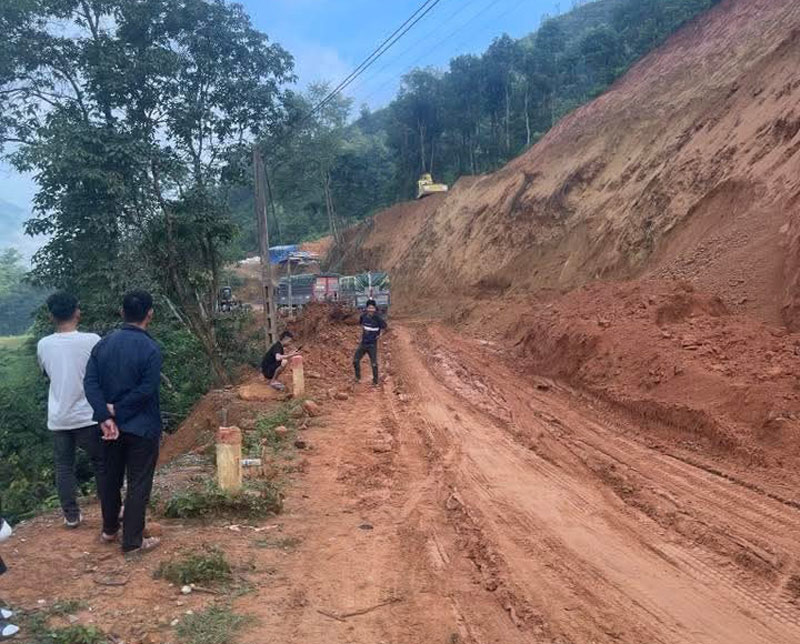
Although it has just entered the rainy season, Cao Bang has faced many extreme weather phenomena. Previously, on July 1, Na Tenh Pass - a vital traffic route connecting the western communes of the province - had a serious landslide.
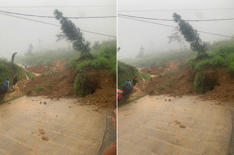
A large amount of rock and soil spilled onto the road, causing traffic disruption and disrupting people's travel. At the same time, many other landslides were also recorded in the province after heavy rains.
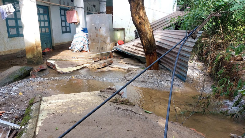
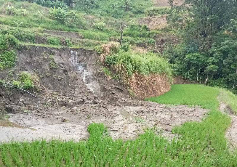
Most recently, on the night of July 9, in Bao Lam commune, heavy rain continued to cause heavy damage, many areas of crops and crops were buried or broken; rocks and soil from above overflowed onto the roads, causing congestion and posing a potential danger to people. The reality at the scene shows some walls collapsed, fields were flooded due to heavy rain causing mud and landslides.
According to recent statistics from the People's Committee of Cao Bang province, from the beginning of 2025 to now, the whole province has experienced 8 storms, lightning, heavy rain, flooding, flash floods, and localized landslides in the communes of Bao Lam, Bao Lac, Ha Quang, Hoa An, Quang Hoa, causing estimated damage of over 4.76 billion VND.
Faced with increasingly complex weather developments and severe consequences from natural disasters, the People's Committee of Cao Bang province has just issued Plan No. 1548/KH-UBND to implement the Project "Early warning of landslides and flash floods".
Cao Bang province identified 47 key areas that need additional surveys. In addition, localities are also assigned the task of proactively reviewing and updating practical information to adjust the risk map to better suit the on-site situation.
To implement the project, Cao Bang province will receive, manage and exploit early warning products transferred by the Ministry of Agriculture and Environment; at the same time, promote propaganda and raise public awareness of landslide and flash flood prevention.
A real-time information and warning system will also be built to support people to quickly access natural disaster information and proactively respond to areas at risk of landslides and flash floods.