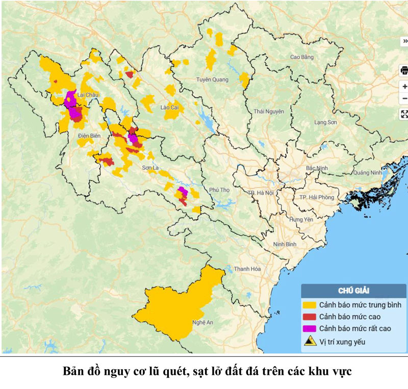
At noon on July 25, the National Center for Hydro-Meteorological Forecasting issued a warning bulletin of flash floods, landslides, and land subsidence due to heavy rain or water flow in the provinces of Lai Chau, Nghe An, Son La, Lao Cai, and Tuyen Quang.
Accordingly, in the past 12 hours (from 10:00 p.m. on July 24 to 10:00 a.m. on July 25), the above localities have had moderate to heavy rain, some places have had very heavy rain. The rainfall recorded in many localities was over 100mm.
Moisture models show that some areas in localities are nearly saturated (85%) or have reached a saturated state.
In the next 3-6 hours, the provinces will continue to have rain with common accumulated rainfall from 10 - 30mm, some places over 70mm. Therefore, in the next 6 hours, there is a risk of flash floods on small rivers and streams, landslides on steep slopes in many communes and wards.
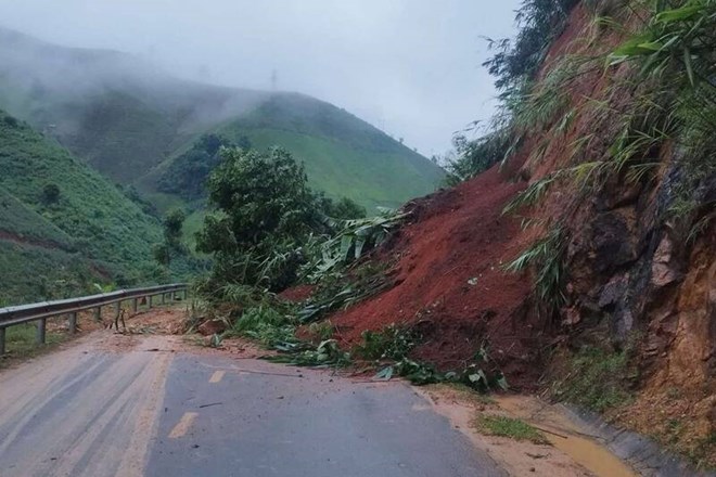
In Son La, according to the report of the Department of Agriculture and Environment of Son La province, heavy rain lasting from July 23-25 caused landslides behind the Ban Phat gas station, Yen Chau commune; locally flooded National Highway 6 through sub-zone 10, Mon village, Moc Chau ward; landslides blocked the 4G national highway through Phieng Pan commune, Huoi Mot...
Heavy rain also flooded fruit gardens in Tan Lap commune and crops in Thuan Chau commune; evacuated 2 households in Na Liu village, Phu Yen commune, 1 household in Ta Lang Thap village, Chieng Hac commune from areas at risk of landslides...
It is known that the People's Committees of the provinces are requiring communes and wards to direct forces to be on duty 24/7, closely monitor the weather situation, grasp the flood situation, continue to propagate so that people can proactively respond to flash floods, landslides, and localized flooding.