Masterise Group Joint Stock Company (Masterise Group) has just sent a document to the Ho Chi Minh City People's Committee proposing to participate in researching and investing in the Saigon riverside road and the LRT (light railway) or Tramway (ground tram) riverside route in the form of public-private partnership (PPP), BT (build - transfer) contract.
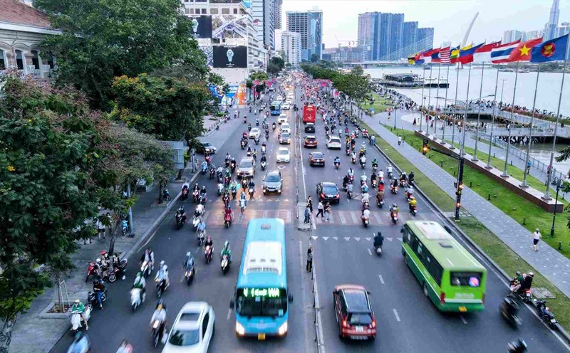
According to the proposal, the Saigon riverside road has a starting point at Can Gio bridge and an ending point at Ben Suc bridge (Provincial Road 15), with a total length of more than 78 km. The route is proposed to be invested with a scale of 8 - 10 lanes.
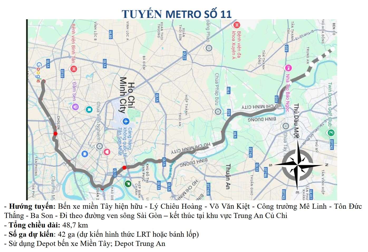
In parallel, the LRT/Tramway line along the Saigon River is about 48.7 km long. The proposed route direction goes from the existing Mien Tay bus station, through Ly Chieu Hoang - Vo Van Kiet - Me Linh Square - Ton Duc Thang - Ba Son, then follows the Saigon riverside road.
The LRT/Tramway line along the Saigon River is actually Metro Line No. 11 that has been planned by Ho Chi Minh City in the urban railway network.
This route applies Resolution 188 of the National Assembly on piloting a number of specific mechanisms and policies, especially developing the urban railway system in Hanoi and Ho Chi Minh City, thereby creating a legal basis to accelerate the implementation progress.
The basis for this proposal is cited by businesses from Decision No. 1711/QD-TTg dated December 31, 2024 of the Government on approving the Ho Chi Minh City Plan for the period 2021 - 2030, with a vision to 2050.
The plan identifies continuing to invest in upgrading and completing urban-level traffic routes; building main urban axes, including the Saigon riverside road connecting neighboring provinces. At the same time, the plan also identifies the riverside road project and the LRT/Tramway along the Saigon River as priority investment projects.
According to Masterise Group, when completed, these two projects will connect with Ring Roads 2, 3, 4; Ben Luc - Long Thanh expressway; National Highway 22, National Highway 13; Ho Chi Minh City - Moc Bai expressway, Ho Chi Minh City - Chon Thanh... Thereby forming an important radial axis, increasing the efficiency of exploitation of existing infrastructure works, contributing to completing the transportation network according to the plan.
Not only meaningful for transportation, businesses believe that the project also opens up urban, commercial, and service development space along the river; creating a highlight for the river landscape, promoting tourism and attracting domestic and foreign investment.
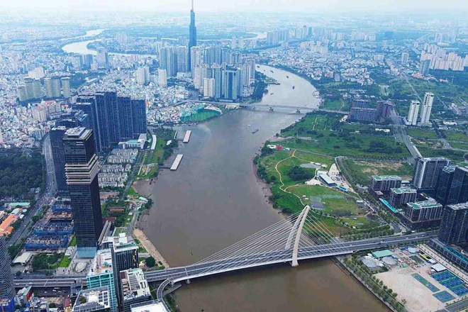
The Saigon River is about 256 km long, originating from the former Binh Phuoc province (now Dong Nai after the merger), flowing through Tay Ninh province, Binh Duong province (formerly) and Ho Chi Minh City.
The section passing through Ho Chi Minh City is about 80 km long, winding through many central areas, creating peninsulas and characteristic landscape spaces such as Thanh Da, Thu Thiem. However, for many years, the development of the riverside corridor has been unsynchronized, the riverbank space is disjointed, and the exploitation potential is not commensurate.
The Resolution of the Ho Chi Minh City Party Congress for the term 2025 - 2030 also sets out the goal of mobilizing maximum resources to complete infrastructure on the dynamic axis of the Saigon river corridor, gradually forming a chain of riverside eco-tourism urban areas stretching from Dau Tieng Lake to Dong Nai River.
In addition to the section through Ho Chi Minh City, the second Saigon riverside road passing through Binh Duong province (formerly) has also been planned with a length of about 98.2 km and a width of 32 m.