Weather forecast for the next 24-48 hours, the low pressure trough with an axis over the North will strengthen. The southwest monsoon will operate at medium to strong intensity. Above, the subtropical high pressure is stable.
Weather forecast for the next 3-10 days, the low pressure trough with an axis over the North will remain, gradually weakening from July 13. From July 14-15, the hot low pressure in the West tends to develop and expand to the East.
From about July 17-18, a low pressure trough will form with an axis through the North - North Central region and the middle of the East Sea. The southwest monsoon will operate at medium intensity. Above, the subtropical high pressure tends to encroach on the West with an axis through the North - North Central region.
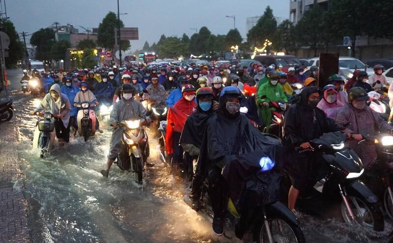
Therefore, the weather in the South will continue to have showers and thunderstorms, with the possibility of moderate to heavy rain. During thunderstorms, beware of thunderstorms, tornadoes, hail and strong gusts of wind, as well as heavy rain causing flooding.
In the coming days, in the sea area of Ho Chi Minh City (including Con Dao and DK11-7 stations), there will be showers and thunderstorms in some places, and thunderstorms may cause strong gusts of wind of level 6-7. From about July 17-20, the southwest wind will strengthen to level 6, gusting to level 7-8; waves 1.5-2.2 m high; rough seas can endanger the operation of ships and boats.