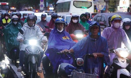
On September 20, thunderstorms continued to occur in Ho Chi Minh City lasting for many hours. Rainfall was generally between 5-15mm, with some places receiving over 20mm.
The cause of rain in Ho Chi Minh City and the provinces and cities in the South is the tropical convergence zone with its axis through the Central Central region and the North of the East Sea. The southwest monsoon operates with medium to strong intensity.
Convective clouds also exist in the provinces of Binh Phuoc, Tay Ninh, Binh Duong, Dong Nai, Ba Ria - Vung Tau, Ho Chi Minh City, Long An, Dong Thap, An Giang, Tra Vinh.
From now until the next 4 hours, these convective clouds will cause showers and thunderstorms in the above mentioned area, then continue to develop and expand, causing rain in neighboring districts of the above mentioned provinces and neighboring provinces. During the thunderstorms, there is a possibility of tornadoes, lightning, hail and strong gusts of wind.
Weather forecast for the next 24-48 hours, the tropical convergence zone will lift its axis northward through the North Central region and gradually weaken. The southwest monsoon in the Southern region will operate at medium-strong intensity, from September 23, the wind will gradually decrease and operate at medium intensity.
From 72 hours to the 10th day, the low pressure trough has an axis across the North Central region, from September 26, it gradually fades. The southwest monsoon operates at medium intensity.
Above, the subtropical high pressure in the southern branch from around September 23 tends to encroach westward and has an axis over the South after stable operation. By around September 26, the axis will lift northward through the Central region and encroach westward. The easterly wind disturbance will operate well and affect the weather in the South from September 26-29.
Therefore, from September 26, thunderstorms will continue to increase. Thunderstorms may cause tornadoes, lightning and strong gusts of wind. Beware of the possibility of heavy rain causing localized flooding in low-lying areas and areas with poor drainage capacity.
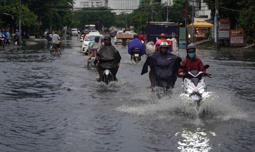
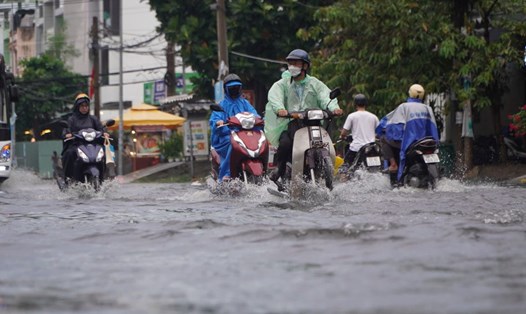
Regarding high tides, water levels at stations continue to rise rapidly and peak today, September 20. On September 21-22, water levels will fall slowly, then fall more rapidly. High tides above alert level I will last until September 23.
The level of natural disaster risk in the downstream area of Saigon - Dong Nai River is at level 2. High peak tide water levels are likely to cause flooding in low-lying areas and riverside areas, affecting traffic, daily life, and socio-economic activities in the Ho Chi Minh City area.
Some roads in Ho Chi Minh City may be flooded such as: Tran Xuan Soan, Dao Su Tich, Huynh Tan Phat, Nguyen Binh, Le Van Luong, National Highway 50, Pham Huu Lau (concentrated in District 7 and Nha Be district)...