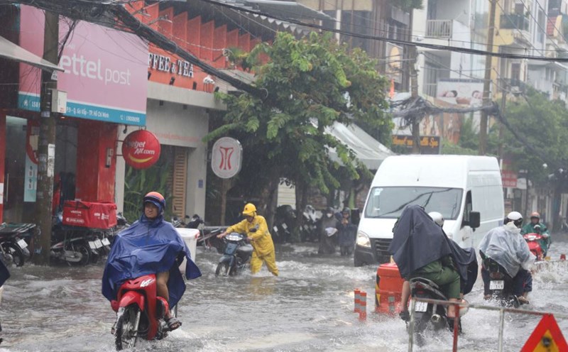
On the afternoon of October 27, thunderstorms are developing, causing showers and thunderstorms in Ho Chi Minh City, the Western and Southeastern provinces.
In the coming hours, thunderstorms will continue to develop and cause showers with thunderstorms and lightning in the above areas. Then the thunderstorms will tend to expand and spread to other neighboring areas.
Rainfall is generally from 5-25mm, some places over 30mm. During thunderstorms, beware of tornadoes, lightning, hail, strong winds of level 5-8 (8-21m/s), heavy rain causing localized flooding.
The thunderstorms are caused by the weak strengthening of the continental cold high pressure. The tropical convergence zone has an axis through the Central Central region connecting with storm No. 6 moving in a south-southwest direction, making landfall in the provinces from Thua Thien Hue to Da Nang. The southwest wind has a moderate to strong intensity.
Weather forecast for the next 24-48 hours, the continental cold high pressure continues to weaken. The tropical convergence zone connecting with storm No. 6 on land in the Central Central region gradually weakens. In the southern seas, the West to Southwest winds are of medium intensity.
On November 1-2, the continental high pressure will strengthen again in the North of our country, and on November 4-5, it will strengthen strongly. The tropical convergence zone connecting with storm No. 6 will gradually weaken. In the Southern seas, the West to Southwest winds will gradually decrease in intensity. From November 2, it will change direction to Northeast and gradually strengthen to level 5-6.
Therefore, in the last days of October, the weather in the South will be cloudy with scattered showers and thunderstorms, with moderate rain and locally heavy rain. During thunderstorms, there is a possibility of tornadoes, lightning and strong gusts of wind. Beware of the possibility of heavy rain causing localized flooding in low-lying areas and areas with poor drainage capacity.


