Infrastructure must lead urban development
On June 2nd, the Ho Chi Minh City People's Council organized a workshop "Overall Planning of Ho Chi Minh City - 100-year vision".
At the conference, many experts said that to become a multi-center megacity, Ho Chi Minh City needs to simultaneously solve bottlenecks in infrastructure connection, flooding and population pressure that is over-concentrated in the central area.
According to Dr. Sam Minh Tuan - Deputy Director of the National Institute for Urban Design Research, Urban and Rural Planning (Ministry of Construction), a multi-center city can only operate effectively when the development poles are connected by a synchronous, highly capable infrastructure system.
Ho Chi Minh City has identified many strategic development corridors such as ring roads, expressways, metro, regional railways, seaports, airports, logistics centers and digital infrastructure. However, the implementation progress is still slow, causing the development poles not to promote their complementary roles.
According to Mr. Tuan, traffic congestion is not only a travel problem but also reflects the imbalance between population distribution, employment and public infrastructure. When new urban areas do not create enough jobs, public transport does not play a leading role, people still depend on private cars, increasing pressure on the transportation system.
To overcome this, infrastructure needs to be seen as a tool to organize development space. Strategic traffic routes must be integrated with compact cities, service centers, high-tech industrial parks and urban development models oriented towards public transport (TOD).
Need to plan the entire ground level of Ho Chi Minh City
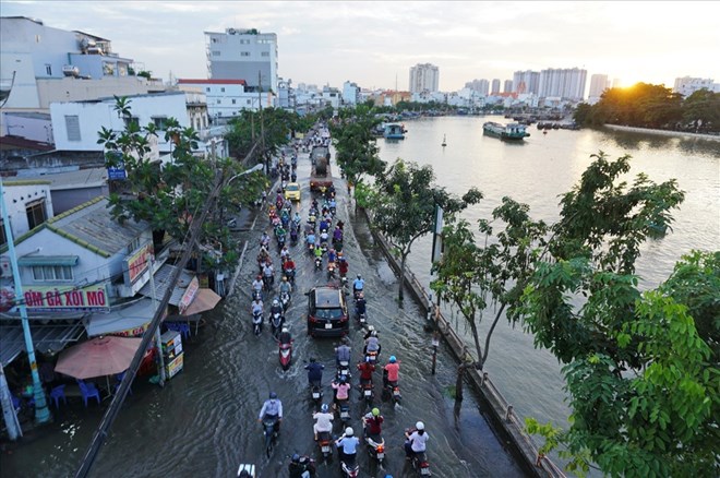
Besides transportation, Ho Chi Minh City also faces challenges of flooding and climate change. According to Dr. Sam Minh Tuan, river systems, canals, low-lying areas, green corridors and mangrove forests are "base infrastructure" that helps regulate water, reduce flooding and protect the urban environment. However, the process of urbanization, leveling and concretization is narrowing down these spaces.
He believes that future planning needs to consider the "green - blue" system, including green trees, water surfaces and ecological zones, as core infrastructure, on par with transportation and technical infrastructure. Decisions on land construction and use must be linked to the load-bearing capacity of the water system as well as its ability to adapt to climate change.
Mr. Nguyen Quoc Ky - Chairman of the Board of Directors of Vietravel Tourism Joint Stock Company, said that the situation of subsidence and flooding in Ho Chi Minh City is increasing rapidly, causing the cost of flood control by 2050 to be very large. Therefore, the city needs to soon establish the ground level in the long-term plan.
After 50 years of national reunification, Ho Chi Minh City still does not have a baseline. Planning for a hundred years cannot be without a baseline" - Mr. Ky said.
Mr. Ky proposed that the ground level in the central area reach 3m, the area along the Saigon River 3.5m and Can Gio 4m. With this ground level, by 2050 Ho Chi Minh City will not sink.
Metro and TOD are driving forces for urban restructuring
From the perspective of urban planning, architect Khuong Van Muoi - former Vice Chairman of the Vietnam Association of Architects - said that Ho Chi Minh City is experiencing the general development rule of major cities in the world.
As the population increases rapidly, the transportation system, which previously met well, will become overloaded, leading to congestion, air pollution, noise and reducing the quality of life.
According to Mr. Muoi, the two factors that determine the urban restructuring process in the coming period are a high-quality residential environment and a large-capacity public transport network, in which the metro plays a key role.
The Central Government has assigned Ho Chi Minh City to complete about 200km of metro by 2030 and continue to complete the network by 2050. This will be the basis for forming TOD urban areas around the station, creating new development momentum for the city.
Mr. Muoi proposed building a "travel map" within a radius of about 1km around each metro station to identify areas that are not directly served. From there, the city can develop connecting bus routes, BRT or shared vehicles, creating a supporting transportation network, helping people access the metro more conveniently.
For suburban stations and depot areas, Ho Chi Minh City should prioritize the development of TOD areas associated with social housing, resettlement housing and essential service works. This approach both reduces population pressure for the central area and creates resources for reinvestment in the public transport system in the future.


