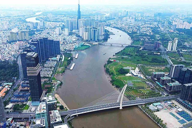
Becoming the world's leading livable city
According to the outline, the scope of planning includes the entire administrative boundary of Ho Chi Minh City with an area of about 6,772.59 km2, including 168 administrative units (113 wards, 54 communes and Con Dao special zone), along with the sea encroachment exploitation to serve economic development.
The scope of research is not only limited to the boundaries of Ho Chi Minh City but also expands to neighboring provinces including Dong Nai, Tay Ninh, Dong Thap, Lam Dong and related sea spaces.
According to the orientation to 2050, Ho Chi Minh City will be in the group of 100 cities with the best quality of life in the world, becoming an important economic, financial, commercial, logistics, tourism, education, health, science - technology and innovation center of the Asia-Pacific region.
Ho Chi Minh City is also identified as an international trading hub, a gateway connecting to the sea of the region and the whole country; playing a role as a driving force for growth, a center for spreading development along the North-South and East-West economic corridors.
The city will develop according to a multi-center megacity model with synchronous infrastructure, smart governance, and effective adaptation to climate change. People with income and quality of life belonging to the leading group in Southeast Asia, enjoy a safe, humane and culturally rich living environment.
Population 20 - 22 million people, GRDP reaches 1,200 billion USD
The outline of the planning forecasts that by 2050, the population of Ho Chi Minh City will reach about 20 - 22 million people, including permanent and temporary residents over 6 months.
The average GRDP growth rate for the period 2025-2050 is expected to reach at least 10%/year in favorable conditions.
The GRDP scale of Ho Chi Minh City by 2050 is expected to reach about 1,200 billion USD, while the urban construction land area is about 290,000 - 320,000ha.
Forming strategic development corridors
One of the key contents of the plan is the construction of strategic inter-regional connecting corridors.
In which, the eastern economic gateway continues to be strengthened to connect Ho Chi Minh City with the Southeast region, especially Dong Nai province and Long Thanh International Airport.
The backbone infrastructure system of this corridor includes Ring Road 3, Ring Road 4, Ho Chi Minh City - Long Thanh - Dau Giay expressway, Ben Luc - Long Thanh, Bien Hoa - Vung Tau, Ho Chi Minh City - Moc Bai and railway lines connecting Long Thanh airport.
Ho Chi Minh City will also strengthen connectivity with the Mekong Delta region through expressways, the Ho Chi Minh City - Can Tho railway and a new transportation network to expand development space to the West and South.
The outline sets out the development orientation of the Southern coastal corridor extending from the Mekong Delta through Can Gio to the Can Gio - Cai Mep - Thi Vai port cluster and possibly directly connected to Vung Tau.
This corridor is expected to become a driving force for the marine economy, logistics, airport city, free trade zone (FTZ), tourism and the coastal eco-urban chain from Can Gio to Ho Tram.
Besides, there is the North-South economic - industrial - urban - service corridor along the Dong Nai River to Ganh Rai Bay, connecting existing industrial parks, urban areas and new development areas.
Ho Chi Minh City is also studying to connect more deeply with Cambodia and Laos through the national railway system, including the Ho Chi Minh City - Loc Ninh line connecting Moc Bai border gate.
Model "1 center - 3 regions - 1 special zone
The planning outline identifies that Ho Chi Minh City will develop according to the model "1 center - 3 regions - 1 special zone".
In which, the core area of Ho Chi Minh City will become the "capital of finance and high technology", focusing on the fields of finance, trade, education, high-quality healthcare, innovation and technology.
Binh Duong region is oriented as an "industrial capital", developing high-tech production.
The Ba Ria - Vung Tau region plays the role of "sea economic capital", focusing on international seaports, logistics, offshore wind energy and free trade zones.
Con Dao Special Zone is oriented to become a tourist, resort, spiritual and ecological center.
Developed areas will be connected by a synchronous system of economic corridors and transport infrastructure, while forming green ecological space along the Saigon - Dong Nai - Thi Vai rivers and coastal corridors.
Promoting TOD, metro and public transport
The outline also emphasizes the requirement for urban development according to the TOD model (urban development associated with public transport).
Ho Chi Minh City will study the rules of optimal travel distance and time, aiming for the goal that people can travel in a maximum time of about 1 hour.
The public transport system will be strongly expanded with metro, LRT, monorail and overhead and underground transport options to save land funds, reduce site clearance pressure and improve urban transport capacity.


