From 7:00 p.m. on November 15 to 6:00 a.m. on November 17, Hue City had heavy to very heavy rain. Rainfall in the plains reached 100 - 200mm, mountainous areas 400 - 550mm; Binh Dien 605mm, Hong Thai (A Luoi) 612mm.
The Hue City Hydrometeorological Station forecasts that from the morning of November 17 to the morning of November 19, Hue will continue to have very heavy rain, with rainfall in the plains 150 - 300mm, mountainous areas 200 - 400mm; some places exceeding 400 - 500mm.
After November 19, the area will still have rain, the total amount from November 17 to 19 can reach 200 - 600mm in the plains and 300 - 800mm in the mountainous areas.
River water level at 7:00 a.m. on November 17, 2025:
The Huong River at Kim Long is at 2.64m, 0.64m above alert level II.
The Bo River in Phuoc reached 4.91m, 0.41m higher than alert level III.
At 7:00 a.m. on November 17, Huong Dien Lake was at elevation of +57.06 m, with a flow rate of 4,327 m3/s, discharging 3,528 m3/s downstream. Binh Dien Lake is at +80.19m, with a flow rate of up to 698m3/s, discharging 638m3/s. Ta Trach Lake reached +40.18m, with a flow rate of up to 506m3/s, discharging 325m3/s. The irrigation lakes have accumulated from 80 - 90% of their designed capacity and have a safe operation plan.
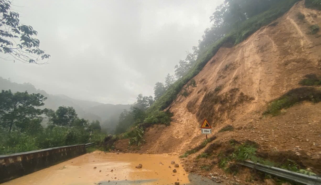
In the mountainous communes of Nam Dong, Khe Tre, Chan May - Lang Co, Phong Dien, Binh Dien and A Luoi, the risk of landslides increased due to prolonged heavy rain.
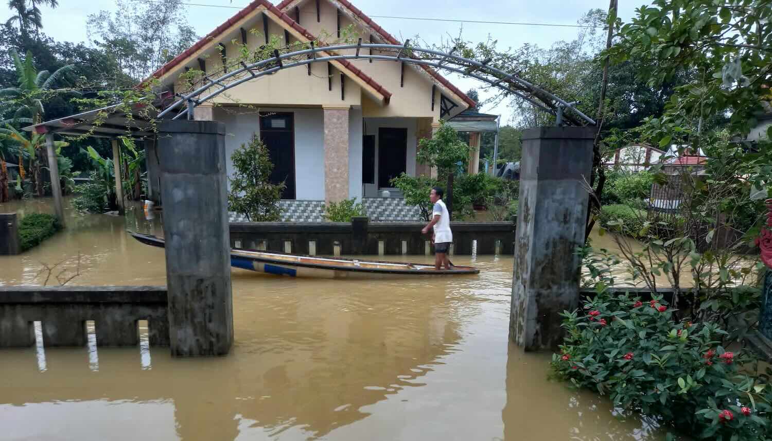
In the plains and urban areas, heavy rain of 70mm/2 hours can cause flooding of 0.3 - 0.5m in the areas: National Highway 1 through Phu Loc, An Cuu urban area, Thuan Hoa, Phu Bai, Ngo Duc Ke street, Thanh Giong, Phu Xuan.
Many downstream areas of the O Lau, Truoi, Bu Lu rivers and the Huong and Bo rivers are at risk of flooding from 0.5 - 1.5m, similar to the early rain in November.
A Luoi 2 commune evacuated 47 households with 132 people. Heavy rain caused flooding on Ho Chi Minh road, water swept away a motorbike but the driver was safe. Many landslides appeared at A Luoi 3, A Luoi 5 and National Highway 49.
Some sections of Ho Chi Minh Road West Branch, National Highway 49B and many provincial roads were flooded 0.2 - 0.7m deep or had landslides, had to be fenced off and drained. Phu Mau Bridge has eroded bridge abutments and has been closed to traffic.


