On June 27, information from the Thai Nguyen Provincial Hydrometeorological Station said that the water level on the main rivers is low and fluctuates slightly.
Specifically, at 1:00 p.m. the same day, at the Gia Bay hydrological station (Cau river), the measured water level was 2,208cm, 292cm lower than the level I alarm (alarm I: 2,500cm).
At Cha station, the water level was 413cm, 387cm lower than alert level I (alarm level I: 800cm).
For the Cong River, the water level of Nui Coc Lake at 1:00 p.m. on June 27 was 44.43m and is being regulated according to the reservoir's operating regime.
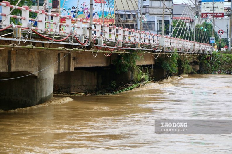
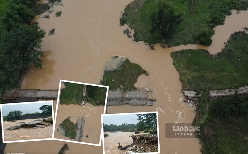
However, according to the forecast, from the night of June 27 to the end of June 29, there is a possibility of a flood on rivers and streams in the province with a flood amplitude of 1.0 - 3.0m. On the Cau River at Gia Bay station, the flood peak may reach level I alarm level.
The meteorological agency warns of the risk of flooding in riverside areas, inner-city streets and low-lying areas.
Some locations may be affected for dyke safety, especially at vulnerable points such as embankments, waste dumps, and residential areas along the river.
In addition, due to the impact of local heavy rain, there is a possibility of flash floods on small rivers and streams, landslides on steep slopes in the province. High-risk areas include: Dinh Hoa, Vo Nhai, Phu Luong, Dong Hy, Dai Tu.
The risk level of natural disasters due to floods is warned at level 1. People are advised to closely monitor forecasts and take preventive measures to ensure the safety of life and property.