From the early morning of May 20 to the afternoon of May 21, widespread thunderstorms poured down on many northern provinces.
According to the National Center for Hydro-Meteorological Forecasting, the soil moisture model in this area has reached a saturation state (over 85%), posing very high risks.
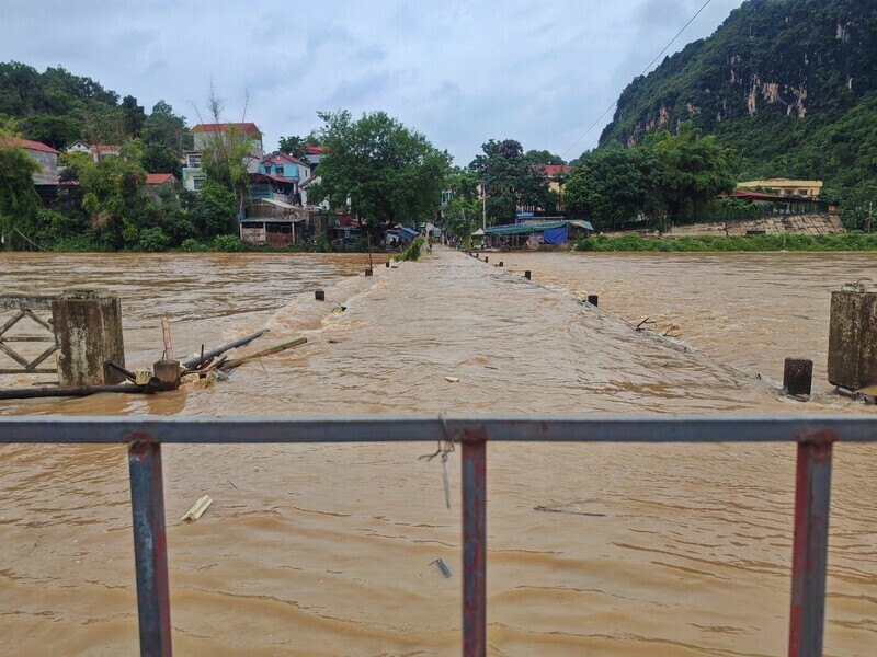
In Lang Son, the locality most heavily affected, rainfall in Yen Binh commune was measured at 161.5 mm; Mau Son area 145.1 mm; Huu Lung 127.2 mm. Prolonged heavy rain caused rapid water surge, causing localized flooding in many low-lying areas and riverside areas.
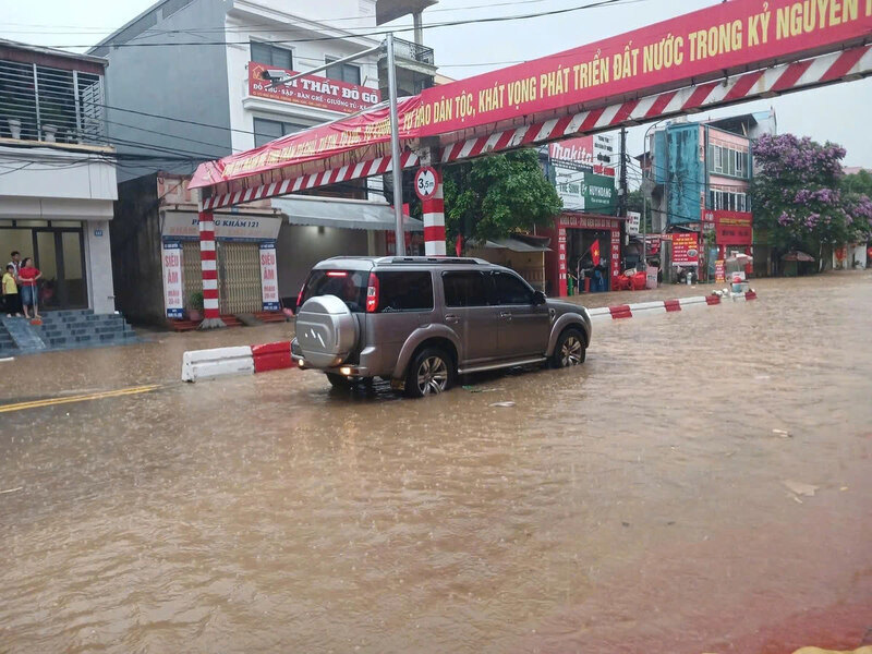
Traffic through Lang Son city is paralyzed at some hotspots.
My Son underpass (Dong Kinh ward), Phai Tran intersection (Tran Quang Khai street) are surrounded by water.
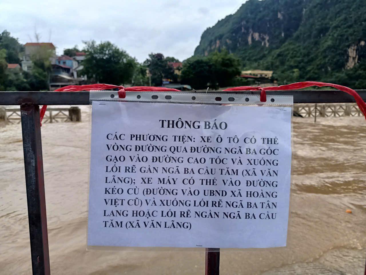
In particular, the Na Sam Bridge area is deeply flooded, making it impossible for vehicles to move, forcing them to circle through IC02 intersection (rice root), Tan Lang intersection to get to the expressway.
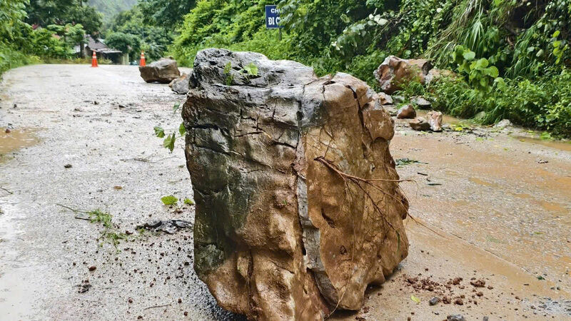
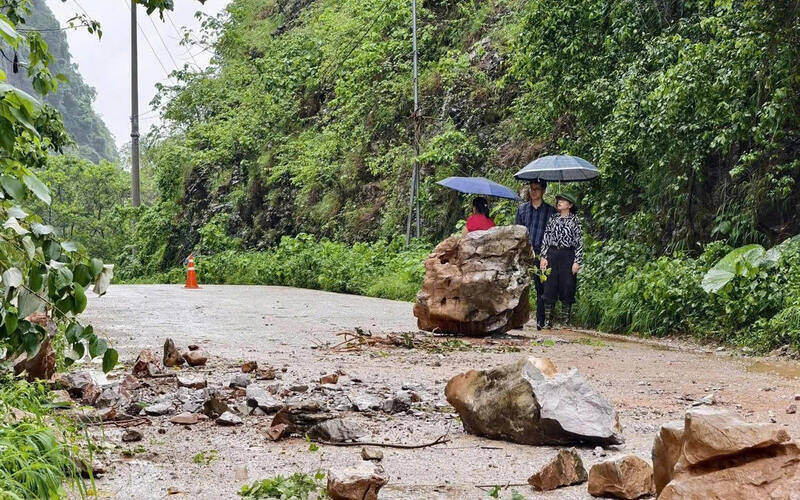
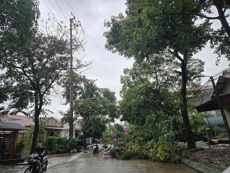
Notably, heavy rain weakened the soil and rock structure, causing landslides on many key traffic routes.
On the road through Deo Lua Pass (Cai Kinh commune), tons of heavy rocks fell from the positive slope, blocking the road surface, threatening passersby.
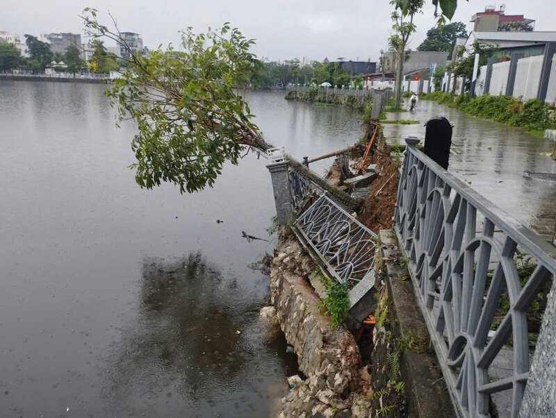
In the early morning of May 21, the embankment and railings of the pedestrian path around Phai Loan Lake (Tam Thanh ward) also seriously eroded, posing a potential danger to the residential area.
Immediately after the incident, functional forces had to mobilize machinery to clear soil and rocks on Deo Lua Pass, install dangerous warning signs, and so far the road has been able to circulate again.
Similar landslides are also recorded sporadically in Chi Lang and Van Linh.
Faced with the rapid developments of natural disasters, the Lang Son Provincial Civil Defense Command issued Urgent Dispatch No. 1115/BCH-QST. The province requests all communes and wards to absolutely not be negligent and activate the "4 on-the-spot" plan.
Military, border guard, police and militia forces are ordered to maintain 100% of their troops on combat duty, ready with means to respond in case of bad situations.
Guard posts have been set up at spillways, suspension bridges, deep flooded areas and fast-flowing water; resolutely not allowing people and vehicles to pass to avoid casualties.
Meanwhile, Son La is facing extreme weather patterns.
Weather radar images from the afternoon of May 21 show convective cloud dens from Upper Laos moving straight into the province with a maximum radio response of 37dBZ.
Son La Provincial Hydrometeorological Station has issued a level 1 disaster risk warning, forecasting that in the next few hours there will be hail, tornadoes, lightning and strong gusts of wind threatening infrastructure and crops.
Other provinces such as Quang Ninh, Tuyen Quang, Phu Tho, Lai Chau also recorded rainfall of over 100-200 mm. The meteorological agency has issued warnings of flash floods and landslides of level 1 for a series of communes and wards throughout the North.
Functional agencies continue to recommend that people in northern mountainous areas limit movement during storms and floods, especially pay attention to observing signs of soil and rock cracks and subsidence to proactively evacuate to safe places.
In the next 6 hours, it is forecast that the Northern region will continue to have common rain from 10-40 mm, in some places over 60 mm, the risk of landslides is still at a red alert level.
Some images recorded in Lang Son: