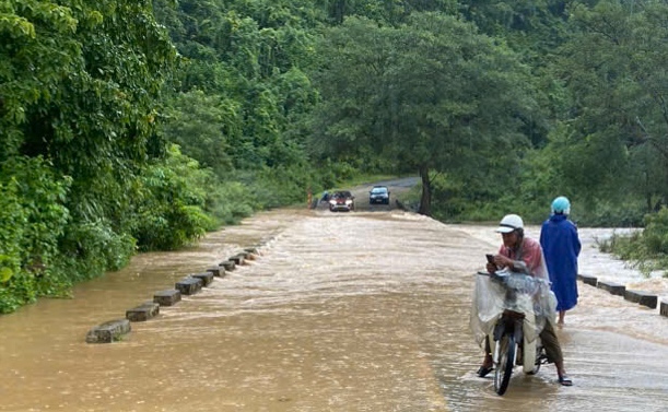
On June 12, the People's Committee of Ngan Thuy commune (Le Thuy district, Quang Binh province) said that prolonged heavy rain had caused many sections of the road through the area to be seriously flooded.
2 flooded spots at km25 and km23 on National Highway 9B, with water levels about 50cm deep and flowing rapidly, making it difficult for vehicles to move.
The authorities have been on duty in these areas to prevent people from passing through, ensuring safety.
Heavy rain continues to occur locally, posing a potential risk of deeper flooding in other areas. Local authorities have advised people to be vigilant and limit travel through flooded areas.
Latest update from the National Center for Hydro-Meteorological Forecasting, at 7:00 a.m. on June 12, the center of the storm was at about 17 degrees north latitude; 110.4 degrees east longitude, in the western area of Hoang Sa archipelago.
The strongest wind near the storm center is level 8 - 9 (62 - 88 km/h), gusting to level 11; moving west-northwest at a speed of 10 - 15 km/h.
It is forecasted that in the next 24 hours, storm No. 1 will move northwest at a speed of about 10 km/h. At 7:00 a.m. on June 13, the center of the storm was at about 18.5 degrees north latitude; 109.1 degrees east longitude, in the area south of Hainan Island (China).
The strongest wind near the storm center is level 10, gusting to level 13. The danger zone has coordinates from 15.5 to 20 degrees north latitude; 108 to 112 degrees east longitude. Level 3 natural disaster risk in the western part of the northern East Sea (including Hoang Sa archipelago), the offshore waters from Quang Tri to Quang Ngai.