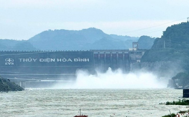
As of 9:00 a.m. on October 23, 2025, according to an update from Vietnam Electricity Group, Hoa Binh Lake recorded upstream water levels at elevation of 115.58m; water flow to the lake reached 2,137m3/s; total discharge was 1,001m3/s.
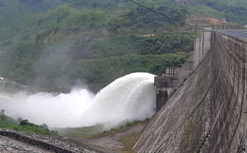
Implementing the inter-reservoir operation process in the Red River basin, Hoa Binh Hydropower Plant closed a bottom spillway gate at 11:00 on October 22 to stabilize downstream flow.
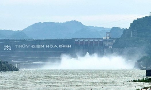
Previously, at 11:00 a.m. on October 20, Hoa Binh Hydropower Plant opened a bottom spillway. The water level downstream of Hoa Binh Hydropower Dam at Hoa Binh Ward measuring station at 7:00 a.m. on October 20 when not yet open a bottom spillway was 8.02 m. When closing a bottom spillway, the downstream water level will gradually decrease.
At Tuyen Quang Lake, by 9:00 a.m. on October 23, the upstream water level reached 118.67 m; the water flow to the lake reached 573 m3/s; the total discharge was 1,210.61 m3/s. Implementing the inter-reservoir operation process in the Red River basin, Tuyen Quang Hydropower Plant opened 1 bottom spillway gate of Tuyen Quang Hydropower Plant at 6:00 p.m. on October 21.
As of 9:00 a.m. on October 23, Son La Lake had an upstream water level of 215.09 m; water flow to the lake was 1,256 m3/s; total discharge was 1,010 m3/s. Currently, the unit has closed all bottom spillways, only maintaining power generation through generators to regulate the flow downstream.
A similar situation occurred in Lai Chau Lake, where the upstream water level reached 294.96m; the water flow to the lake reached 864m3/s; the total discharge was 759m3/s. Currently, Lai Chau Hydropower Plant has also closed all bottom spillways, only operating power generation.
At Thac Ba Lake, by 9:00 a.m. on October 23, the upstream water level reached 57.97 m; the water flow to the lake reached 285 m3/s, the total discharge was 322.52 m3/s. Currently, Thac Ba Hydropower Plant maintains open 1 spillway.
In the context of complicated heavy rain, the flexible operation of hydroelectric reservoirs, ensuring safety downstream is considered a key factor in natural disaster prevention in the North.
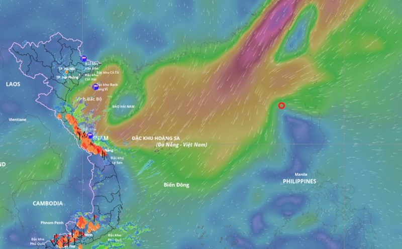
According to the National Center for Hydro-Meteorological Forecasting, at 1:00 a.m. on October 23, the center of the tropical depression weakened from storm No. 12 was at about 16.3 degrees north latitude - 109 degrees east longitude, in the sea from southern Quang Tri to Quang Ngai, about 80 km east-northeast of Da Nang city.
The strongest wind near the center of the tropical depression is level 6 (39-49 km/h), gusting to level 8. The tropical depression is moving southwest at a speed of 10-15 km/h.
This morning, October 23, the tropical depression is forecast to make landfall.
On land, due to the influence of the tropical depression circulation and cold air combined with winter wind disturbances and terrain effects, from the night of October 22 to the night of October 24, the area from Ha Tinh to Quang Ngai will have heavy rain and thunderstorms, with common rainfall of 100 - 200 mm, some places over 300 mm.
In particular, the area from southern Quang Tri to Da Nang city will have heavy to very heavy rain, with common rainfall of 200-400 mm, locally over 700 mm. Warning of heavy rain over 150 mm/3 hours in coastal communes and wards from southern Quang Tri to Da Nang city.
Heavy rain in the Central region is likely to last until the end of October 2025. There is a high risk of flash floods and landslides in mountainous areas, flooding in low-lying areas and urban areas.