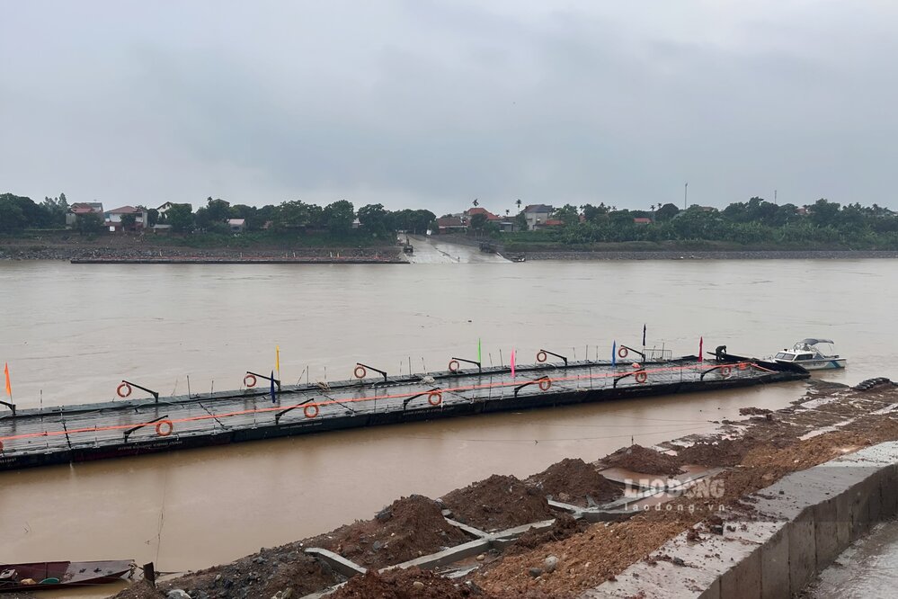
On the afternoon of July 11, due to the rising water level of the Red River and the high flow rate, the Phong Chau pontoon bridge operator (connecting Phung Nguyen commune and Tam Nong commune, Phu Tho province) cut the pontoon bridge to ensure safety.
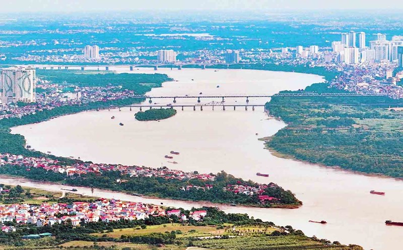
According to the reporter of Lao Dong Newspaper, the water level of the Red River section passing through Phong Chau bridge area is currently at a high level, the river water flows rapidly, cloudy with many trees, mud...
According to the National Center for Hydro-Meteorological Forecasting and Forecasting's short-term hydrological warning No. 192 dated July 11, on the Thao River (Red River), the water level at Yen Bai station and Phu Tho station is rising.
The actual water level measured at Phu Tho station (Phong Chau bridge downstream) at 1:00 p.m. on July 10 was 13.08 m, at 7:00 p.m. the same day was 13.14 m, at 1:00 a.m. on July 11 it was 13.23 m, at 7:00 a.m. on July 11 it was 13.38 m.
The bulletin predicts that the water level of the Red River at Yen Bai Station and Phu Tho Station will continue to rise. It is forecasted that by 1:00 a.m. on July 12, the actual water level measured at Phu Tho station will reach 13.70 m, by 7:00 a.m. it will be 13.80 m.
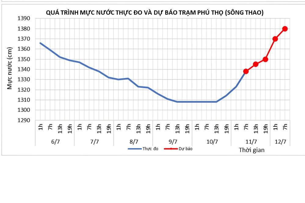
Longer, according to the Forecast Newsletter, hydrological warning for the medium period of time No. 23 on July 11 (expected from July 11 to 15), in the next 5 days, the water level on the Thao River at Yen Bai station and Phu Tho station is likely to rise in the first 1 to 2 days.
In the 5 days before the forecast, the actual water level measured at Phu Tho station was 13.28 m on average, the lowest was 13.06 m, the highest was 13.36 m. It is forecasted that in the next 5 days, the actual water level measured at this station will be 13.30 m on average, the lowest is 12.80 m, the highest can reach 14.20 m.
On the evening of July 11, the National Center for Hydro-Meteorological Forecasting also issued a heavy rain forecast bulletin in the Northeast region, the West of Phu Tho, Thanh Hoa and Nghe An.
It is forecasted that from the evening of July 11 to July 12, the above areas will have moderate rain, heavy rain and thunderstorms, locally very heavy rain with common rainfall of 20 - 50 mm, locally over 100 mm (heavy rain concentrated at night and morning). Warning of the risk of heavy rain (>100 mm/3 hours).
Heavy rain is likely to cause flooding in low-lying areas, urban and industrial areas; flash floods on small rivers and streams, landslides on steep slopes.