During this flood, flood peaks on small rivers in the northern mountainous provinces and downstream areas of the Red River Delta - Thai Binh, coastal river areas reached alert level 2 - alert level 3, with some rivers above alert level 3.
Current status of past floods
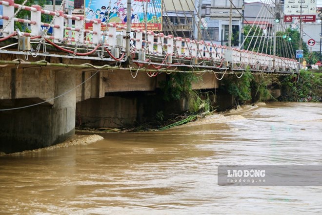
Floods on Thao River in Lao Cai City are receding slowly, in Bao Ha, Yen Bai are rising, floods on Lo River (Tuyen Quang, Phu Tho), Cau River (Thai Nguyen, Bac Ninh), Thuong River (Bac Giang), Thai Binh River (Hai Duong), Red River (Hanoi), Hoang Long River (Ninh Binh) are rising; Luc Nam River (Bac Giang) is receding slowly.
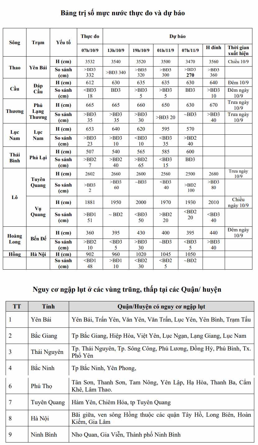
Water levels at 7am on September 10 on rivers are as follows:
On Thao River in Yen Bai 35.32m, on BĐ3 3.32m, 1.1m above the historical level in 1968 (34.42m). On Cau River at Dap Cau 6.12m, below alarm level 3 (0.18m). On Thuong River at Phu Lang Thuong 6.65m, above 803 0.35mm; on Luc Nam River at Luc Nam 6.53m, above BĐ3 0.23m.
On the Lo River in Tuyen Quang 26.02m, above BD3 0.02m; at Vu Quang 1881, above BD1 0.51m. On the Hoang Long River in Ben De 3.60m, above BD1 0.10m. On the Thai Binh River in Pha Lai 5.07m, above BD1 0.07m; On the Red River in Hanoi 9.02m, below BD1 0.48m.
Forecast for the next 12 hours
According to the National Center for Hydro-Meteorological Forecasting, in the next 12 hours, the flood on Thao River in Lao Cai will continue to decrease, in Bao Ha it will change slowly; in Yen Bai it will continue to rise and remain above historical flood levels; in Phu Tho it will reach above alert level 1.
Floods on Lo River and Cau River continue to rise to alert level 3, Thuong River is slowly changing to above alert level 3. Floods on Luc Nam River are receding slowly but are still above alert level 3.
Floods on the Thai Binh River continue to rise above alert level 2. Floods on the Hoang Long River continue to rise above alert level 2. Floods on the Red River in Hanoi continue to rise rapidly, reaching alert level 1.
It is forecasted that in the next 12 - 24 hours, the flood on Thao River in Lao Cai will continue to decrease; in Bao Ha it will decrease slowly; in Yen Bai it will change slowly and remain above historical flood levels, in Phu Tho it will be above alert level 1.
Floods on Lo River, Thuong River and Cau River are changing slowly and maintaining alert level 3. Floods on Luc Nam River continue to fall below alert level 3. Floods on Thai Hinh River continue to rise to alert level 3. Floods on Hoang Long River continue to reach alert level 3.
Floods on the Red River in Hanoi continue to rise rapidly, reaching alert level 2.
Warning: From now (September 10) to September 11, there will be a flood on other rivers in the Northern region. During this flood, the flood peak on small rivers in the northern mountainous provinces and rivers in the downstream areas of the Red River Delta - Thai Binh, coastal estuaries will reach alert level 2 - alert level 3, with some rivers above alert level 3.
Floods on rivers and streams cause flooding in low-lying areas along rivers, encroachment of river banks, many areas of floating flats in the middle of the river are deeply flooded, affecting activities such as water transport, aquaculture, agricultural production, people's lives and socio-economic activities in the downstream areas of Lo River and Red - Thai Binh River.
Flood water levels downstream of the Red River - Thai Binh River remain high for many days, which can cause landslides along the river and affect the safety of dikes along the river in the Red River - Thai Binh Delta.
In Hanoi, there is a warning of flooding risk in the middle and Red River banks in Tay Ho, Long Bien, Hoan Kiem and Gia Lam districts.