Riverbank erosion diễn biến phức tạp
According to a report by the Department of Agriculture and Environment of Ca Mau province, in a short time, many riverbank landslides have occurred in localities, causing great property damage and directly threatening people's lives.
At the Trai Luoi river route, in Bien Truong hamlet, Dat Moi commune, in the early morning of April 23, a landslide occurred about 8m long, encroaching 24m deep into the mainland, causing Mr. Nguyen Van Duc's level 4 house to be swept into the river. Estimated damage is about 250 million VND.
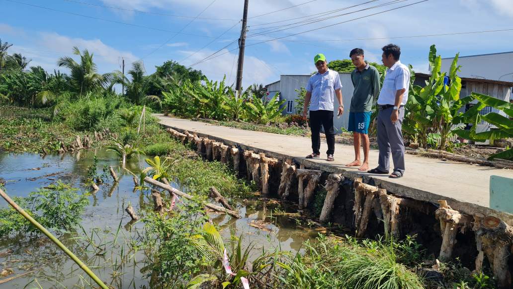
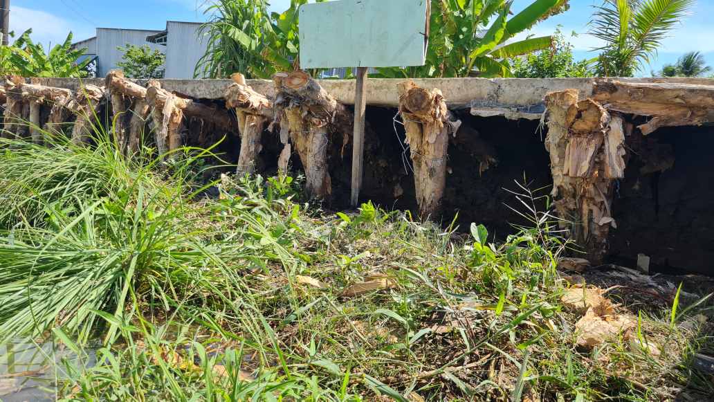
On the road along the Dong Hung Canal, Cai Nuoc commune, functional agencies recorded 5 subsidence and landslide points with a total length of about 320m. Many sections have eroded to the asphalt road surface, large cracks have appeared and there is a risk of continued subsidence.
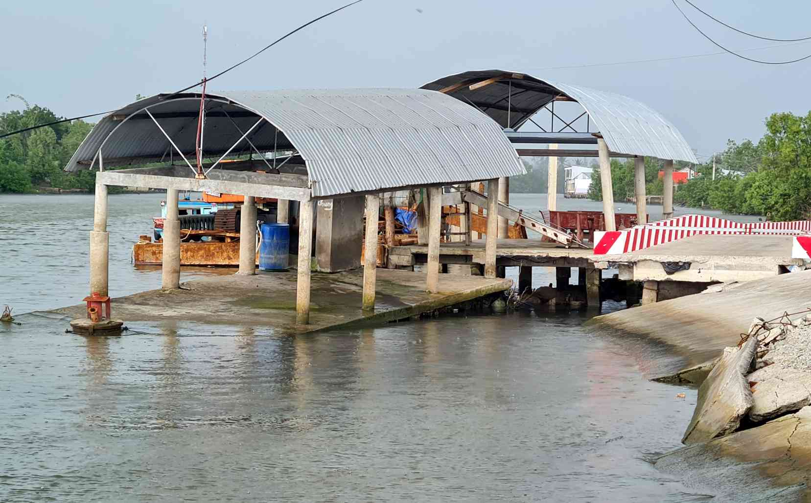
In Dam Doi commune, the Duong Thi Cam Van road along the Dam Doi river was landslide about 70m long, completely affecting 1 house, 2 cargo wharves and many other civil works. Total damage is estimated at over 3 billion VND.
Mr. Nguyen Hoang Nghiep, a resident living near the landslide area, said that the diễn biến happened very quickly, in less than 1 hour the soil and construction collapsed into the river.
Many other landslide points were also recorded in Tan Thuan commune and Tan Thanh ward. The landslide on Cong Chua trail, hamlet 13, Tan Thanh ward completely caused 4 houses to fall into the river, and 2 other houses showed dangerous cracks. Property damage is about 900 million VND.
Mr. Pham Thanh Hai, Deputy Head of Ca Mau Sub-Department of Irrigation, said that the landslide points are mainly located in areas with deep riverbeds, complex flows and strong impacts from tides. Weak soil foundation and embankment erosion cause the embankment structure to become unstable, increasing the risk of subsidence and landslides.
Initially, local authorities have supported people to relocate property, arrange safe accommodation, put up warning signs and implement temporary reinforcement solutions to limit damage.
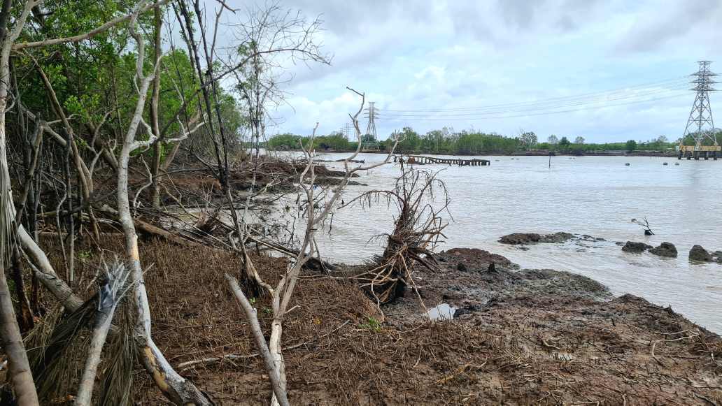
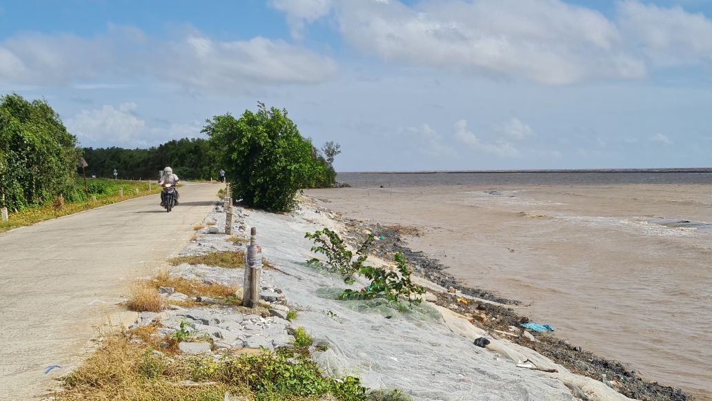
More than 56km of East Sea coast at a particularly dangerous level
Not only on river routes, the situation of East Ca Mau coastal erosion is also developing seriously.
According to the Ca Mau Department of Agriculture and Environment, the entire East Sea coastline currently has about 56.1km belonging to particularly dangerous landslide areas. Many areas record landslide speeds from 30-80m per year, especially in some places over 100m per year.
Hot spots are concentrated in the sections Bo De - Ho Gui, Ho Gui - Tan Tien, Kien Vang - Ong Ta and the area from O Ro towards Ganh Hao.
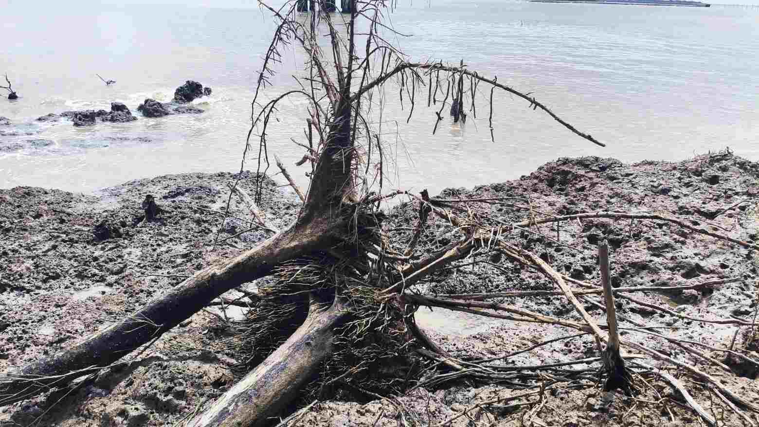
Erosion that has lasted for many years has lost from 250 - 300ha of protection forest each year, causing the natural wave belt to narrow. Many residential areas, infrastructure works, electrical systems, schools, state agency headquarters and coastal production areas are facing the risk of being directly affected.
Worryingly, if not handled promptly, landslides may affect the Ho Chi Minh road through Phan Ngoc Hien commune, high-tech shrimp farming areas and many key socio-economic projects of the province.
Mr. Nguyen Hoang Truong, a resident of the coastal area, said that previous landslides occurred continuously, causing many households to relocate their houses deep inland. Places invested in embankment protection have been effective, contributing to limiting land loss and protecting people's property.
Faced with the increasing erosion from the riverbank to the coast, the Department of Agriculture and Environment proposed that the People's Committee of Ca Mau province announce an emergency situation for natural disasters in the East Coast area. At the same time, it proposed that the Central Government support resources to invest in erosion prevention works to protect people's lives and property, maintain the protection forest system and key infrastructure projects of the locality.


