Red River churns with water after many days of heavy rain in Lao Cai

Đinh Đại |

Lao Cai - Prolonged rain for many days has caused the water level of the Red River and many rivers and streams in the province to continue to rise.

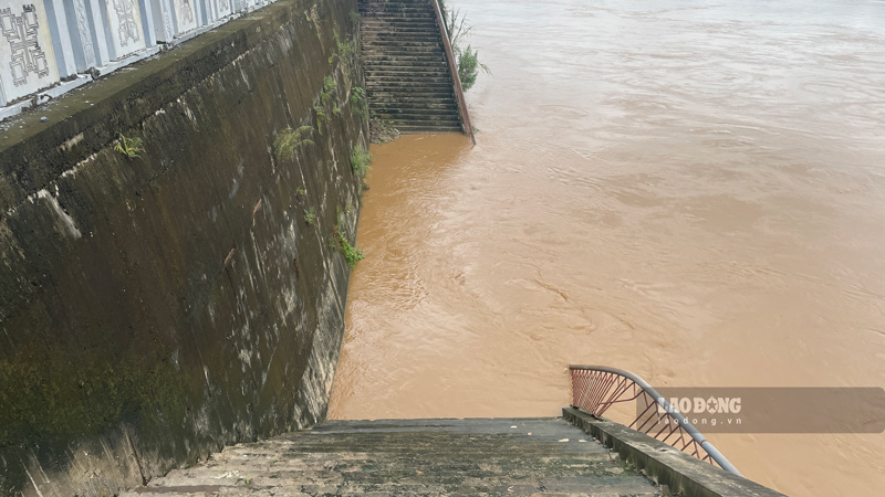
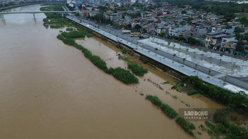
On August 5, reporters recorded in the Lao Cai ward area that after many days of early August with moderate to heavy rain, with very heavy rain in some places causing some areas to be flooded, the water level of the Red River has increased significantly compared to the dry season.

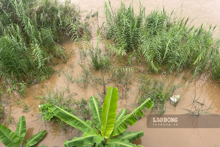
The water is cloudy, flowing swiftly, carrying many branches and garbage drifting along the stream. In some riverside areas, water has flooded into people's crop areas.

Local authorities are strengthening monitoring of water levels, and at the same time recommending people not to approach riverbanks or wharves to ensure safety.

According to the Lao Cai Provincial Hydrometeorological Station, the water level on the Thao River at Lao Cai station and Yen Bai station is currently fluctuating upwards. On the Ngoi Thia River and Chay River at Bao Yen station, the water level fluctuates according to the regulation regime of upstream hydropower reservoirs.
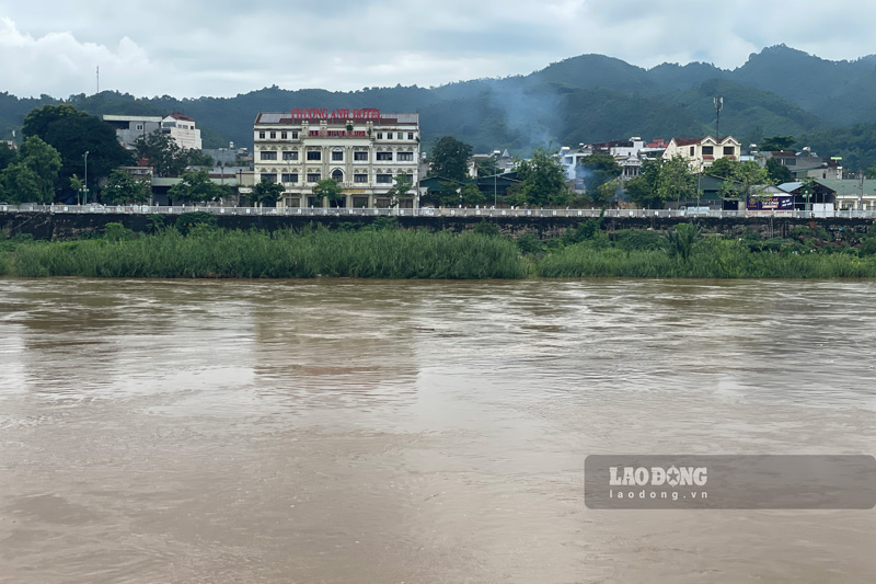
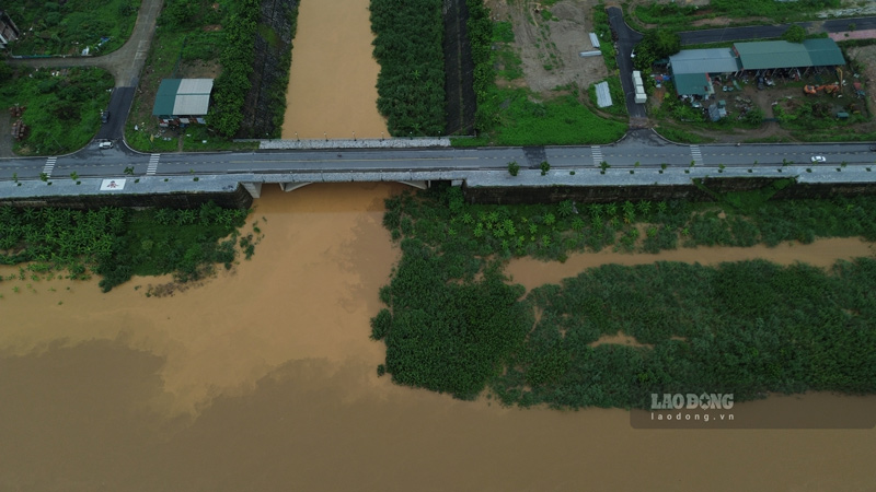
Dòng nước sông Hồng đục ngầu, chảy xiết. Ảnh: Đinh Đại
The water of the Red River is muddy and flows fast. Photo: Dinh Dai

The meteorological agency predicts that from August 4th to the end of August 5th, a flood with an amplitude of 1.5-3m is likely to appear on rivers and streams in Lao Cai province.

The peak flood on the Thao River at Lao Cai station is likely to exceed alarm level 1; at Yen Bai station at approximately alarm level 1. Small rivers and streams are likely to reach alarm level 1.

Rising river water levels can cause flooding in low-lying areas along rivers and streams.

The risk of flooding is warned in many communes and wards such as Lao Cai, Cam Duong, Coc San, Bat Xat, Muong Khuong, Luc Yen, Muong Lai, Phuc Loi, Tan Linh, Yen Binh, Yen Bai, Au Lau, Nam Cuong, Van Phu, Tran Yen, Thac Ba and some neighboring areas.
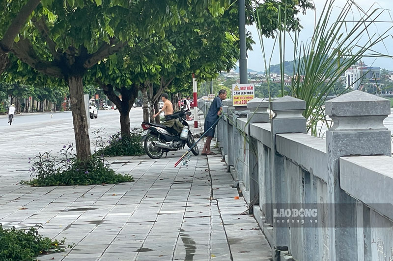
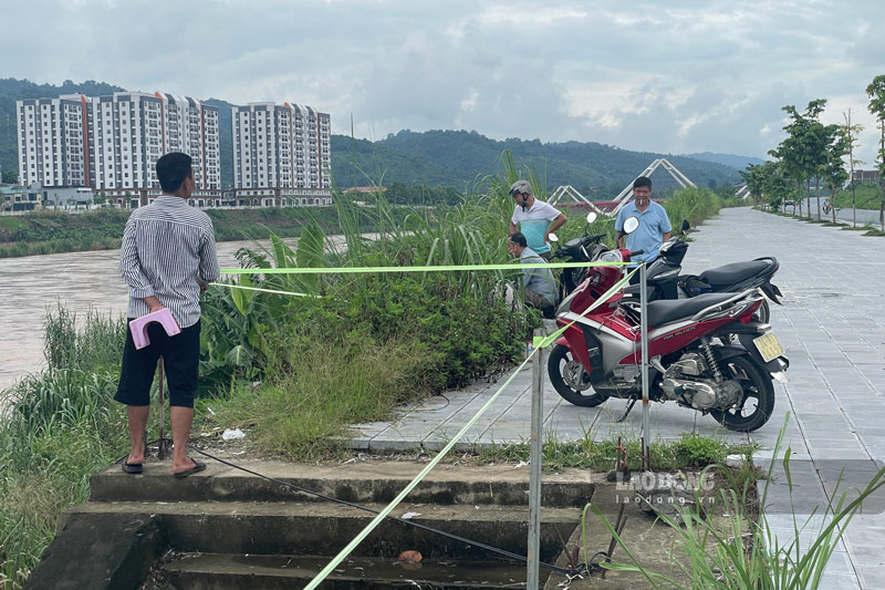
Khu vực ven sông Hồng được người dân thường xuyên theo dõi khi mực nước liên tục biến động. Ảnh: Đinh Đại.
The area along the Red River is regularly monitored by people when the water level continuously fluctuates. Photo: Dinh Dai

In addition, prolonged heavy rain increases the risk of flash floods and landslides on small rivers and streams; landslides on hillsides, traffic road slopes and land subsidence in areas with weak geological foundations.

Localities with suspension bridges and underpasses are recommended to strengthen warnings and limit people and vehicles from passing through during rain and floods.

The meteorological agency assesses the level of natural disaster risk due to floods at level 1, but floods and inundation can still affect people's lives, traffic, agricultural production, aquaculture and socio-economic activities.

Some images recorded about the Red River water on the morning of August 5th:
Nước sông Hồng dâng cao hơn nhiều so với thời điểm mùa cạn sau đợt mưa kéo dài. Ảnh: Đinh Đại
The Red River water level is much higher than during the dry season after a prolonged rain. Photo: Dinh Dai
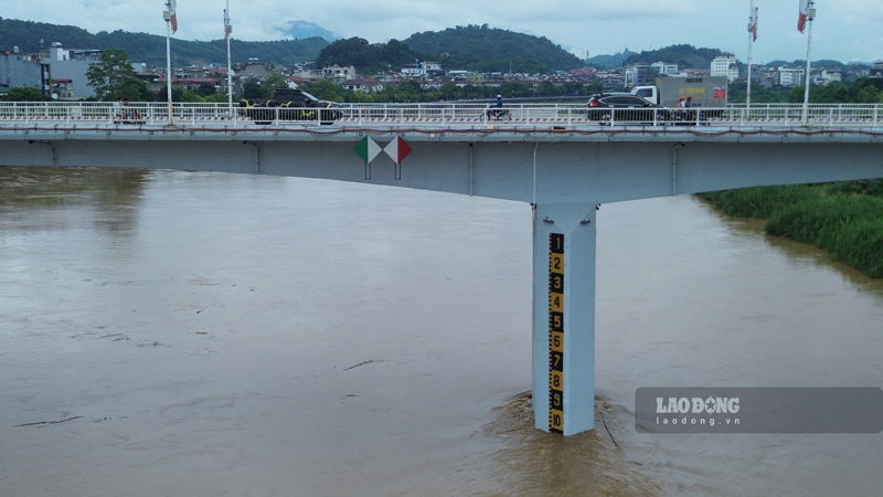
Mực nước trên sông Hồng tăng nhanh so với thời điểm mùa cạn, tiềm ẩn nguy cơ ngập các khu vực ven sông. Ảnh: Đinh Đại.
Water levels on the Red River are rising rapidly compared to the dry season, posing a risk of flooding riverside areas. Photo: Dinh Dai
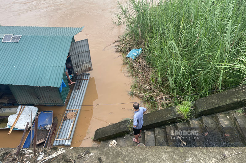
Người dân được khuyến cáo không đến gần bờ sông, bến bãi trong thời điểm mực nước sông Hồng tiếp tục lên cao. Ảnh: Đinh Đại.
People are advised not to approach riverbanks or wharves during times when the Red River water level continues to rise. Photo: Dinh Dai
Mưa kéo dài nhiều ngày khiến nước sông đổi màu, dòng chảy mạnh hơn so với thời điểm trước. Ảnh: Đinh Đại.
Prolonged rain for many days caused the river water to change color, and the flow to be stronger than before. Photo: Dinh Dai
Mực nước sông Hồng có xu hướng tiếp tục dâng, trong khi cơ quan khí tượng cảnh báo khả năng xuất hiện một đợt lũ trên các sông, suối trong tỉnh. Ảnh: Đinh Đại.
The water level of the Red River tends to continue to rise, while the meteorological agency warns of the possibility of a flood on rivers and streams in the province. Photo: Dinh Dai
Biến động mực nước sông Hồng đang được các lực lượng chức năng theo dõi sát để chủ động phòng, chống thiên tai. Ảnh: Đinh Đại.
Currently, functional forces are closely monitoring to proactively prevent and combat natural disasters. Photo: Dinh Dai
Đinh Đại
RELATED NEWS

Investing 985 billion VND to build a road connecting the Red River dike with Van Phuc bridge

|

Phu Tho - The project to build a road connecting the left dyke of the Red River with Van Phuc bridge with a total investment of nearly 985 billion VND has begun to select a construction contractor.

Forecast of floods on the Red River in Lao Cai, Phu Tho in August 2026

|

It is forecasted that in August 2026, floods and fluctuations will appear on the Red River in Lao Cai and Phu Tho.

ADB surveys flood control project along the Red River worth more than 13,200 billion VND in Lao Cai

|

The project to overcome and handle flooding and waterlogging along the Red River in the central area of Lao Cai province and surrounding areas is expected to have a total investment of over 13,200 billion VND.

Proposing more prohibited acts in publishing activities

|

The draft Law amending and supplementing a number of articles of the Publishing Law proposes to add prohibited acts in publishing activities.

Proposal to swap work schedule for 4 days off on Vietnam Culture Day 2026

|

Among the 2 options proposed, the Ministry of Home Affairs proposed the option of exchanging 1 working day for civil servants and public employees to take 4 consecutive days off on Vietnam Culture Day 2026.

5 candidates whose exam results in Quang Tri were canceled are allowed to re-register for the 2027 exam

|

Quang Tri - 5 candidates whose exam results were canceled due to negativity at the Le Truc High School exam site were registered to retake the exam in 2027.

School transcripts record unusual place names, Quang Tri Department of Education and Training requests police to verify

|

Quang Tri - The Provincial Department of Education and Training is coordinating with the police to verify the secondary school transcript of Vo Danh Thuan, Chairman of the Vietnam Fatherland Front Committee of Sen Ngu commune.

Investing 985 billion VND to build a road connecting the Red River dike with Van Phuc bridge

Tô Công |

Phu Tho - The project to build a road connecting the left dyke of the Red River with Van Phuc bridge with a total investment of nearly 985 billion VND has begun to select a construction contractor.

Forecast of floods on the Red River in Lao Cai, Phu Tho in August 2026

Tô Công |

It is forecasted that in August 2026, floods and fluctuations will appear on the Red River in Lao Cai and Phu Tho.

ADB surveys flood control project along the Red River worth more than 13,200 billion VND in Lao Cai

Bảo Nguyên |

The project to overcome and handle flooding and waterlogging along the Red River in the central area of Lao Cai province and surrounding areas is expected to have a total investment of over 13,200 billion VND.