
In July, there were 3 floods on the Thao River with an amplitude of water rising from 1 - 4m in the early and late months; 2 fluctuations with an amplitude of 0.5 - 2m in the middle of the month.
The highest flood peak at Yen Bai station (Lao Cai province) is 28.78m (9 am on July 30), at Phu Tho station is 14.24m (13 am on July 30) and both are below alarm level 1.
The water level of the Thao River at Yen Bai station in July averaged 26.43m, the lowest was 24.88m; at Phu Tho station, the average water level was 13.00m, the lowest was 11.88m.
According to records of Lao Dong Newspaper reporters on August 3, the water level of the Thao River in Phu Tho has now receded compared to the flood peak about 4 days ago, but is still at a high level, the river is immense with floodwater.
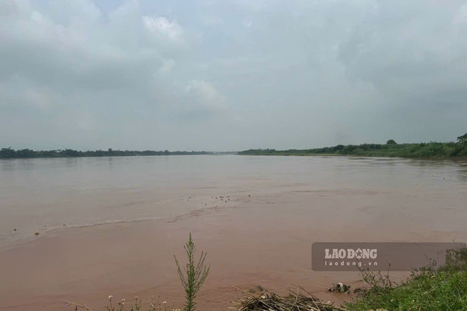
However, compared to the record low water level more than 3 months ago (22.81m at Yen Bai station on May 27th, 10.14m at Phu Tho station on April 16th), the water level of the Thao River has improved significantly after the first floods of the season.
It can be seen that the river water is muddy, flowing quite fast, the flow is vast... Alluvial grounds, sand dunes on the river and low-lying areas along the river have been obscured by floodwaters.
According to the forecast bulletin, short-term hydrographic warning issued at 10:30 am on August 3rd by the National Center for Hydro-Meteorological Forecasting, the water level of the Thao River at Yen Bai station at 7:00 am on August 3rd was at 27.04m, at the same time at Phu Tho station at 13.22m.
And throughout August, long-term hydrological forecast and warning bulletins said that there is a possibility of 2-3 floods and 1-2 fluctuations on the Thao River.
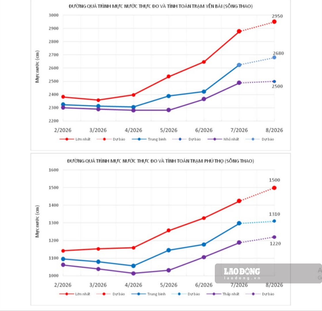
The water level of the Thao River at Yen Bai station is forecast to average in August at about 26.80m, highest at 29.50m, lowest at 25.00m; at Phu Tho station, the average monthly forecast is about 13.10m, highest at 15.00m, lowest at 12.20m.
For the downstream Red River at Hanoi station, in July, the water level fluctuates according to the regulation of the upper-level hydropower plant and is strongly affected by the tidal regime.
In July, there were 4 fluctuations following an upward trend, of which the highest water level in the month reached 5.35m (5:00 AM on July 31st) due to the flood impact on the Thao River basin (currently Hoa Binh reservoir closed 1 at 4:00 PM on July 31st, and Tuyen Quang reservoir still maintains opening 1 bottom discharge gate).
It is forecasted that the water level downstream of the Red River at Hanoi station will continue to fluctuate according to the above-line hydropower plant and be affected by tides. In August, there is a possibility of 2-3 fluctuations.


