
On the evening of August 21, Mr. To Anh Dung - Chairman of Thanh Hoa Provincial People's Committee issued an urgent telegram on focusing on responding to storm No. 4 and heavy rain in the province.
According to the urgent dispatch, in the late afternoon of August 21, 2026, the tropical depression in the Northern Gulf area has strengthened into storm No. 4. At 16:00 on August 21, the storm center was at about 20.6 degrees North latitude; 108.5 degrees East longitude, the strongest wind near the storm center was level 8, gusting to level 10.
Forecast from the morning of August 21 to the morning of August 23, Thanh Hoa area will continue to have moderate rain, heavy rain, in some places very heavy rain and thunderstorms, total rainfall commonly 70 - 150mm, especially in the North and Northwest regions, some places over 200mm. From the afternoon of August 23 to August 25, the locality will continue to have the possibility of moderate rain, heavy rain, total rainfall commonly 50 - 100mm, in some places over 100mm.
Total rainfall from the morning of August 21 to the end of August 25 is likely to reach 100 - 250mm, especially in the North and Northwest regions, there are places over 300mm. Functional agencies warn of a high risk of flash floods on small rivers and streams, landslides and flooding.
Chairman of Thanh Hoa Provincial People's Committee requested departments, branches, and localities to strengthen information on storm developments, heavy rain, risks of floods, inundation, flash floods, and landslides to people to proactively respond.
For coastal areas, units must closely monitor the developments of storms, promptly notify ship owners and vehicles operating at sea; count and guide ships and boats to escape dangerous areas or return to safe shelters. At the same time, deploy measures to ensure safety for tourism activities, aquaculture, seafood exploitation and coastal and island projects.
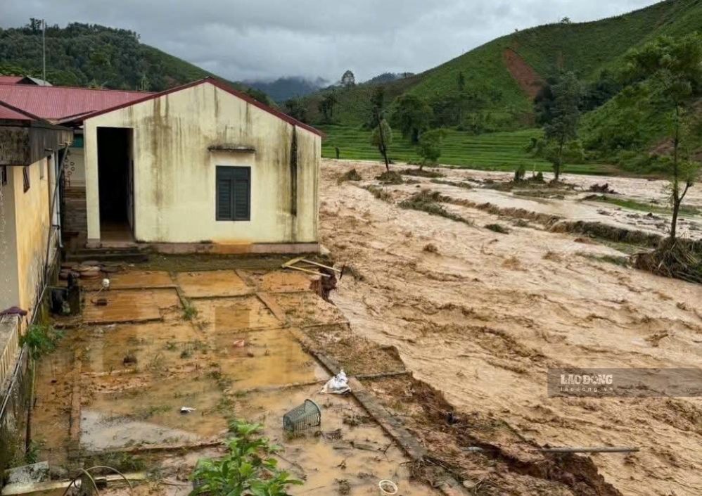
On land, the Provincial People's Committee requests to review residents in areas at high risk of flooding, flash floods, and landslides, especially places that have experienced subsidence and landslides in the past time, to proactively relocate and evacuate people when necessary.
Localities must ensure necessities for people in evacuated areas, not to let food and drinking water shortages occur; absolutely not to let people return home when safety is not guaranteed.
The telegram requests units to inspect and review plans to ensure safety for dykes, dams, traffic works, under construction works and important infrastructure; arrange on-duty forces to promptly handle arising situations.
Localities must proactively drain water in agricultural production areas, low-lying areas, urban areas, and industrial parks; inspect drainage systems, clear flows, and limit the risk of flooding and waterlogging.
Request functional forces to be ready to control traffic in underground areas, spillways, deep flooded areas, fast flowing water, areas at risk of landslides; resolutely not allow people and vehicles to pass through when safety is not ensured.
In addition, localities must prepare forces, materials, vehicles, and logistics according to the "4 on-site" motto, especially in key areas and residential areas at risk of being cut off when floods occur.
The Provincial People's Committee also requested information and communication agencies to increase the time for propaganda about natural disaster developments, guide people on response skills; organize serious duty 24/24h, regularly update the situation to promptly direct handling.


