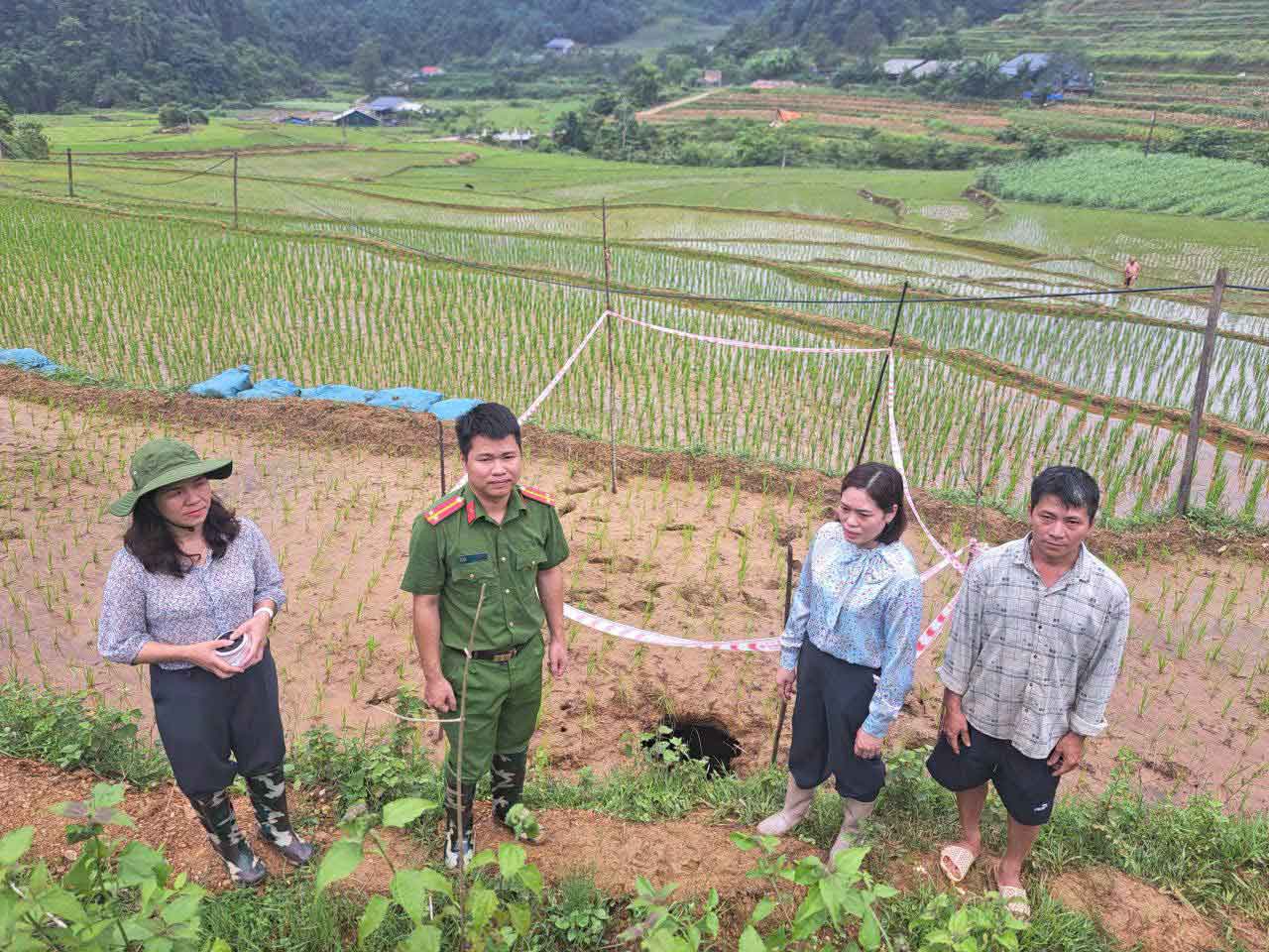
On June 18, Nguyen Binh Commune Police coordinated with functional forces to survey the scene of a karst sinkhole (sinkhole) that had just appeared in Tong Nga hamlet, Nguyen Binh commune.
According to initial information, during the production process on June 17, people discovered an unusually deep sinkhole on the cultivated field area and quickly reported it to the local authorities.
Through actual inspection, the subsidence pit has a mouth diameter of about 60cm and a depth of more than 3m.
The location of appearance is located right on the agricultural production area, so there is a potential risk of further expansion, affecting people's labor activities.
Immediately after the survey, functional forces planted warning signs, stretched ropes to cordon off dangerous areas, preventing people and livestock from approaching the scene.
At the same time, people are advised not to go into the subsidence area, to proactively monitor signs of cracks, breaks, and abnormal subsidence to promptly notify functional agencies.
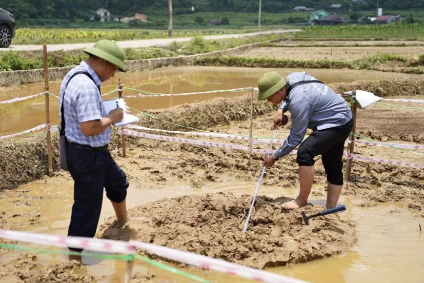
Previously, in early June 2026, in Ban Hoong hamlet, Truong Ha commune, a large subsidence hole appeared in the middle of a cultivated field, attracting the attention of people and experts.
The survey team of the Northeast Geological Federation, Vietnam Geological Survey directly came to the site to assess the current status and related geological factors.
Initial survey results show that the Ban Hoong area is located in a typical karst valley, where the intersection of many geological fault systems and contact between limestone formations and the sedimentary layer covering the surface occurs.
The sinkhole is determined to be more than 3m wide, about 2.5m deep, developing in the North-South direction, coinciding with one of the main fault directions of the area.
According to geological experts, the subsidence phenomenon may be related to the natural karstification process combined with the fluctuation of groundwater flow.
Heavy rainfall in recent times along with water drainage activities serving agricultural production may increase water seepage, leading to the displacement of soil and rock materials into hollow cavities underground.
The survey team believes that it is necessary to continue researching and collecting more data to accurately determine the cause of the sinkhole formation.
In the immediate future, localities are recommended to zone dangerous areas, regularly monitor the change of materials at the bottom of the pit as well as signs of deformation on the surface to promptly propose handling plans.
The continuous appearance of karst subsidence holes shows the complexity of the limestone terrain in Cao Bang.
In the context of extreme weather diễn biến, prolonged heavy rain may increase the risk of arising abnormal geological phenomena, requiring monitoring, warning and ensuring safety for people to be carried out regularly and continuously.


