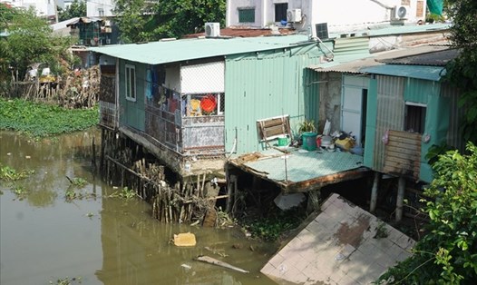
The Ho Chi Minh City Department of Transport has just approved a project to prevent landslides on riverbanks, canals, and ditches in the city.
The project will deploy the construction of embankments at two sections of the river at high risk of landslides.
The left bank of the Red River - Kinh Lo River (in Hiep Phuoc Commune, Nha Be District) is about 400m long.
The right bank of the Dong Nai River (in Thanh My Loi Ward, Thu Duc City) is 100m long.
The main items include building solid walls and embankment foundations, integrating a drainage system and a corridor behind the embankment of more than 2 m wide to ensure the safety of people and improve riverbank infrastructure.
The project has a total investment of 142 billion VND, of which construction costs account for nearly 81 billion VND, more than 35 billion VND is for site clearance, the rest is for consultation costs, contingency...
The entire investment cost is from the Ho Chi Minh City budget. It is expected that the project will be implemented and completed this year.
According to statistics, Ho Chi Minh City currently has 31 locations of dangerous and especially dangerous landslides, directly affecting 427 households.
Nha Be district is the area most severely affected with 7 landslides, concentrated at Long Kieng bridge, Phuoc Loc bridge, Rach Giong - Kinh Lo river, Doi canal...
Thu Duc City recorded 5 landslides, including 2 particularly dangerous points in Giong Ong To Canal, threatening 19 households. Other landslides are located along the Dong Nai River, Saigon River...
Can Gio District and Binh Thanh District have 5 landslides in each location, while the remaining locations are scattered in District 12, Hoc Mon District, Cu Chi and Binh Chanh.


