How dangerous storm No. 3 Wipha is and how to deal with it is receiving great attention from the people.
The way of reporting on storm No. 3 Wipha has been changed in a timely manner to continuously update, directly to the people. The number of reports from VTV and newspapers increased to update information promptly.
The way storms or weather reports are reported has changed significantly over time.
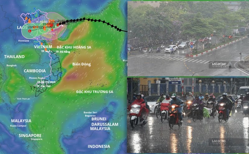
Previously, weather forecast, flood and storm news was only updated by the National Center for Hydro-Meteorological Forecasting, but now it has been livestreamed ( live) according to the developments every minute, every hour with the reporter's scene image.
Reporters on the scene must be on duty and bravely work directly in localities affected by the storm.
In particular, many press agencies and centers also take advantage of TikTok and YouTube Shorts, creating 3060 second short videos with natural voice, subtitles, and visual iconography, helping to reach young audiences who rarely watch TV but can still grasp the situation of storms and floods.
The storm news also uses closer language to help audiences of all ages understand and grasp easily.
At the same time, storm bulletins strengthen specific warning and guidance factors: Explain why the storm is strong, which areas are most dangerous and provide detailed prevention instructions such as preparing necessities, checking the house, avoiding going to sea...
Obviously, in recent years, audiences have seen a clear change in the way weather reports are delivered, especially storm reports. That is thanks to digital technology and changes in the habit of receiving information from the public.
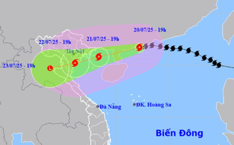
Instead of just broadcasting news about storms at fixed times with static weather maps, viewers are now constantly updated. Vietnam Television (VTV) broadcasts at a frequency of 2 hours each time to inform about storm No. 3 Wipha.
Today, storm news has been continuously updated in real time through social networks, mobile applications such as Facebook, Zalo, TikTok and official weather forecast apps, mini apps for preventing natural disasters in Vietnam.
The use of dynamic graphics, 3D videos, and interactive maps helps viewers easily visualize the path, affected areas, and the level of danger of storms.
In addition, with the application of digital technology, each citizen is sent a warning via a mobile application on skills to respond to storm No. 3, from the Department of Dyke Management and Natural Disaster Prevention.
Push notification notification on the phone will help warn people as soon as there is a major change in the direction or level of the storm.