LEGEND OF THE SEREPOK LINE
Serepok also has a strange water journey, from one origin then split into two streams, finally merging. It is like the flow of a love story that we often encounter: Uniting then breaking up, breaking up then uniting, and then the story of merging and breaking up continues forever, creating many ups and downs, many wonders and much pain along that journey.
The story of a river is no different from the story of a human being. Therefore, the great and rich imagination of the Central Highlands epic also sees the story of the separation of Serepok as a tragic love story, just like the Dak Bla river in Kon Tum province that Lao Dong Weekend newspaper introduced in the previous issue.
However, this love story will be different from the other love stories because they still share the same motif of passionate love, encountering difficulties, then finding eternal life together and thanks to that, good values are born in that land and those communities.
According to the legend of the M’nong people, Serepok is the timeline of a forbidden love. There was a young couple in love separated by a river, but it was also the dividing line between two families. Unable to overcome family prejudice, the couple committed suicide by embracing each other in the Serepok River on a bright moonlit night.
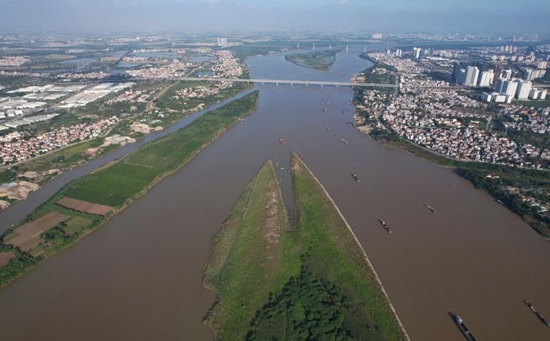
Giang (the supreme god of the M’nong people), upon witnessing the intense and sad love between the two, caused the river to split into two - one side flowing rapidly and muddy, the other side clear and gentle. The muddy, masculine stream was called Bo River (Krong No), while the clear, soft, feminine stream was called Me River (Krong Ana). The two streams flowed to Krong Ana district of Dak Lak province, where they merged again to form the Serepok River as before.
The water that has been divided into Bo River and Me River originates from Krong Kmar waterfall at the foot of Chu Yang Sin mountain range - the roof of Dak Lak province and South Central Coast (2,442 meters). There, the water of Krong Kmar waterfall divides into 7 streams to join together to form the upper source of Serepok.
Before 2004, both Krong No and Krong Ana rivers belonged to Dak Lak province. But then, a separation occurred, 6 districts of Dak Lak province were separated to form Dak Nong province, and the Krong Ana river remained in Dak Lak, while the Krong No river went to Dak Nong province.
And whether by accident or on purpose, the natural boundary between these two brother provinces is the Serepok River. Therefore, Serepok is even more symbolic of the union and separation, proving that, no matter how they are united or separated, they will forever share the same origin.
From the highest mountain peak named Heaven's Gate in the South of Truong Son range, Serepok crossed ancient volcanic soil foundations, with Bidoup plateau - the roof of the Central Highlands - in the Southeast and Krong Nang plateau in the Northeast.
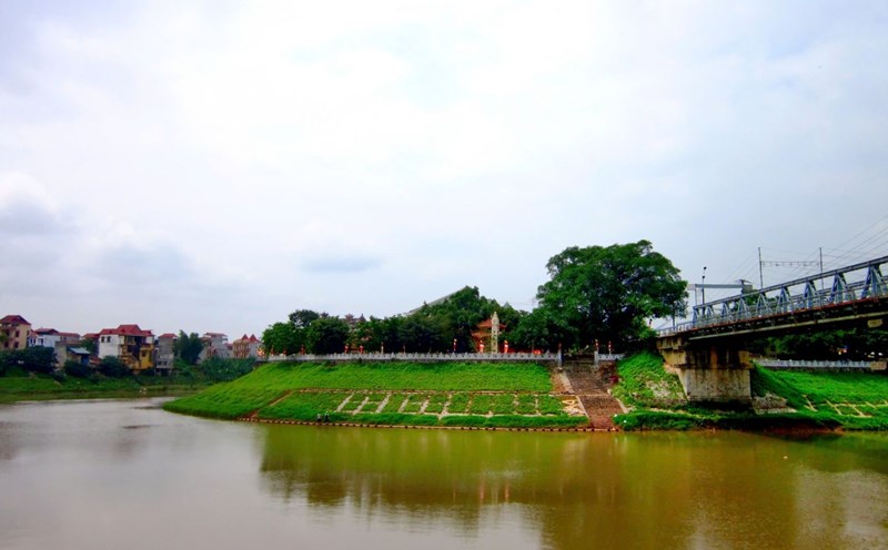
This stream not only flows through the core area of Dak Nong Global Geopark but also becomes an important waterway for trade, commerce, and exchange of material and spiritual goods between Lao, Cambodian and residents in the Dak Lak Highlands with Don village as a Hoi An trading post of the Central Highlands.
But the Serepok's waterway is still strange, because this is also a river that flows in the opposite direction. Of its total length of 315km, the Serepok only flows 125km in Vietnam, the rest is in Cambodia and then joins the rivers here to the Mekong Delta in the Southwest, before dissolving into the East Sea.
This is because the Southern Truong Son mountain range is the watershed (divided water) of the river systems flowing to the eastern coastal plains and into the East Sea and the river systems flowing to the west are tributaries of the Mekong River. And the Serepok River is one of the few rivers (along with the Dak La River) that flows back to the west, forming a pair of rivers flowing back in the Central Highlands.
The Birth of a Hundred High Waterfalls
Serepok is considered the most ferocious river in Vietnam, surpassing the ferocity of the Da River in the Northwest. The reason is very simple, Serepok flows through a complex terrain, diverse in surface and elevation, so it has many faces: Sometimes gentle like Krong Kno and Krong Ana, but mostly it is raging with rapids, throwing up misty water.
High waterfalls are the traditional works of the Serepok River, especially in the places where the river flows through Dak Nong province. According to Mr. Vu Ngoc Tu - Editor-in-Chief of Dak Nong Party Newspaper and a person who is very knowledgeable about this land, there are about 300 waterfalls created by Serepok and Krong Kno in Dak Nong.
Anh Tu said that Dak Nong Plateau is composed of Dak Mil and Dak Nong Plateaus, at an altitude of 160m to 1960m, low in the North and gradually higher in the West - South. Therefore, this place is the source of large rivers such as Serepok and Be River (due to the confluence of Dak Tit and Dak R'lap Rivers).
Such a difference in altitude has turned Dak Nong into the "capital of high waterfalls", with magnificent, majestic but also extremely poetic waterfall clusters such as Trinh Nu - Dray Sap - Gia Long waterfall cluster, and small waterfalls such as: Dray H'Linh, Dak G'lun, Lieng Nung, Dak Buk So, Luu Ly...
Dray Sap is the downstream waterfall in the system of 3 waterfalls Gia Long - Dray Nur - Dray Sap of Serepok River. This waterfall is located in Nam Ha commune, Krong No district, Dak Nong province, 30km from Buon Ma Thuot city center. Dray Sap in Ede language means Smoke Waterfall, the name is enough to show the magic and fierceness created by the smoke and water.
The height of the waterfall is about 30m, spreading about 100m, when Buon Kuop hydroelectric lake discharges water, the water from above falls down the valley, creating a large mass of water like a fierce dragon. The height of the waterfall causes the water mist to fly up like a mist covering hundreds of meters, creating a majestic landscape with the sound of the waterfall echoing throughout the space.
Standing in front of Dray Sap, we will think of the strong, straightforward, and noble character of the Central Highlands people. That is also the character of Serepok or the Krong No River. And Dray Sap is in complete contrast to the poetic and graceful beauty of Dray Nur waterfall in Dak Lak province.
Dray Nur waterfall is over 250m long and 30m higher than Dray Sap. This leads to a hypothesis that these two waterfalls are actually located at the same altitude as Serepok, but because in the upstream area of the waterfall, the surface of Serepok suddenly expands unusually, and is blocked by a cliff, so it is impossible to see that the two waterfalls are on the same section of the river.
This further illustrates the strange nature of the Serepok River. There are too many factors that are related to or created by the river. But the Serepok does not care much, just rumbling across the million-year-old rocks created from molten magma, the black columnar basalt rocks that are up to 5 million years old.
Serepok continues to flow with a huge volume of water, despite being blocked upstream to build a hydroelectric plant. Because millions of underground water veins of Dak Nong Geopark always give themselves to Serepok, from the honeycomb cracks of basalt flowing from the Nam Blang volcanic area.
The great and enduring power of Serepok and the geological formation of the volcanic system stretching across the Central Highlands have created a heroic legend of Fire and Water. From these two great elements, life has been formed, until today!