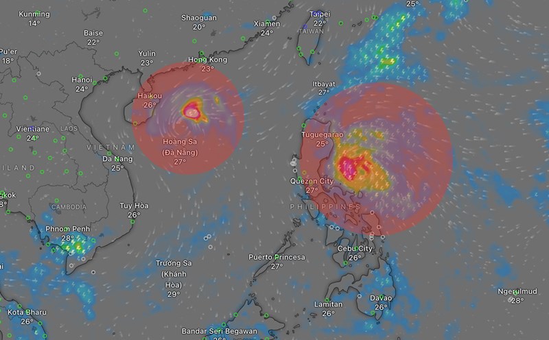
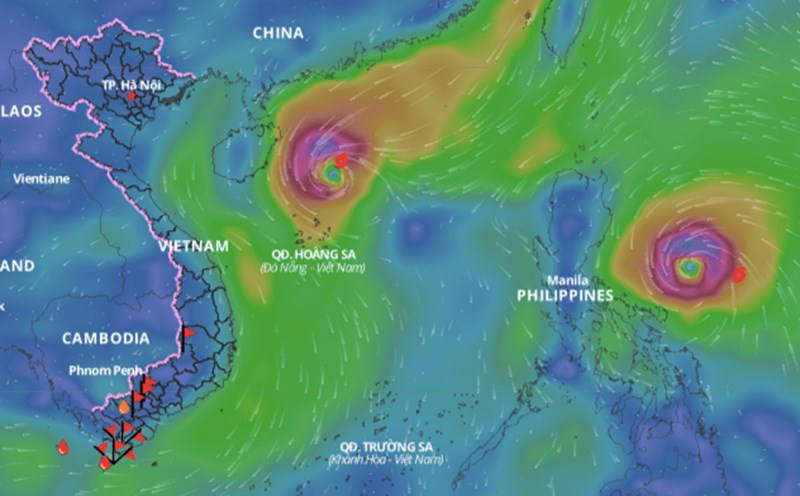
According to the National Center for Hydro-Meteorological Forecasting, currently, the eastern region of the Philippines has 2 storms and 1 tropical depression active at the same time.
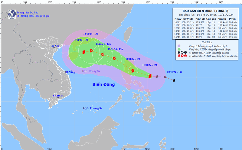
"Storm Toraji is likely to move into the East Sea in the evening to the night of November 11," said Mr. Nguyen Van Huong, Head of Weather Forecast Department, National Center for Hydro-Meteorological Forecasting, General Department of Hydro-Meteorology.
At 1 p.m. on November 10, the center of storm Toraji was located in the sea northeast of Luzon Island (Philippines). The strongest wind near the center of the storm was level 11 (103 - 117 km/h), gusting to level 13. The storm moved west-northwest at a speed of 15 - 20 km/h.
According to Mr. Huong, after storm number 7, storm number 8 Toraji will appear immediately.
"Under the impact of storm number 7 and then storm number 8, the northern and central areas of the East Sea will experience continuous bad weather in the coming days, with strong winds, high waves and rough seas," said Mr. Huong.
The National Center for Hydro-Meteorological Forecasting will continuously issue storm warnings near the East Sea to update the latest developments of storm Toraji.
Due to the impact of storm No. 7 Yinxing, the sea area west of the North East Sea (including the Hoang Sa archipelago) has strong winds of level 7 - 9, the area near the storm's center has winds of level 10 - 12, gusts of level 14, waves 4 - 6m high, the area near the center is 6 - 8m; the sea is very rough.
From early morning on November 11, the sea off the coast of Quang Tri to Quang Ngai has gradually increased winds to level 6 - 7, gusts to level 9, waves 2 - 4m high; rough seas.
Ships operating in the above mentioned dangerous areas are likely to be affected by storms, whirlwinds, strong winds and large waves.


