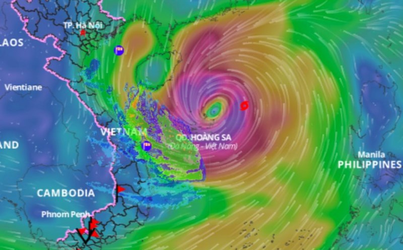
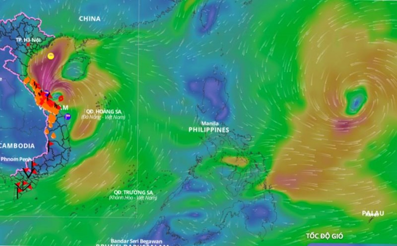
Typhoon No. 7 Yinxing has had a major impact on marine weather. Forecast information on the storm's impact on land is of interest to the public.
Mr. Nguyen Van Huong - Head of Weather Forecast Department, National Center for Hydro-Meteorological Forecasting, General Department of Hydro-Meteorology provided the latest comments on this storm.
Sir, why did the intensity of storm No. 7 Yinxing weaken rapidly after entering the East Sea?
- On the afternoon of November 9, storm No. 7 had its strongest intensity at level 14 - 15. After reaching its strongest intensity yesterday afternoon, from the night of November 9, storm No. 7 stabilized and early this morning (November 10), changed direction to move south, with its intensity rapidly decreasing.
Since last night, storm No. 7 has moved into an area with unfavorable environmental conditions for storm development. Firstly, the current sea surface temperature in the western part of Hoang Sa archipelago is below the optimal level, below 26 degrees, reducing the energy supply for the storm, contributing to its gradual weakening.
Second, the cold and dry air mass still prevails, so the relative humidity in the atmosphere from the ground to an altitude of 1500m is very low, limiting the development of storm clouds.
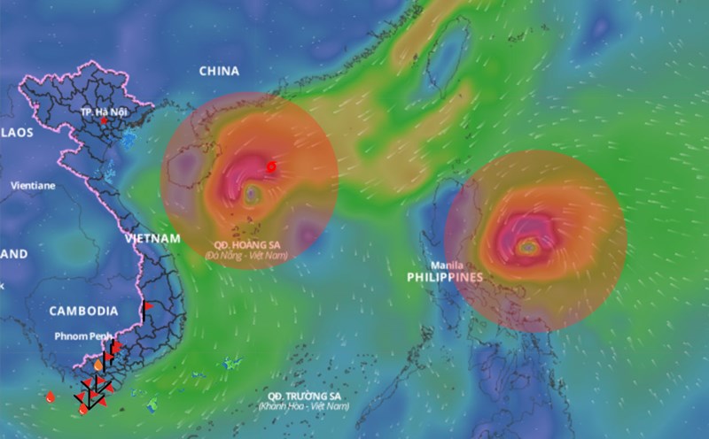
In addition, there is currently a new storm, internationally named Toraji, active in the eastern part of the Philippines. Tomorrow morning, when moving into the eastern part of Luzon Island (Philippines), the distance between storm No. 7 Yinxing and storm Toraji will be about 1,200 - 1,400 km. This is the distance at which the double storm interaction occurs.
Typhoon Toraji will shift Typhoon No. 7 Yinxing further south.
It is forecasted that in the next 24 - 48 hours, the storm will continue to move southwest and its intensity will rapidly decrease to below level 10 due to unfavorable conditions of temperature and humidity.

What is the most dangerous impact of storm number 7 now, sir?
- For storm No. 7, the most dangerous impact is the strong wind at sea, with the sea area west of the North East Sea having strong winds of level 7 - 9, near the storm's center having winds of level 10 - 13, gusting to level 16, waves 4 - 6m high, near the center 6 - 8m; the sea is very rough.
From early morning on November 11, the sea area from Quang Tri to Quang Ngai has strong winds of level 6 - 7, near the eye of the storm is strong at level 8, gusts of level 10, waves are 2 - 4m high, near the eye of the storm are 3 - 5m; the sea is rough. Ships operating in the above dangerous areas are likely to be affected by storms, whirlwinds, strong winds, and big waves.
The storm weakened so quickly, so will it have any impact on land, sir?
- Due to the influence of storm No. 7 from tomorrow evening and night until the end of November 12, there will be rain in the Central Central and South Central regions, but there is very little possibility of extreme rain causing flooding on rivers in the Central region.
These are impact warnings based on current data. People in the coastal areas of the Central region, especially from Quang Tri to Quang Ngai, need to closely monitor the storm situation and prepare response plans to minimize risks.
Thank you very much!


