According to the National Center for Hydro-Meteorological Forecasting, due to the influence of storm No. 3, in Bach Long Vi special area, there were strong winds of level 8, gusting to level 10; Co To and Cat Ba special areas (special to Cat Hai area) had strong winds of level 6, gusting to level 8; Cua Ong had strong winds of level 9, gusting to level 10; Quang Ha had strong winds of level 8; Mong Cai had strong winds of level 6, gusting to level 9.
Storm No. 3 Wipha reduces intensity when entering the mainland
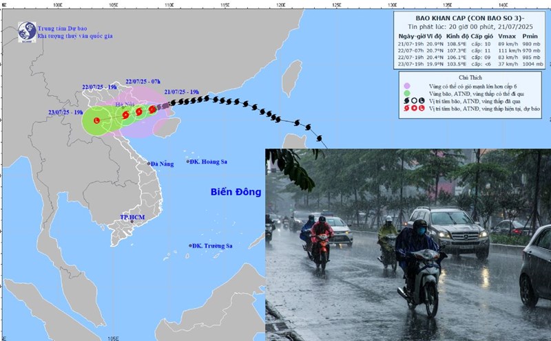
At 10:00 p.m. on July 21, the center of the storm was at about 20.8 degrees north latitude; 108.2 degrees east longitude, about 80 km from Quang Ninh, 180 km from Hai Phong, about 190 km from Hung Yen, about 220 km from Ninh Binh. The strongest wind near the storm center is level 10 (89 - 102 km/h), gusting to level 13. The storm is moving west-southwest at a speed of about 10 km/h.
It is forecasted that in the next 12 hours, the storm will move west-southwest at a speed of about 10 km/h and is likely to strengthen. At 10:00 on July 22, the center of the storm was at about 20.6 degrees north latitude; 107.1 degrees east longitude, in the sea from Quang Ninh to Ninh Binh. The strongest wind near the storm center is level 11, gusting to level 14.
The dangerous area at sea is north of the latitude of 18.5 degrees north, from the longitude of 106 degrees east to 110 degrees east. The risk level of natural disasters due to storms is level 3 for affected areas including the Gulf of Tonkin, coastal waters of provinces from Quang Ninh to Thanh Hoa.
It is forecasted that in the next 24 hours, the storm will continue to move west-southwest at a speed of about 10-15 km/h. At 10:00 p.m. on July 22, the center of the storm was at about 20.3 degrees north latitude; 105.8 degrees east longitude, on the mainland from Hai Phong to Thanh Hoa. The strongest wind near the storm center is level 8, gusting to level 10.
The dangerous area at sea is north of latitude 18.5 degrees north, west of longitude 109.5 degrees east. The disaster risk level is level 3 for affected areas including the Gulf of Tonkin, coastal waters and mainland provinces from Quang Ninh to Nghe An.
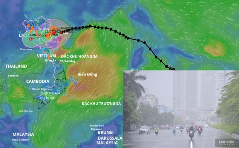
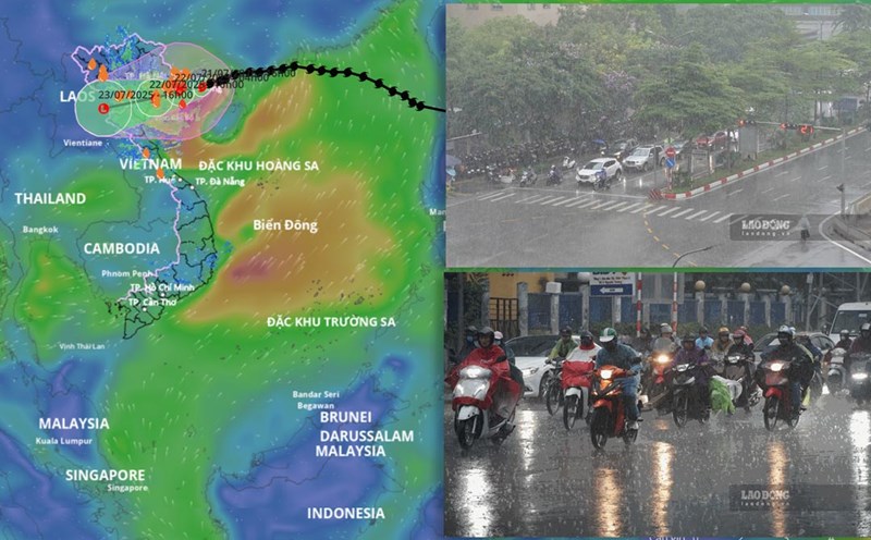
It is forecasted that in the next 48 hours, the storm will continue to move west-southwest at a speed of about 10-15 km/h and gradually weaken into a low pressure area. At 10:00 p.m. on July 23, the center of the low pressure area was at about 19.7 degrees north latitude; 102.9 degrees east longitude, in the upper Laos area. Wind power below level 6.
Warning of increased heavy rain and strong winds from tonight
Regarding the impact of the storm, at sea, the northern sea area of the Gulf of Tonkin including the special areas of Bach Long Vi, Co To, Van Don, Cat Hai, Hon Dau island will have strong winds of level 7-9, the area near the storm's center will have winds of level 10-11, gusting to level 14. Waves 2-4 m high, near the center of the storm 4-6 m, the sea is rough. The southern sea area of the Gulf of Tonkin, including Hon Ngu Island, will have winds gradually increasing to level 6-7, near the storm center level 8-9, gusting to level 11. Waves are 2-4 m high, the sea is very rough.
Coastal areas from Hung Yen to Quang Ninh have storm surge water from 0.5-1.0 m. The water level in Ba Lat (Hung Yen) is 2.4-2 1.6 m high, in Hon Dau (Hai Phong) is 3.9-4.3 m high, in Cua Ong (Quang Ninh) is 4.6-5.0 m high and in Tra Co (Quang Ninh) is 3.6-4.0 m high. There is a high risk of flooding in coastal areas and river mouths on the afternoon of July 22.
Warning, the weather at sea and in coastal areas during the storm is extremely dangerous, unsafe for any vehicles or works operating in dangerous areas such as tourist boats, passenger ships, transport ships, cages, aquaculture areas, dykes, embankments, coastal roads. Vehicles at high risk of capsizing, destruction, flooding due to strong winds, thunderstorms, whirlwinds, large waves and rising sea levels.
On land, coastal areas from Quang Ninh to Nghe An will have winds gradually increasing to level 7-9, near the storm center level 10-11, gusting to level 14. Deep inland areas of Hai Phong, Hung Yen, Bac Ninh, Hanoi, Ninh Binh and Thanh Hoa provinces and cities have winds gradually increasing to level 6, some places level 7, gusting to level 8-9. Winds of level 10-11 can cause trees, electric poles to fall, and roofs to fall, causing very heavy damage.
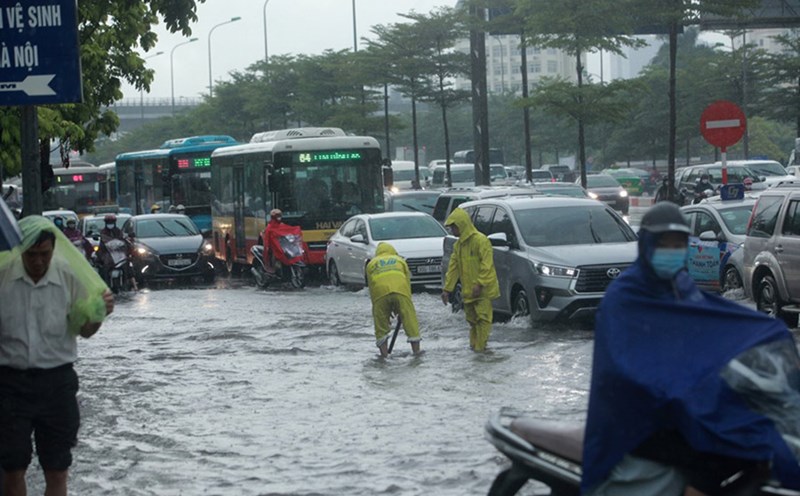
Regarding heavy rain, from the night of July 21 to July 23, in the Northeast region, the Northern Delta, Thanh Hoa and Nghe An, there will be heavy to very heavy rain and thunderstorms with common rainfall of 200-350 mm, some places over 600 mm. Other places in the Northern region and Ha Tinh will have moderate rain, heavy rain, some places will have very heavy rain and thunderstorms with common rainfall of 100-200 mm, some places over 300 mm. Warning of the risk of heavy rain over 150 mm in 3 hours. Heavy rainfall in a short period of time can cause flash floods, landslides in mountainous areas, and flooding in low-lying areas.