According to the National Center for Hydro-Meteorological Forecasting, in the past 24 hours (from 2:00 p.m. on October 6 to 2:00 p.m. on October 7), the Northern and Thanh Hoa provinces have had moderate rain, heavy rain, and very heavy rain in some places. Some places have heavy rainfall such as: Muong Khoa 170.6 mm (Lai Chau); Sin Thau 115.4 mm (Dien Bien); Chieng Khay 140.4 mm (Son La); Thanh Luong 147 mm (Phu Tho); Trinh Tuong 204 mm (Lao Cai); Hoa Thuong 565 mm (Thai Nguyen); Nguyen Binh 239.4 mm (Cao Bang); Quyet Thang 253.5 mm (Lang Son); Chuc Bai Tho 285.8 mm (Quang Ninh); Bo Ha 399.6 mm (Bac Ninh); Ten Tan 219.6 mm (Thanh Hoa)... The soil moisture model shows that some areas in the above provinces have reached or are close to the state of typhoon (over 85%).
Warning in the next 3 - 6 hours (from 2:30 p.m. on October 7), the Northern and Thanh Hoa provinces will continue to have rain, with common accumulated rainfall as follows: Tuyen Quang, Cao Bang, Thai Nguyen, Bac Ninh, Hai Phong from 40 - 80 mm, some places over 150 mm; Lang Son, Quang Ninh, Thanh Hoa from 20 - 50 mm, some places over 90 mm; other areas in the Northern region from 20 - 40 mm, some places over 70 mm.
Warning in the next 6 hours (from 2:30 p.m. on October 7), there is a risk of flash floods on small rivers and streams, landslides on steep slopes in many communes and wards.
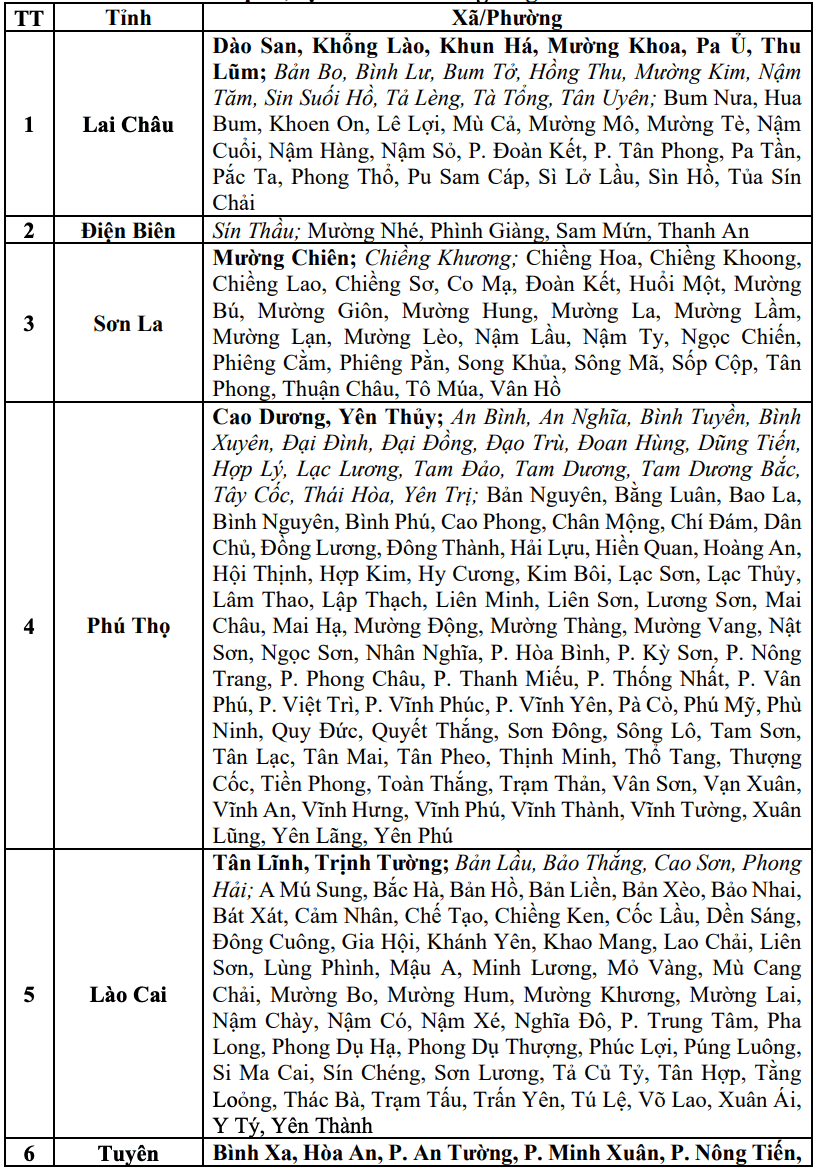
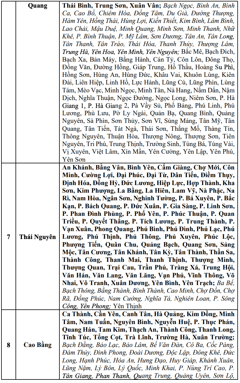
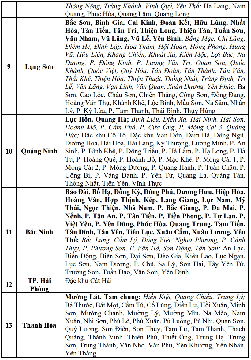
The meteorological agency warns that the risk of natural disasters due to flash floods, landslides, and land subsidence due to heavy rain or water flow is level 1; in Cao Bang and Lang Son, it is level 2; Thai Nguyen is level 3.
The meteorological agency recommends that localities proactively review flow bottlenecks and vulnerable areas to take timely preventive and response measures to the above risks.