Thunderstorms in the South in the next 3 days

HẠ MÂY |

According to the Southern Hydrometeorological Station, thunderstorms will continue in the last days of September, concentrated in the afternoon and evening.

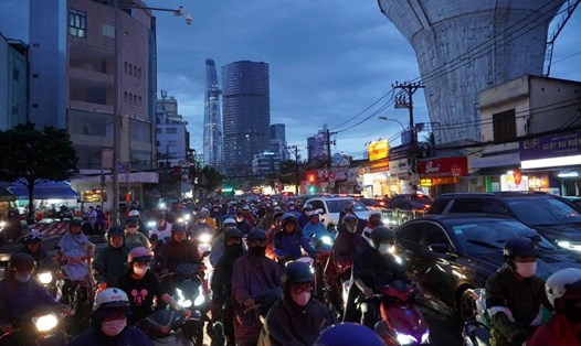
On the afternoon of September 27, combined with monitoring on satellite cloud images, lightning location data and weather radar images, it was shown that convective clouds formed and developed in the areas of Long An, Ho Chi Minh City, Dong Thap, Dong Nai, and Ba Ria - Vung Tau provinces.

From now until the next 4 hours, these convective clouds will cause showers and thunderstorms in the above mentioned area, then continue to develop and expand, causing rain in neighboring districts of the above mentioned provinces and neighboring provinces. During the thunderstorms, there is a possibility of tornadoes, lightning, hail and strong gusts of wind.

The thunderstorms are caused by the weakening of the continental high pressure and its movement to the East. The wind is weak over the South China Sea. Above, the subtropical high pressure encroaches on the West with an axis through the Central region. The high-altitude East wind disturbance exists over the South China Sea and moves to the West.

Weather forecast for the next 24-48 hours, wind direction changes with weak intensity in the Southern sea areas. Above, subtropical high pressure encroaches on the west and has an axis through the Central region.

Around September 30, a new low pressure trough formed with an axis through the Central region connecting with a tropical cyclone in the Northeast of the Philippines. From October 1, the continental cold high pressure increased to the North of our country, compressing and pushing the low pressure trough to gradually move south through the South Central region. The wind changed direction and became weak over the Southern seas. Above, the subtropical high pressure continued to encroach on the West, gradually weakening from September 30.

Therefore, in the next 3 days, the Southern region will have scattered showers and thunderstorms, locally heavy rain with rainfall from 10-30mm, locally over 50mm (rain concentrated in the afternoon and evening).

HẠ MÂY
RELATED NEWS

Da Nang voters hope National Assembly deputies will pay attention to stable education policies

|

Da Nang - Voters expect National Assembly deputies of the 16th term to pay more close attention to education policies, ensuring stability and practical suitability.

Vietnamese people in Gulf countries are still safe

|

Vietnamese representative agencies in the Gulf region said that all Vietnamese people in the area are still safe.

Car owners and drivers talk about new regulations to check diesel engine emissions

|

According to drivers, if the vehicle is maintained periodically and in accordance with the manufacturer's recommendations, the emission inspection process will generate less risk.

Truck wheel catches fire, people run after to put out the fire

|

Hanoi - When they saw the rear wheel of the truck catch fire, people along the road chased after it to help the driver put out the fire.

Arranging public service units associated with staff streamlining in March 2026

|

Ministries, branches, and localities continue to rearrange and consolidate the organizational and administrative structure, public non-business units to ensure streamlining and reducing intermediate levels.

Southern region is forecast to welcome heavy rain

HẠ MÂY |

Widespread thunderstorms are forecast to increase again in Ho Chi Minh City and the southern provinces and cities.

Forecast for thunderstorms in the South, heavy rain in some places

AN AN |

The meteorological agency forecasts that today, September 26, there will be heavy rain in some areas in the southern region.

Forecast of increased heavy rain in the Southern region

HẠ MÂY |

It is forecasted that from September 27, widespread thunderstorms will increase in the Southern region.