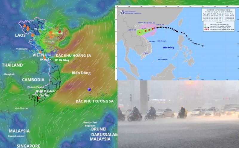
Latest update from the National Center for Hydro-Meteorological Forecasting, at 1:00 p.m. on July 23, the center of the tropical depression was at about 18 degrees north latitude; 119.7 degrees east longitude, in the eastern sea of the northern East Sea. The strongest wind near the center of the tropical depression is level 6-7 (39-61km/h), gusting to level 9. The tropical depression is moving west-southwest at a speed of 10-15km/h.
It is forecasted that in the next 12 hours, the tropical depression will continue to move west-southwest at a speed of 10-15km/h and is likely to strengthen.
At 1:00 a.m. on July 24, the center of the tropical depression was at about 17.6 degrees north latitude; 118.4 degrees east longitude, in the eastern sea of the northern East Sea. The strongest wind near the center of the tropical depression is level 7, gusting to level 9.
The danger zone is identified as from 16 degrees north latitude to 19.5 degrees north latitude, east of 116.5 degrees east longitude. Level 3 natural disaster risk, the affected area is the eastern sea area of the northern East Sea.
It is forecasted that in the next 24 hours, the tropical depression is likely to strengthen into a storm, moving south-southeast at a speed of 5-10km/h.
At 1:00 p.m. on July 24, the center of the storm was at about 16.7 degrees north latitude; 118.7 degrees east longitude, in the eastern sea of the northern East Sea. Strong wind level 8, gust level 10.
The danger zone is between 15 degrees north latitude and 19.5 degrees north latitude, east of 116.5 degrees east longitude. The natural disaster risk level remains at level 3 with the eastern sea area of the northern East Sea continuing to be directly affected.
It is forecasted that in the next 36 hours, the storm will move east-northeast at a speed of about 10km/h. The center of the storm is currently at about 17 degrees north latitude; 119.8 degrees east longitude, in the eastern sea of the northern East Sea. The wind force remains at level 8, gusting to level 10.
The danger zone continues to be within the range from 15 degrees north latitude to 19 degrees north latitude, east of 116.5 degrees east longitude. Natural disaster risk level 3, affected areas remain unchanged.
It is forecasted that in the next 48 hours, the storm will move rapidly northeast at a speed of 25-30km/h and weaken into a low pressure area.
At 1:00 p.m. on July 25, the center of the low pressure area was at about 19.5 degrees north latitude; 122.5 degrees east longitude, in the sea north of Luzon Island (Philippines). The wind speed is currently below level 6.
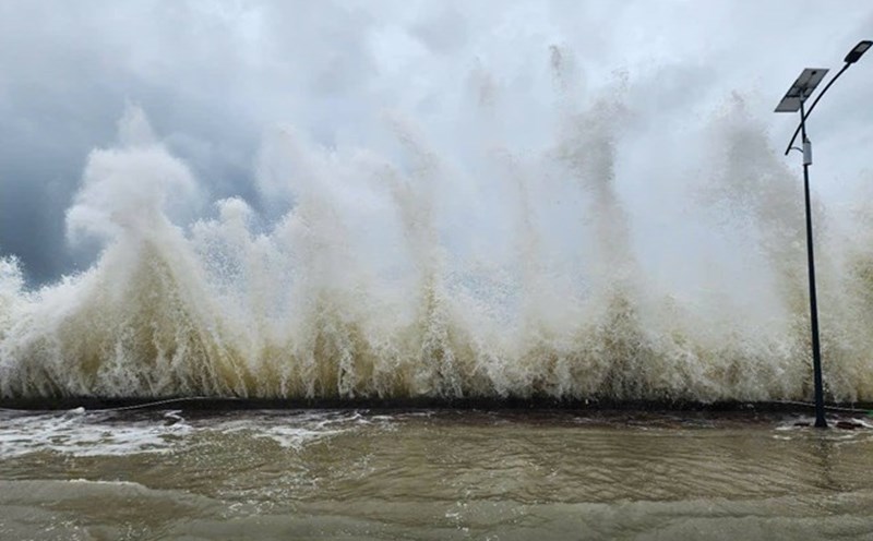
Regarding the impact of the tropical depression, the eastern sea area of the northern East Sea will have strong winds of level 6 - 7, near the storm center will have strong winds of level 8, gusting to level 10. Waves are 2 to 4 meters high, rough seas. Ship operating in the above-mentioned dangerous areas are likely to be affected by thunderstorms, whirlwinds, strong winds and large waves.