According to Mr. Mai Van Khiem - Director of the National Center for Hydro-Meteorological Forecasting, Department of Hydro-Meteorology, from October 22 to now, the Central region has been affected by a complex of multi-disaster formed forms.

"The cold air in the north is strengthened, the activity of storm No. 12 then weakens into a low pressure area in the coastal waters of Hue - Da Nang, then the tropical convergence zone lifts its axis from the south and distorts the easterly wind zone combined with the wind-receiving terrain, causing particularly heavy rain, especially in Hue and Da Nang" - Mr. Khiem analyzed.
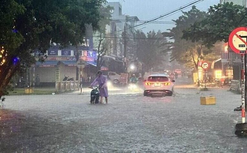
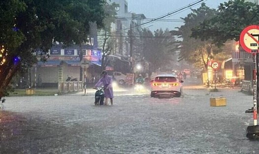
Total rainfall from October 22 to 4:00 a.m. on October 29 in Ha Tinh, Quang Tri and Quang Ngai, the common rainfall is 200 - 450mm; Hue city from 450 - 900mm; Da Nang city 300 - 600mm. In particular, there was a very heavy rain point such as in Bach Ma, where 1,739.6mm of rain occurred in 1 day.
"This is the largest single-day rainfall ever in Vietnam. According to statistics from the World Meteorological Organization (WMO), the heaviest one-day rainfall was 1825mm at a French monitoring station in the Indian Ocean in January 1966," said Mr. Khiem.
According to the National Center for Hydro-Meteorological Forecasting, today (October 29), the area of Hue city, Da Nang city and the eastern part of Quang Ngai province will have heavy to very heavy rain.
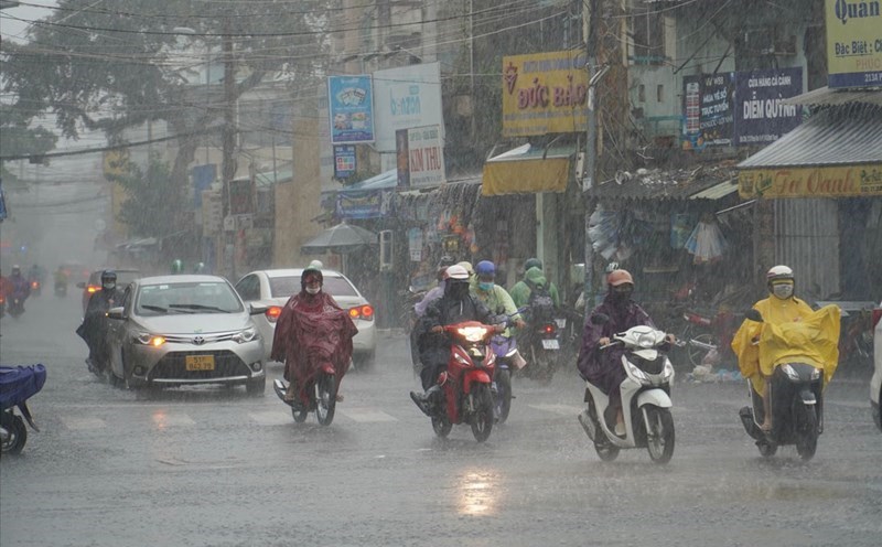
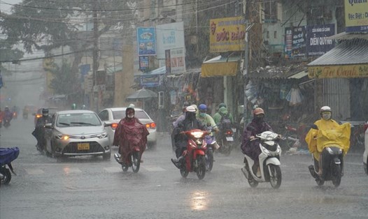
Rainfall from 7am to 3pm on October 29 was locally over 150mm in some places such as: Bach Ma peak station (Hue city) 406.4mm, Ba Na station (Da Nang city) 232.8mm, Tra Nham station (Quang Ngai) 170mm,...
Quang Ngai province from the evening of October 29 to early morning of October 30 is forecast to have moderate rain, heavy rain with rainfall of 30 - 60mm, locally very heavy rain over 100mm. From October 30, the rain will decrease.
The area from southern Quang Tri to Da Nang city from the evening of October 29 to October 30 is forecast to have heavy to very heavy rain with common rainfall of 100 - 250mm, locally over 500mm. From the night of October 30, heavy rain is likely to gradually decrease.
The meteorological agency said that the heavy rain area tends to move gradually to the north of the Central region.
The area from southern Nghe An to northern Quang Tri from the evening of October 29 to October 31 is forecast to have moderate rain, heavy rain with common rainfall of 70 - 150mm, locally very heavy rain over 300mm. Warning of the risk of heavy rain with rainfall greater than 150mm in 3 hours.
From the night of October 31 to November 1, in the area from Nghe An to Bac Quang Tri, there will be moderate rain, heavy rain with common rainfall of 50 - 100mm, locally very heavy rain over 200mm.
The Central Highlands, the South and the eastern provinces from Gia Lai to Lam Dong in the evening and night of October 29 are forecast to have rain, moderate rain and thunderstorms with rainfall of 15 - 40mm, locally heavy to very heavy rain over 100mm. During thunderstorms, there is a possibility of tornadoes, lightning, hail and strong gusts of wind. Warning of the risk of heavy rain with rainfall greater than 80mm within 3 hours.
The meteorological agency warns that the risk of natural disasters due to heavy rain, tornadoes, lightning, and hail in areas is level 1, especially in Hue city and Da Nang city.
Heavy rain is likely to cause flooding in low-lying areas, urban and industrial areas; flash floods on small rivers and streams, landslides on steep slopes.
Real-time warning information for areas at risk of flash floods and landslides is provided online on the website of the Department of Hydrometeorology at: https://luquetsatlo.nchmf.gov.vn and in a separate bulletin warning of flash floods and landslides. During thunderstorms, there is a possibility of tornadoes, lightning, hail and strong gusts of wind.