The Philippine Atmospheric, Geophysical and Astronomical Services Administration (PAGASA) typhoon forecast on October 29 said that two to three typhoons could form and enter the Philippine Forecast Area (PAR) in November, with the possibility of directly affecting Luzon and the Visayas at the beginning of the month.
According to PAGASA weather forecaster Benison Estareja, the next three local names for storms that could form this month are Tino, Uwan and Verbena.
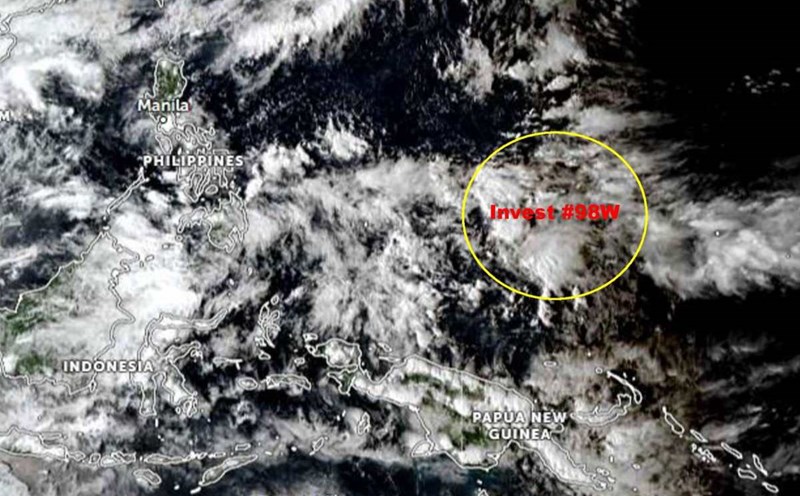
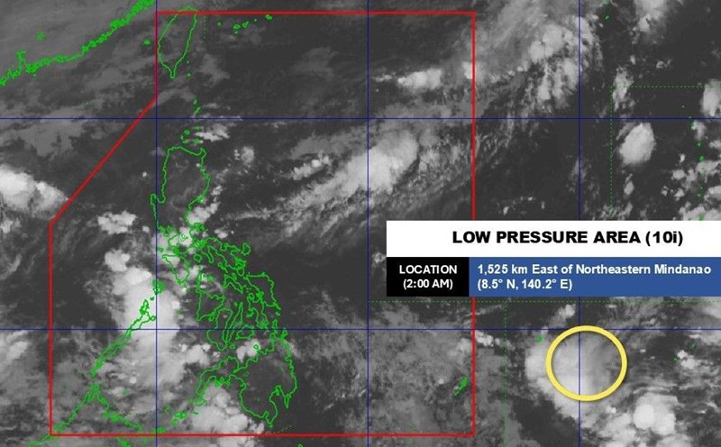
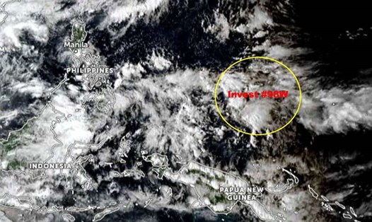
As of 2:00 a.m. on October 30, PAGASA is monitoring a low pressure area (10i) outside the PAR, at 8.5 degrees north latitude, 140.2 degrees east longitude, 1,525 km east of northeast Mindanao. This low pressure is likely to develop into a tropical depression within the next 24 hours.
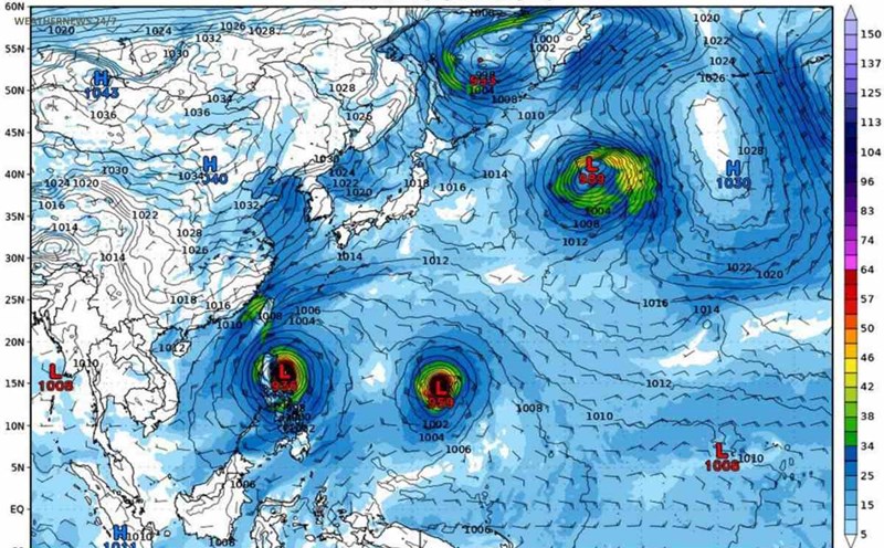
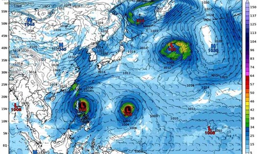
Also according to the latest weather trend forecast data, from October 29 to November 4, there may be 3 tropical depression areas, of which 1 is low pressure 10i mentioned above.
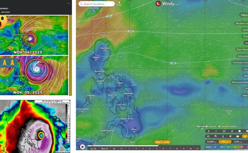
Two other low pressure areas may form outside the PAR area, over the Pacific Ocean. One of these two regions is forecast to move westward, towards the Philippine mainland, most likely entering the PAR on November 4.
We do not rule out the possibility that the nearest low pressure area could strengthen into a tropical storm, even a strong storm, when it enters the Philippine area of responsibility, said Mr. Estareja.
According to PAGASA, the first low pressure area from the Pacific Ocean could directly affect the Luzon and Visayas regions from November 5.
The possibility of it developing into a typhoon or super typhoon cannot be completely ruled out, but according to current forecast models, the intensity is likely to only reach tropical storm or strong typhoon level, Estareja added.
However, PAGASA stressed that all scenarios are still subject to change in the coming days, as the path and intensity of these weather systems are still unstable.
PAGASA has previously denied the false information circulating on social media about a super typhoon making landfall in the Philippines between November 5 and 7.
According to the agency, forecast maps only show a moderate chance of a cyclone forming from the eastern Pacific Ocean to the west, which could pass through the central Philippines between October 27 and November 2, but this is still a long-term forecast with low reliability.
As this is a two-week forecast, details of the path and intensity of the low pressure system are still uncertain, PAGASA stressed.
PAGASA recommends that the public do not share or believe in unverified weather information, especially posts about "super typhoons" on social media.
Typically, November is the final peak of the typhoon season in the Northwest Pacific, when cyclones may turn south and bring heavy rain to the Central and South Philippines, affecting the East Sea.
According to the Vietnam National Center for Hydro-Meteorological Forecasting, from now until the end of 2025, there is a possibility of about 2-3 storms or tropical depressions operating in the East Sea area. Of which, about 1-2 cases can directly affect Vietnam.