New low pressure appears, forecast to likely enter the East Sea

Khánh Minh |

A new low pressure area formed on the afternoon of October 29 is forecast to likely enter the Philippines and the East Sea.

The latest storm/low pressure information from the US Joint Typhoon Warning Center (JTWC) said that low pressure 98W formed on the afternoon of October 29 south of Guam and continued moving west. The strongest wind of the low pressure is 25 km/h. The low pressure is forecast to enter the Philippine Forecast Area (PAR) on November 4.

Meanwhile, the 2-week storm/low pressure forecast of the Philippine Atmospheric, Geophysical and Astronomical Services Administration (PAGASA) also clearly states that during the week from October 29 to November 4, 2024, there will be 3 low pressure areas around the country.

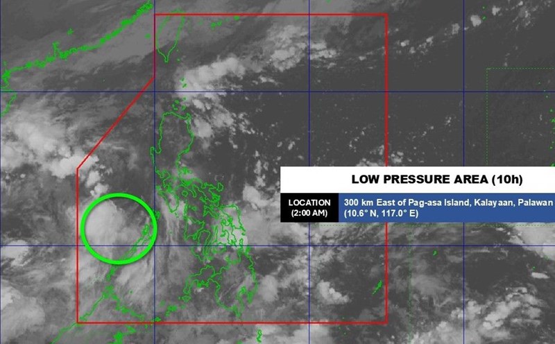
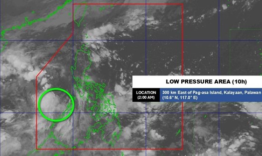
Low pressure 1 in the Sulu Sea - a sea area near the Philippines and the East Sea - is unlikely to strengthen into a storm.

Low pressure 2 is located east of the Philippines, south of Guam (the same low pressure 98W mentioned above), likely to enter PAR, towards Visayas - Southern Luzon. PAGASA forecasts the possibility of this low pressure intensifying to medium level.

Currently, low pressure 98W is creating a large area with scattered showers and thunderstorms. However, upper-level winds are currently very unfavorable for storm formation, so in the next few days, this system is expected to move westward without the possibility of significant development.

As it moves south of Guam, environmental conditions are expected to become more favorable, and a tropical depression could form on October 31 or November 1. The system is forecast to continue moving westward until early next week, entering the East Sea.

  Cac hinh thai ap thap o Tay Bac Thai Binh Duong ngay 29.10. Anh: CIRA/JTWC
Low pressure across the northwest Pacific Ocean on October 29. Photo: CIRA/JTWC

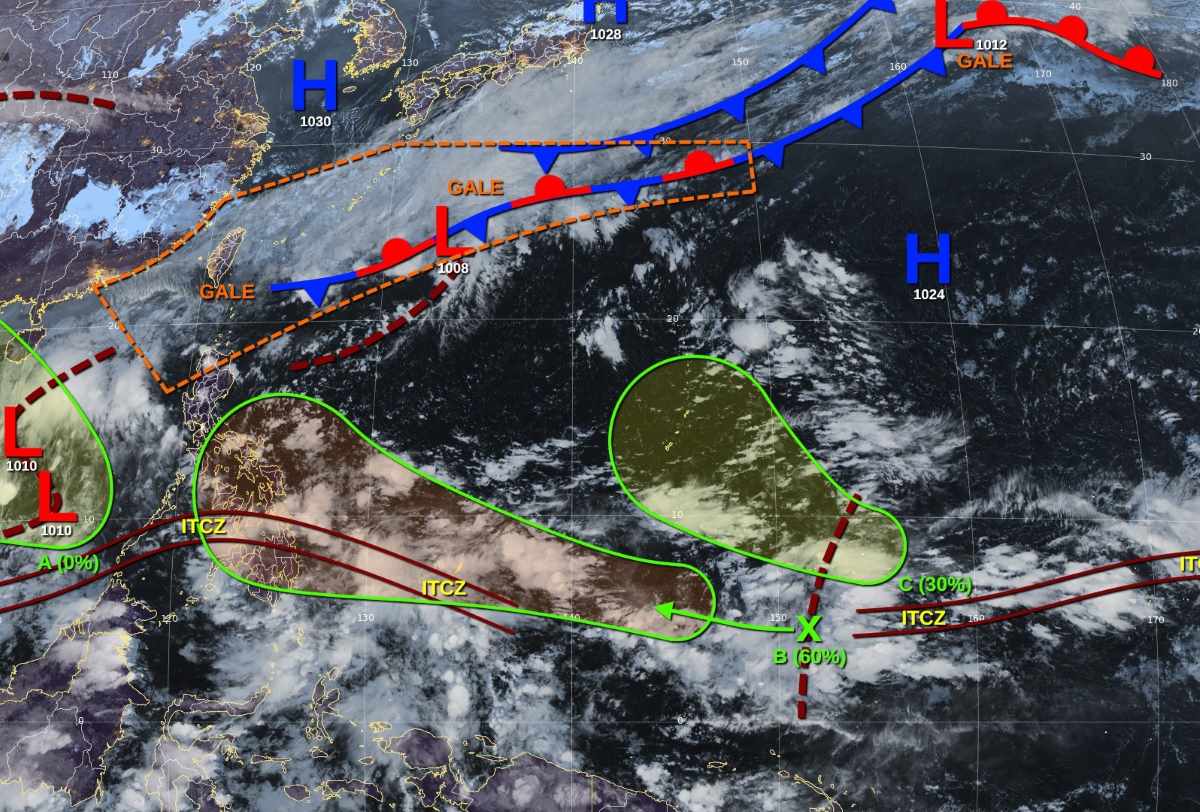
Notably, this is a system that is being exaggerated by many social media posts about its ability to develop into a strong storm, even a super typhoon, but the JTWC notes that it is still too early to predict.

Also during the week of October 29 - November 4, low pressure 3 is expected to appear east of the TCID forecast area of the Philippines, southeast of Chuuk state in the Federated States of Micronesia. The system is likely to gradually develop as it moves mainly west-northwest until early next week. The 7-day chance of formation is low, 30%.

Khánh Minh
RELATED NEWS

Low pressure expected to enter the East Sea today

|

A low pressure is forecast to enter the East Sea from the Philippines on October 28, in the context of complicated floods in Central Vietnam.

Low pressure near the East Sea causes strong impact, forecast heavy rain, flooding

|

The low pressure area moving near the East Sea has begun to cause widespread heavy rain with a high risk of flash floods, landslides and localized flooding

Forecast of consecutive low pressure in the East Sea at the end of October

|

It is forecasted that there may be 2 low pressure areas entering the East Sea from now until the end of October and the beginning of November.

The US maintains a counterpart tax of 20%, opening up opportunities to reduce to 0% for Vietnamese goods

|

Maintaining the counterpart tax rate of 20% and the possibility of expanding the scope of tax reduction for some groups of goods to 0% will open up new opportunities for Vietnam.

Metro No. 1 reaches 14 million passengers, stops selling paper tickets at 11 stations

|

HCMC - From November 1, Metro Line 1 (Ben Thanh - Suoi Tien) will stop selling paper tickets at 5 more stations, bringing the total number of stations that have stopped selling tickets to 11/14.

Conflict of inexorable accounts over investment capital contribution of Hanoi University of Business and Technology

|

Not only in legal crisis, Hanoi University of Business and Technology was also accused of "abandoning" hundreds of investors, "losing" more than 117 billion VND in capital contributions.

sandbags are used all day and night to block the water of Tra Khuc river from overflowing into the inner city of Quang Ngai

|

Quang Ngai - The authorities are keeping their mouths closed day and night at the pumping station at the embankment project to prevent landslides on the southern bank, preventing the Tra Khuc River from flowing back into the inner city.

Floodwaters rise again, the center of Hue City becomes a chaotic traffic "river"

|

HUE - On the afternoon of October 29, floodwaters on rivers rose rapidly, causing many central streets of Hue City to be deeply flooded, vehicles stalled, and traffic paralyzed.

Low pressure expected to enter the East Sea today

Song Minh |

A low pressure is forecast to enter the East Sea from the Philippines on October 28, in the context of complicated floods in Central Vietnam.

Low pressure near the East Sea causes strong impact, forecast heavy rain, flooding

Khánh Minh |

The low pressure area moving near the East Sea has begun to cause widespread heavy rain with a high risk of flash floods, landslides and localized flooding

Forecast of consecutive low pressure in the East Sea at the end of October

Song Minh |

It is forecasted that there may be 2 low pressure areas entering the East Sea from now until the end of October and the beginning of November.