On the morning of October 9, Mr. Mai Van Khiem - Director of the National Center for Hydro-Meteorological Forecasting, Department of Hydro-Meteorology provided the latest information on flood situation on rivers updated until 5:00 a.m.

Floods on Thuong River (Bac Ninh) at Cau Son station peaked at 18.37m (at 2:00 a.m. on October 9), above alert level 3 by 2.37m; floods at Phu Lang Thuong station peaked at 7.6m (at 3:00 a.m. on October 9), above alert level 3 by 1.3m, exceeding the historical flood in 1986 (7.52m) by 0.08m. Currently, floods in the downstream of Cau River (Bac Ninh) are rising; floods on Trung River (Lang Son) and Thuong River are receding.
Cau River (Thai Nguyen) in the next 6 hours, floods on Cau River at Dap Cau station are likely to peak at 7.4m, above alert level 3.1m, then decrease.
In the next 6 - 24 hours, the flood on the Cau River at Gia Bay station will drop below alert level 2 0.5m; at Dap Cau station will continue to drop and will be about 0.6m above alert level 3.
In the next 24 hours, the flood on the Thuong River at Cau Son station will continue to decrease and remain above alert level of 3 1.4m; at Phu Lang Thuong station, it will continue to decrease and remain above alert level of 3 0.5m.
"Widespread flooding is forecast in Thai Nguyen and the downstream of the Thuong River (Bac Ninh) for the next 2-3 days" - Mr. Khiem said.
In the next 24 hours, the flood at Huu Lung station will continue to decrease and be above alert level 3.0m; forecast to drop below alert level 3 in the next 1-2 days. Flooding along the Trung River and Bac Giang River (Lang Son) lasted for 3 - 4 days.
Real-time warning information for areas at risk of flash floods and landslides is provided online on the website of the Department of Hydrometeorology at: https://luquetsatlo.nchmf.gov.vn and in a separate bulletin warning of flash floods and landslides.
The warning level of natural disaster risk due to floods is level 3. Floods on rivers cause flooding in low-lying areas along rivers, affecting activities such as waterway transportation, aquaculture, agricultural production, people's lives and socio-economic activities.
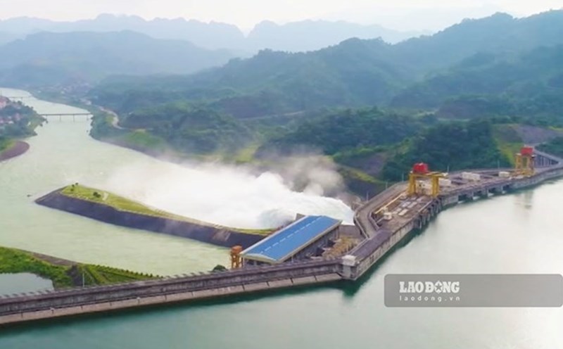
The meteorological agency noted that forecast and warning information is calculated at the expected regulation level of discharge from upstream reservoirs. The Hydrometeorological Agency will update bulletins when there are changes in the discharge flow of reservoirs.

Regarding the cause of this widespread flooding, according to Mr. Le Ngoc Quyen - Deputy Director of the Northern Hydrometeorological Station (Hydrometeorological Station), in the early morning of October 6, storm No. 11 after making landfall in Phong Thanh area of Guangxi province (China) continued to move in the West Northwest direction and weakened into a low pressure area. By the night of October 6, this low pressure area was located in the mountainous areas of the Northern provinces.
From the night of October 6 to the afternoon of October 7, the strong Southeast wind zone from the ground up to over 5,000m combined with the Southwest wind zone from Bengan Bay will rise to form an easterly wind convergence zone in the mountainous and midland areas of Viet Bac, causing heavy to very heavy rain in the provinces of Cao Bang, Thai Nguyen, Lang Son.
Rainfall in 36 hours (from 7am on October 6 to 7pm on October 7) in Thai Nguyen is generally 200 - 400mm, some places are larger such as Dong Hy 596mm, Nam Hoa 554mm, Phan Dinh Phung 514mm,... In Cao Bang, the rainfall is generally 100 - 200mm, some places are larger such as: Xuan Truong 293mm, Nguyen Binh 273mm, Minh Tam 266mm...
In Lang Son, the common rainfall of 100 - 200mm is greater in some places such as Yen Binh 334mm, Tan Tri 290mm, Thien Tan 279mm,... With heavy rainfall (Tous rainfall in 36 hours exceeding the total rainfall of TBNN in the whole month of October occurring in a short time combined with the terrain with a large slope from North to South, narrow riverbed and strongly winding, reducing drainage speed when heavy rain occurs.
"The effect is that when the water from above rapidly recedes, the water from below cannot drain in time, so the provinces of Cao Bang, Thai Nguyen, and Lang Son have experienced serious flooding and major floods in recent days" - Mr. Quyen commented.