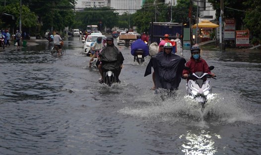
Up to now, Typhoon No. 3 Yagi is the strongest typhoon in the past 30 years in the East Sea, making landfall in the North at the end of the rainy season in this area. At that time, the reservoirs had switched to the water storage phase to serve the dry season.
Typhoon Yagi is also a storm that has increased in intensity very quickly (from storm to super typhoon, increasing 8 levels in 48 hours) and maintained super typhoon level for a long time. When it made landfall in the east of Hainan Island (China), Typhoon Yagi still maintained super typhoon level.
Although Storm No. 5 Krathon did not affect mainland Vietnam, it continued to be the second storm reaching super typhoon level in the East Sea in 2024.
Thus, 2/5 of the storms that occurred this year were very strong.

According to Dr. Hoang Phuc Lam - Deputy Director of the National Center for Hydro-Meteorological Forecasting, Directorate of Hydro-Meteorological Forecasting, the peak of the storm season is forecast to fall in October and November.
"Storms will be more active and in October and November, the possibility of storms gradually moving southward, affecting the Central region. We still emphasize that this year there is a high risk of strong storms and storms causing heavy rain in the Central Central region during the peak period," Mr. Lam warned.
According to the Deputy Director of the meteorological agency, storms always have very different developments and distributions of rain and wind intensity.
"Therefore, for all storms, the most important thing is to monitor regularly, follow the latest forecast information, and especially in case of emergency storms - that is, there are only about 24 to 48 hours left to respond" - Mr. Lam analyzed.
According to Mr. Lam, in case the meteorological agency issues an urgent storm warning, all response work must strictly follow the instructions of the National Steering Committee for Natural Disaster Prevention and Control and the local Command Committee to ensure prevention work, house reinforcement, evacuation, and review of vulnerable points to ensure minimizing unfortunate damage in natural disaster situations.
Given the complicated situation of natural disaster forecasting from now until the end of the year, the National Center for Hydro-Meteorological Forecasting will closely monitor the development of the hydro-meteorological situation, strengthen and improve the quality of natural disaster forecast and warning bulletins.
Especially for natural disasters such as heavy rain, floods, landslides and flash floods; transmit diverse information on digital technology platforms and provide timely information to agencies and organizations in accordance with regulations to serve the work of preventing, combating and responding to natural disasters.