
On August 6, according to updates from the Philippine Atmospheric, Geophysical and Astronomical Services Administration (PAGASA) and the Japan Meteorological Agency (JMA), the Northwest Pacific region is entering the peak of the typhoon season, with 3 active tropical cyclones and another new low pressure area likely to strengthen within the next 48 hours.
According to the forecast models used by PAGASA, combined with the JMA surface forecast map, a low pressure area near the Mariana Islands is having favorable conditions to develop into a tropical depression in the next 2 days.
PAGASA currently assesses the possibility of tropical cyclone formation from this low pressure area at a low to medium level. Meanwhile, JMA and some international forecasting models suggest that the system may develop into a tropical depression.
If it strengthens, this new low pressure area is likely to have the Fujiwhara effect with Typhoon Chanhom as the 2 systems approach northern Japan. This is an effect that occurs when 2 tropical cyclones interact when at a sufficiently close distance, which can cause the trajectory or intensity of each typhoon to change.
According to current assessments, the new low pressure area is unlikely to enter the Philippine Area of Responsibility (PAR).
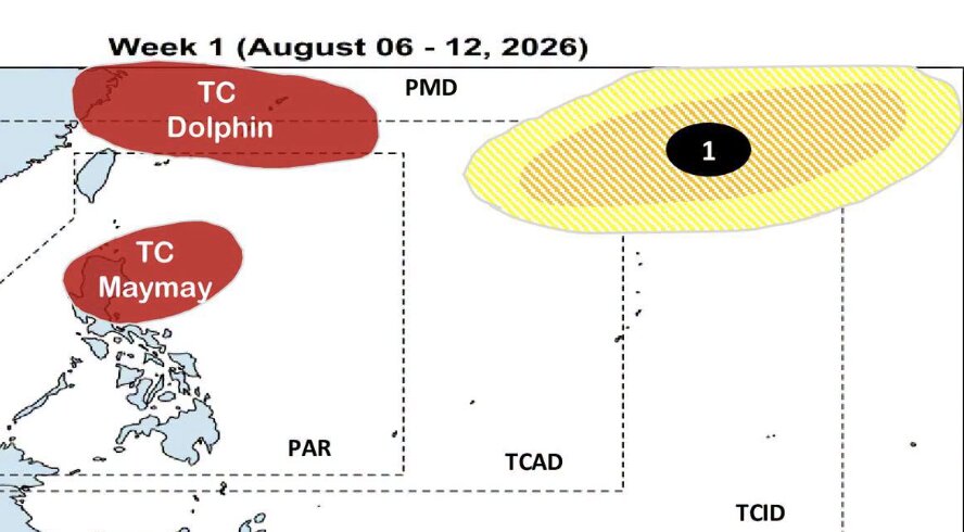
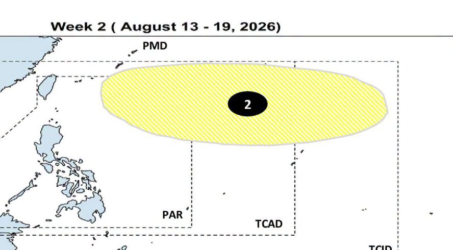
However, meteorologists predict that the appearance of this system, along with the remaining circulation of the tropical depression Kujira (Maymay), storm Dolphin, storm Chanhom and a widespread low pressure area in the northern East Sea region, will continue to strengthen the southwest monsoon (Habagat) in the coming days.
This means that many areas in Southeast Asia may continue to experience moderate to heavy rain from this weekend and extend to next week.
In addition to Southeast Asia, the Micronesia region in the Western and Central Pacific is also forecast to be affected by the circulation of active weather systems.
PAGASA notes that this is still a forecast scenario based on existing data. The trajectory, intensity as well as the possibility of a new low pressure area formation may still change as more monitoring data and updates appear in the coming days.


