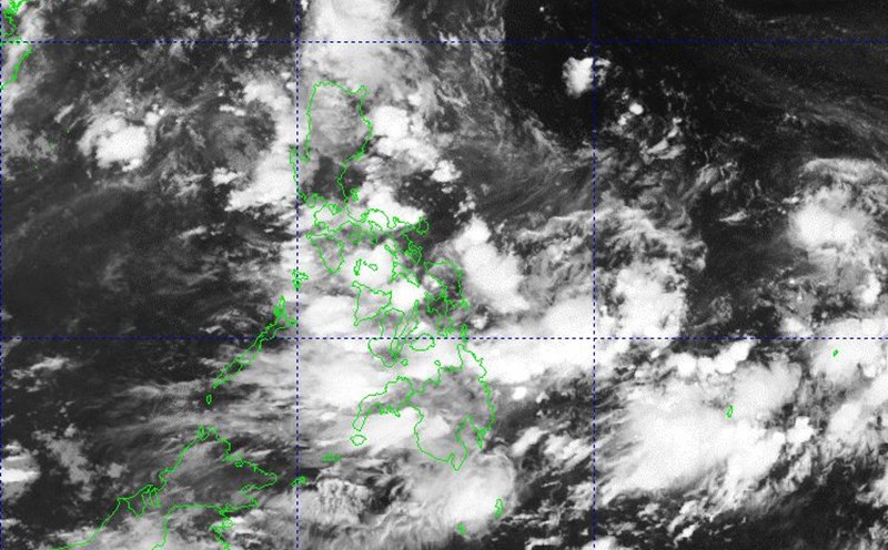
In the area near the East Sea, low pressure 06h in the Philippine Forecast Area (PAR) is showing signs of strengthening. The Philippine Atmospheric, Geophysical and Astronomical Services Administration on the afternoon of June 30 raised the probability of tropical depression formation in the next 24 hours from low to medium.
Although it has not yet strengthened into a storm, the low pressure trough of this system combined with the southwest monsoon will cause widespread showers and thunderstorms, affecting Bicol, Aurora, Quezon, most of Luzon, Visayas and Mindanao. PAGASA warns of the risk of flash floods and landslides, especially in steep mountainous areas and along rivers.
In the East Pacific, Typhoon No. 6 Flossie is also accelerating northwest along the southern coast of Mexico. According to AccuWeather, Flossie is expected to become a strong storm in the next few days.
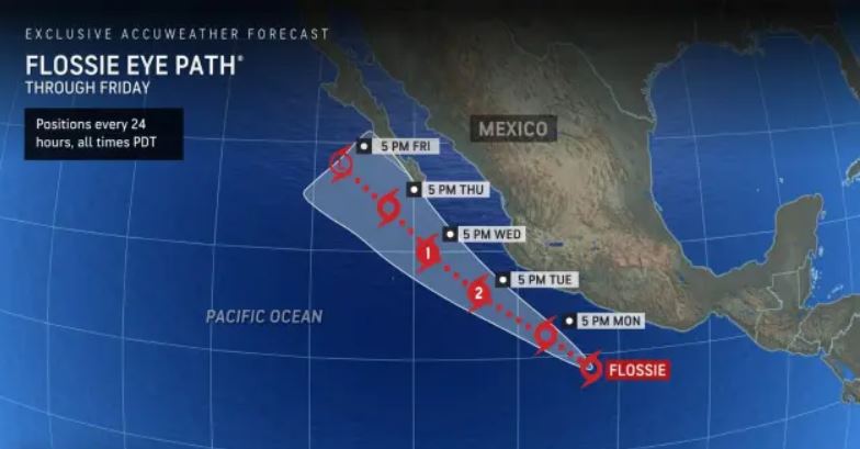
On July 1, Typhoon Flossie is forecast to bring widespread heavy rains to Mexico's southwestern coastal states, along with the risk of landslides and flash floods in mountainous areas. Rough seas, high waves, offshore flows and high tides are expected to affect many coastal areas from Oaxaca to Jalisco this week.
In the Atlantic hurricane center, Hurricane Barry - the second storm of the 2025 hurricane season - just made landfall in Veracruz (Mexico) on June 30, nearly 3 weeks earlier than the average of many years. After weakening, the remnants of Hurricane Barry continue to bring heavy rain to eastern Mexico.
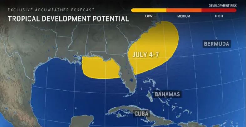
More notably, AccuWeather experts warn of the risk of a new low pressure area forming from the remnants of a cold front in the Gulf of Mexico or off the Southeast coast of the United States during the National Day holiday on July 4.
This year, tropical cyclone phenomena are appearing earlier and with stronger intensity. Typhoon Flossie formed up to five weeks earlier than average, Typhoon Barry arrived three weeks ahead of schedule, and the Philippines' depression was likely to become the second typhoon in June alone.
The latest storm forecast from PAGASA said that from July to the end of the year, there will be 11-19 tropical cyclones forming or entering the PAR, with 2-3 storms each July and August.
Weather forecasters emphasized that the early July will be a period of strong activity of storms, low pressure and widespread rain.
The forecast bulletin of thunderstorms, tornadoes and strong gusts of wind at sea of the Vietnam National Center for Hydro-Meteorological Forecasting said that on July 1, the area affected by thunderstorms includes the Gulf of Tonkin, the North and Central East Sea (including the Hoang Sa special zone); the East of the South East Sea (including the East sea area of the Truong Sa special zone); the Gulf of Thailand. During thunderstorms, tornadoes and strong gusts of wind of level 6-7 may appear, with waves over 2m high.
In the sea area from Lam Dong to Ca Mau, there are strong southwest winds of level 5, sometimes level 6, gusting to level 7. Waves are 1.5 - 2.5m high, rough seas.