The latest storm/low pressure information from the Philippine Atmospheric, Geophysical and Astronomical Services Administration (PAGASA) said that at 8:00 a.m. on October 14, the center of the low pressure near the East Sea, marked 10f, was at about 14.6 degrees north latitude, 122.9 degrees east longitude, on the coast of Vinzons, Camarines (Philippines). PAGASA forecasts that this low pressure is unlikely to develop into a tropical depression within the next 24 hours.
Meanwhile, Depression 10e - believed to be the predecessor of Typhoon No. 12 in the East Sea - is at about 8.4 degrees north latitude, 142.5 degrees east longitude, 1,780km east of northeast Mindanao. This low pressure has a moderate chance of developing into a tropical depression within the next 24 hours.
According to the storm forecast of the US Joint Typhoon Warning Center (JTWC), low pressure area 10e (code 96W according to JTWC) is causing a large area of showers and thunderstorms that are not in accordance with the law.
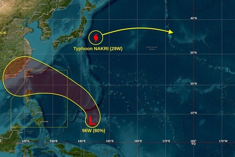
Environmental conditions are expected to be favorable for development, and the low pressure is likely to strengthen into a tropical depression on October 15 as the system moves north, then turns west-northwest and enters the Philippine Sea, strengthening into a storm.
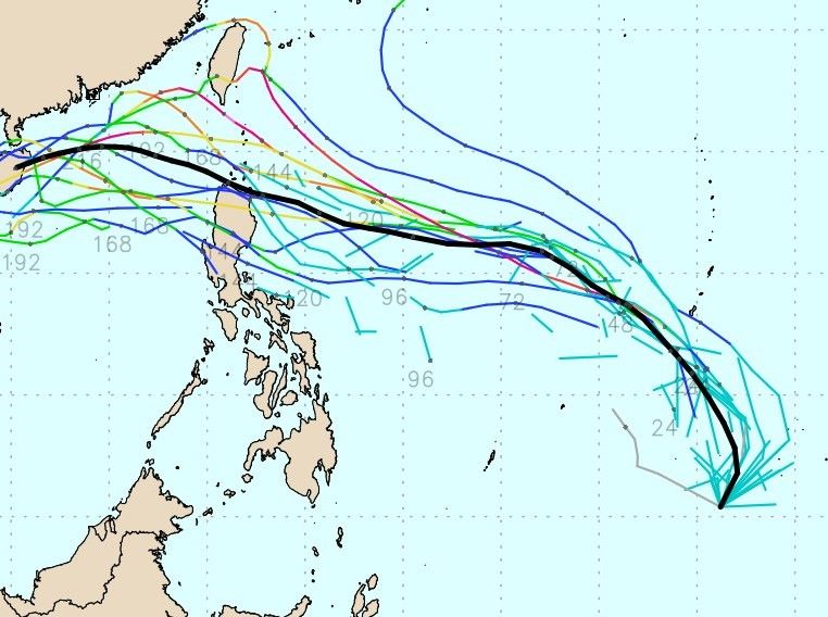
Currently, the forecast track shows that the storm may move to Northern Luzon, mainly in part of the Cagayan Valley. There are also some forecast routes that suggest the storm could pass through Central Luzon. However, there is still a high possibility that the route will change in the coming days.
The low pressure is forecast to strengthen into a storm in the early morning of October 18, then enter the East Sea. In the following days, the storm will strengthen rapidly, moving quite steadily northwest, with the maximum possibility of reaching level 14 when it is northeast of the Hoang Sa archipelago on October 21.
However, as soon as the storm is strongest, cold air flows down from the north, causing the storm to gradually move westward and then southwestward, starting a rapid weakening process due to the dry air of the cold air and inadequate sea heat.
If the cold air does not recede in time, storm No. 12 will likely be a bad scenario for Northern Vietnam.