The western United States is about to see the most widespread heavy rains and snowfall of the season since the beginning of the year, as many Pacific typhoons simultaneously make landfall from California to Montana.
According to forecasters, this will be the strongest and most widespread series of autumn storms since the beginning of the year, signaling the arrival of winter early with a sharp drop in temperatures and the risk of traffic disruption in many Western states.
The first storm began affecting the US northwest coast since October 10, causing widespread rain from western Washington to northwestern California. Although not too intense, this is considered the widespread rainstorm since the beginning of the season.
Longer inland, many areas in Montana and Wyoming saw the first heavy snowfall of the winter. From the night of October 11 to October 13, many places in the Rockies will be covered in white snow, especially in the Teton area (northwest Wyoming) and Yellowstone National Park, where 15-30cm of new snow can be recorded.
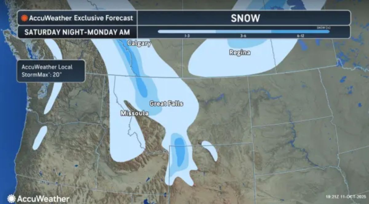
Meanwhile, in the north, the system will strengthen as it moves into southern Saskatchewan and midwest Manitoba ( Canada), causing snowstorms and dangerous travel conditions.
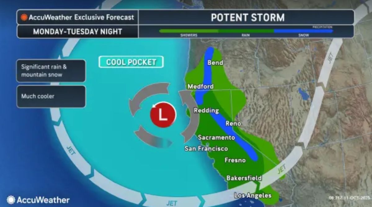
After the first storm, a new storm from the Pacific will sweep across the US earlier this week, accompanied by a tropical moisture left over from Priscilla and Raymond. This large amount of moisture will trigger strong thunderstorms from California to the Southwest of the US, while causing cold air, causing temperatures to drop significantly.
In Northern California and along the southern coast of California, daytime temperatures are expected to drop from 21 degrees Celsius to 15 degrees Celsius early in the week.
Along with rain and snow, strong gusts along the coast and in the mountains of California could cause minor damage to trees and power grids.
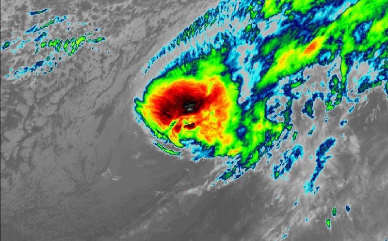
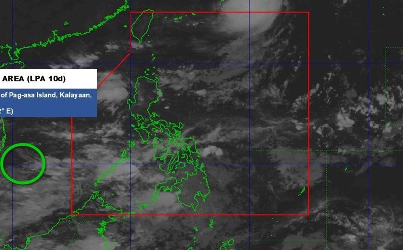
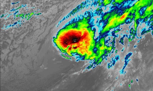
In Vietnam, the National Center for Hydro-Meteorological Forecasting said that from now until November 10, it is forecasted that there will be about 1-2 storms/tropical depressions that are likely to affect the mainland of Vietnam.
From now until the end of 2025, tropical cyclone activity in the East Sea will be at a level close to the average of many years, i.e. about 3 - 4 storms and tropical depressions.
The main affected area is likely the Central region, especially in October and the first half of November, when storm activity typically peaks at the end of the season.
From around October 14-16, the North and North Central regions will welcome weak cold air, with the possibility of rain, moderate rain and scattered thunderstorms, locally heavy to very heavy rain.
Meanwhile, due to the influence of La Nina, the East Asia Ring will operate more strongly than usual, creating cold air waves of moderate to large intensity and higher frequency.
Based on the mild La Nina scenario, in the first half of this winter, the national temperature may be about 0.3 to 0.7 degrees Celsius lower than the average of many years. In some mountainous areas, deep cold areas may be 1 degree Celsius lower than the average. There is a high possibility of severe cold in the North and North Central regions starting from the second half of December.