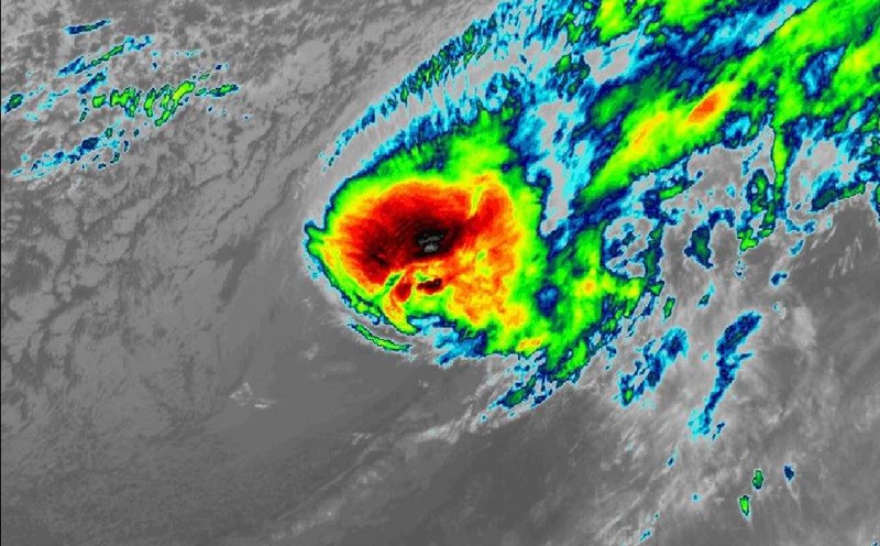
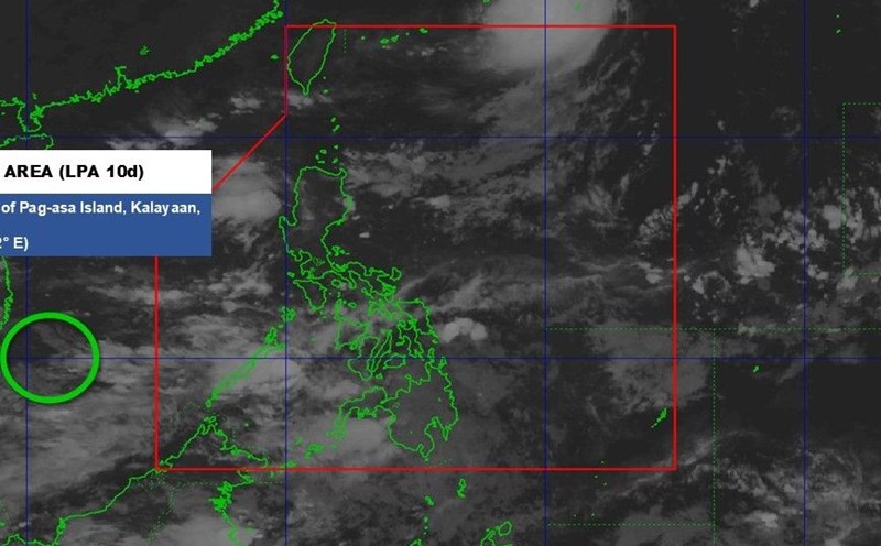
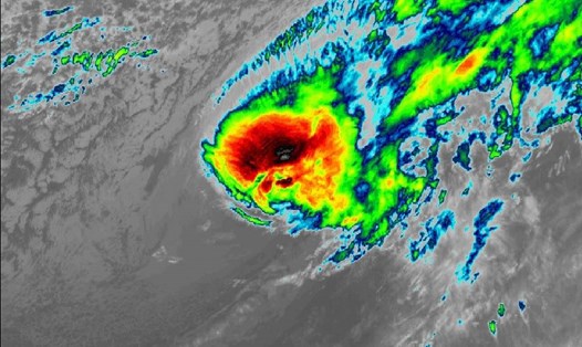
The latest storm information from the Philippine Atmospheric, Geophysical and Astronomical Services Administration (PAGASA) said that at 8:00 a.m. on October 13, the center of low pressure area 10e was at about 5.4 degrees north latitude; 145.8 degrees east longitude, 2,295 km east of southeast Mindanao. This low pressure has a moderate chance of developing into a tropical depression in the next 24 hours.
Forecaster Daniel Villamil said the low pressure area could enter PAR on October 16 or 17, approaching Luzon, especially northern Luzon, and is less likely to strengthen into a storm in the next 14 hours.
In the next 4 days, this system will not have a significant impact. However, people need to regularly monitor updates from PAGASA, Villamil recommended.
PAGASA warned that the easterly winds from the Pacific are bringing showers and thunderstorms to many areas of the country. Luzon and Visayas regions, especially Bicol Region, Eastern Visayas, Isabela, Aurora, Rizal and Quezon, are likely to experience moderate to heavy rain.
PAGASA confirmed that the La Nina phenomenon has officially formed in the equatorial Pacific since September 2025, after sea surface temperatures gradually decreased since August.
According to climate models, La Nina 2025-2026 could last until February 2026, causing an above-average increase in rainfall, especially in the eastern part of the Philippines.
The La Nina phenomenon often causes increased frequency of storms and heavy rains, and when combined with other weather systems, causes flooding and landslides, PAGASA warned.
So far, the Philippines has recorded 17 typhoons in 2025, of which 2 appeared in October. The country welcomes an average of 20 typhoons each year, but experts predict that the number of storms this year could exceed this level due to the impact of La Nina. If the low pressure area 10e enters the PAR and strengthens, it will be locally named Ramil - the 18th storm in the Philippines this year.
PAGASA also stressed that although the current low pressure area is not a cause for concern, this could be the beginning of a series of unstable weather conditions in the last months of 2025.
Meanwhile, in Vietnam, last night and early this morning, October 13, the area from Quang Tri to Da Nang City had showers and thunderstorms, with some places having heavy rain.
Rainfall from 7pm on October 12 to 3am on October 13 locally over 50mm in some places such as: Vinh Linh (Hue City) 66.2mm, An Tay (Hue City) 50.4mm,...
Forecast of rain during the day and night of October 13, the area from Quang Tri to Lam Dong and the South will have scattered showers and thunderstorms; common rainfall is 10-30mm, locally heavy rain over 80mm. The rain will be concentrated in the afternoon and evening.
In the afternoon and night of October 13, the Northeast region and from Thanh Hoa to Ha Tinh will have rain, moderate rain and scattered thunderstorms. The Northeast region will have 15-30mm, with some places having heavy rain over 70mm. Thanh Hoa to Ha Tinh area 20-40mm, locally heavy rain over 80mm.
Warning of the risk of heavy rain over 70 mm/3 hours. During thunderstorms, there is a possibility of tornadoes, lightning, hail and strong gusts of wind.
Localized heavy rains can cause flash floods on small rivers and streams, landslides on steep slopes and flooding in low-lying areas.