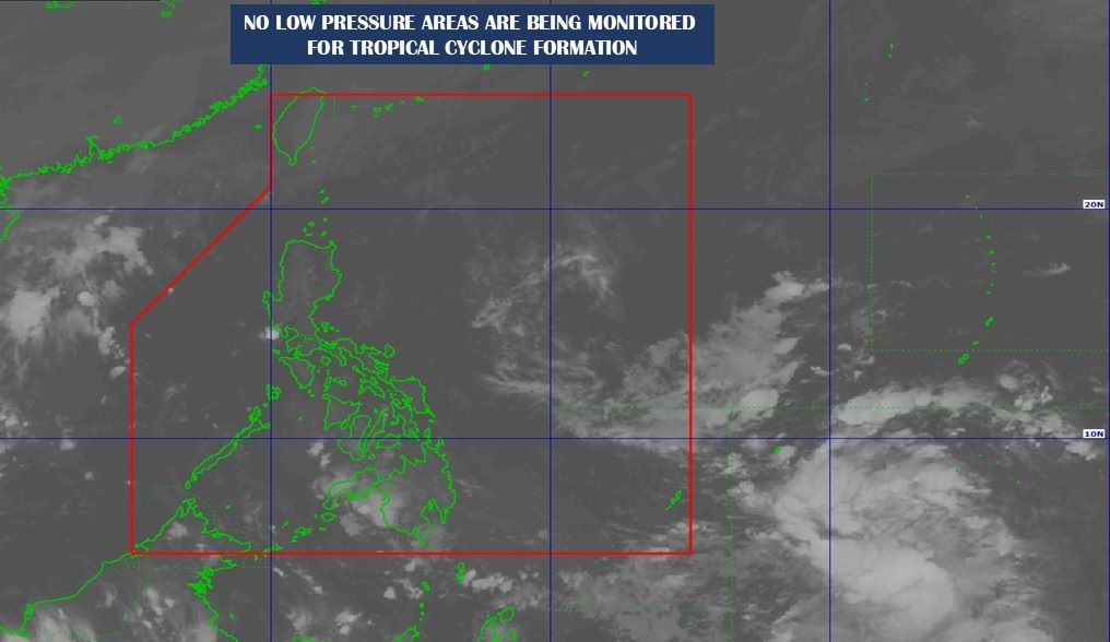
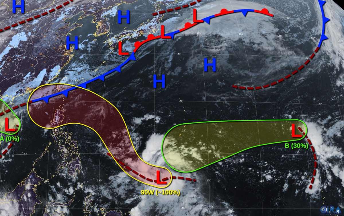
The storm/low pressure forecast bulletin of the Philippine Atmospheric, Geophysical and Astronomical Services Administration (PAGASA) said that at 2:00 a.m. on November 3, the cloud cluster outside the Philippine forecast area (PAR) developed into Low Pressure 11a. The center of the low pressure was located at about 6.7 degrees north latitude, 141.0 degrees east longitude, 1,630 km east of Northeast Mindanao (Philippines).
PAGASA's latest storm news at 4am on November 3 said that within the next 24 hours, low pressure 11a is unlikely to strengthen into a tropical depression.
Previously, in the storm/low pressure forecast bulletin at 10pm on November 2, PAGASA said that there was no low pressure area near the Philippines. Thus, low pressure 11a formed within about 4 hours.

The US Joint Typhoon Warning Center (JTWC) in its weather forecast on November 2 called the cloud cluster that developed into the above low pressure area 90W, located east of Palau.
On November 2, scatterometer data showed the system clearly developing and generating winds of 46-55 km/h. Environmental conditions are favorable for further development and if this trend continues, a tropical depression or tropical storm will form.
According to JTWC on November 2, system 90W is moving west-northwest and is likely to turn northwest during the night of November 2. JTWC assessed the chance of 90W forming within 7 days as 100%.
Update on the low pressure area in the central East Sea, off the coast of Vietnam, JTWC said that this weak low pressure area is creating some chaotic showers. Environmental conditions are not favorable for the development of this system before it moves inland on November 3. JTWC assessed the chance of formation in the 7 days at 0%.

The Vietnam National Center for Hydro-Meteorological Forecasting forecasts that from the morning of November 3 to the night of November 4, the area from Ha Tinh to Quang Ngai will have moderate rain, heavy rain and scattered thunderstorms, locally very heavy rain with rainfall from 80-200mm, locally over 350mm. Warning of the risk of local heavy rain (over 150mm/6 hours).
During the day and night of November 4, Thanh Hoa - Nghe An area will have moderate rain, heavy rain and scattered thunderstorms, locally very heavy rain with rainfall from 30-70mm, locally over 120mm.
The JTWC is also tracking another depression, designated B, southeast of Wake Island. This depression continues to produce scattered showers and thunderstorms. Upper-level winds are currently unfavorable for development. However, they are forecast to become more favorable by midweek as the depression moves west-southwest of Western Micronesia and develops over the weekend. The 7-day chance of formation is 30%.


