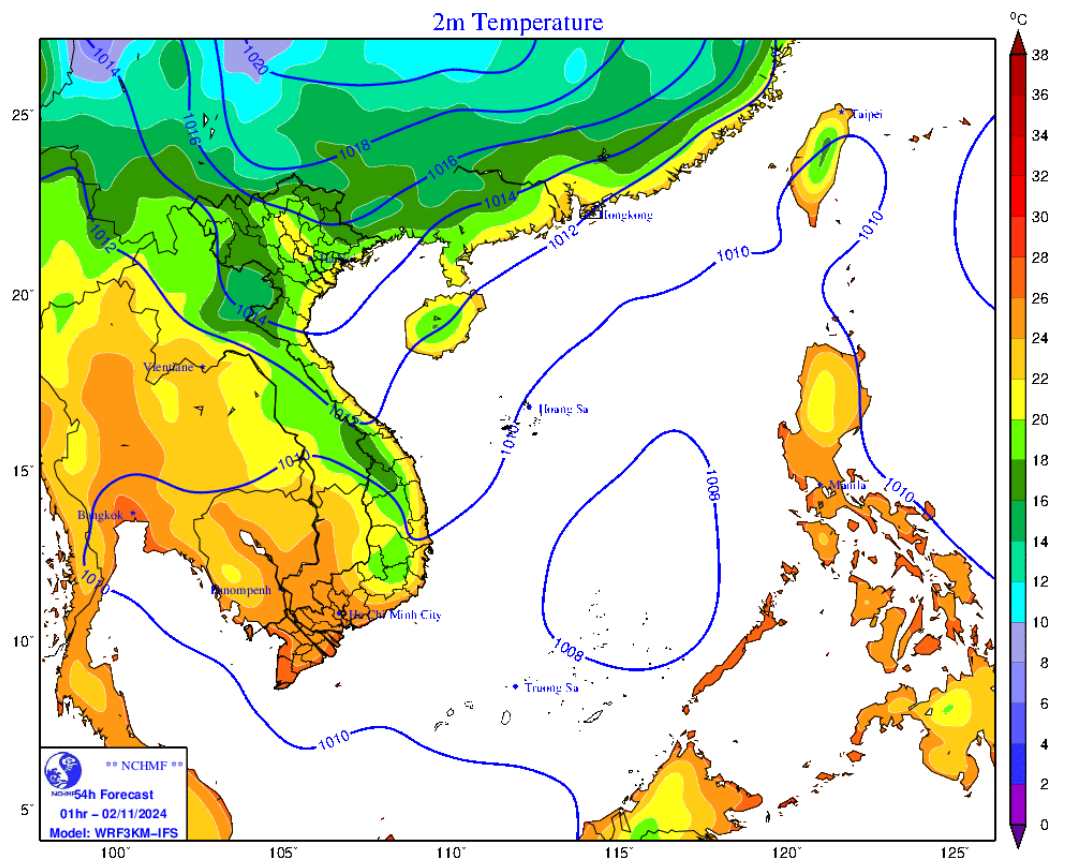
The Joint Typhoon Warning Center (JTWC)'s Typhoon/Low Pressure Forecast Bulletin on November 2 said that a turbulent weather area in the central East Sea is related to a low pressure trough. Satellite images show that a new low pressure may be forming, although it is not yet organized, but still causing widespread showers.
Upper-level winds are expected to slightly favor the development of this low-pressure system as it moves slowly northwestward toward Vietnam over the next few days. The JTWC assesses the chance of the low pressure developing in the next 7 days at 20%.
Meanwhile, according to the warning of the Storm page on the Northwest Pacific, on November 2, a low-pressure area formed in the central and southern East Sea.
In the coming time, this low-pressure area is likely to develop further and move towards the mainland of the Central provinces of Vietnam.
In addition, the northeast wind of the cold air is also on its way to Vietnam and disturbances in the upper easterly wind zone will also be active in the next 1-2 days.

The above weather patterns can create a combination that causes very heavy rain. According to the Vietnam National Center for Hydro-Meteorological Forecasting, from November 3-5, in the North and Central Central regions, there is a possibility of heavy rain, locally very heavy rain and thunderstorms with common rainfall of 100-200mm, locally over 300mm; in the area from Ha Tinh to Da Nang, common rainfall is 200-400mm, locally over 500mm.
From November 6, heavy rains will continue and may move down to the Ha Tinh to Binh Dinh areas. Heavy rains in the central provinces may last for many days.
Warning level of natural disaster risk due to heavy rain, tornado, lightning: level 1, especially the area from Ha Tinh to Da Nang level 2.
Heavy rain and localized heavy rain can cause flooding in low-lying areas; flash floods in small rivers and streams, and landslides on steep slopes.
At sea, day and night of November 2, the northern sea area of the North East Sea has strong winds of level 6, gusts of level 7-8, rough seas.
In the Gulf of Tonkin, the wind is strong at level 5, sometimes level 6, gusting to level 7-8, and the sea is rough. From Quang Ngai to Ninh Thuan, the wind is strong at level 5, sometimes level 6, gusting to level 7-8, and the sea is rough.
The weather forecast for the day and night of November 3 clearly states that the Gulf of Tonkin area will have strong northeast winds of level 5, sometimes level 6, gusting to level 7; rough seas; waves from 1.5 to 2.5 meters high.
The northern sea area of the North East Sea has strong northeast winds of level 6, gusting to level 7-8; rough seas; waves from 2-3.5m high. Disaster risk level due to strong winds at sea: level 2


