The latest storm and low pressure forecast on October 29 from the Philippine Atmospheric, Geophysical and Astronomical Services Administration (PAGASA) said that there are expected to be 3 consecutive low pressure areas in the coming time until November 11.
Accordingly, it is forecasted that all three of these low pressure areas are likely to form in the East Sea and near the East Sea during the week of October 29 to November 4.
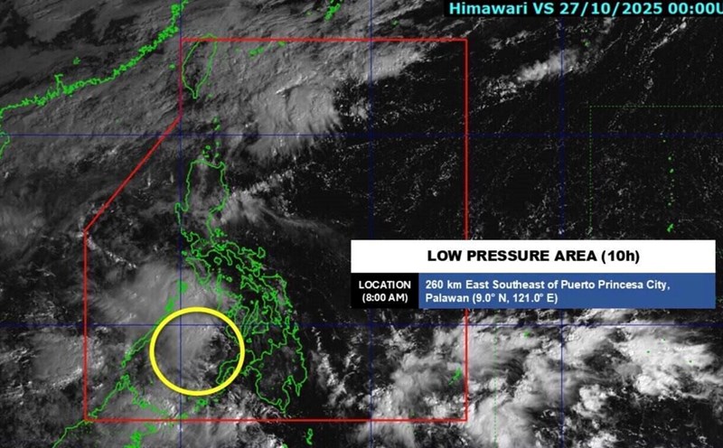
The first low pressure is a low pressure that forms in the Sulu Sea, the sea area near the Philippines and the East Sea. This low pressure has a wide range of influence, is likely to become a low pressure in the East Sea and head towards Vietnam but is unlikely to strengthen into a storm or tropical depression.
During the forecast period, a second low pressure is expected to form at the southeastern boundary of PAGASA's TCAD forecast area. This low pressure in the eastern Philippines is likely to enter the Philippine Forecast Area (PAR) during the week of October 29 to November 4.
Notably, this low pressure is likely to strengthen into a storm higher than the first low pressure. This potential low pressure system is expected to enter the East Sea, heading towards Vietnam during the week of November 5 to November 11.
The third low pressure near the Philippines is also likely to form during the week of October 29 to November 4 at the eastern boundary of PAGASA's TCID forecast area.
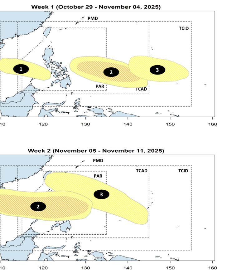
This low pressure is considered by Philippine weather forecasters to have little chance of strengthening into a storm. However, a third low pressure is likely to enter the Philippine PAR forecast area.
According to PAGASA's bulletin on October 29, storms or tropical depressions in the Philippines in October often have 4 main directions of movement.
First of all, a storm or depression forms in the western Pacific Ocean, entering the northeast of the PAR, not making landfall in the Philippines but turning towards Japan or South Korea.
Second, the storm or depression will make landfall in the Philippines in the central or northern Luzon area, enter the East Sea, towards Hong Kong (China) or China.
Third, the storm or low pressure near the Philippines makes landfall in central or southern Luzon, enters the East Sea and heads straight towards Vietnam.
Fourth, storms and depressions make landfall in the Visayas, Philippines, then enter the East Sea and head towards Vietnam.
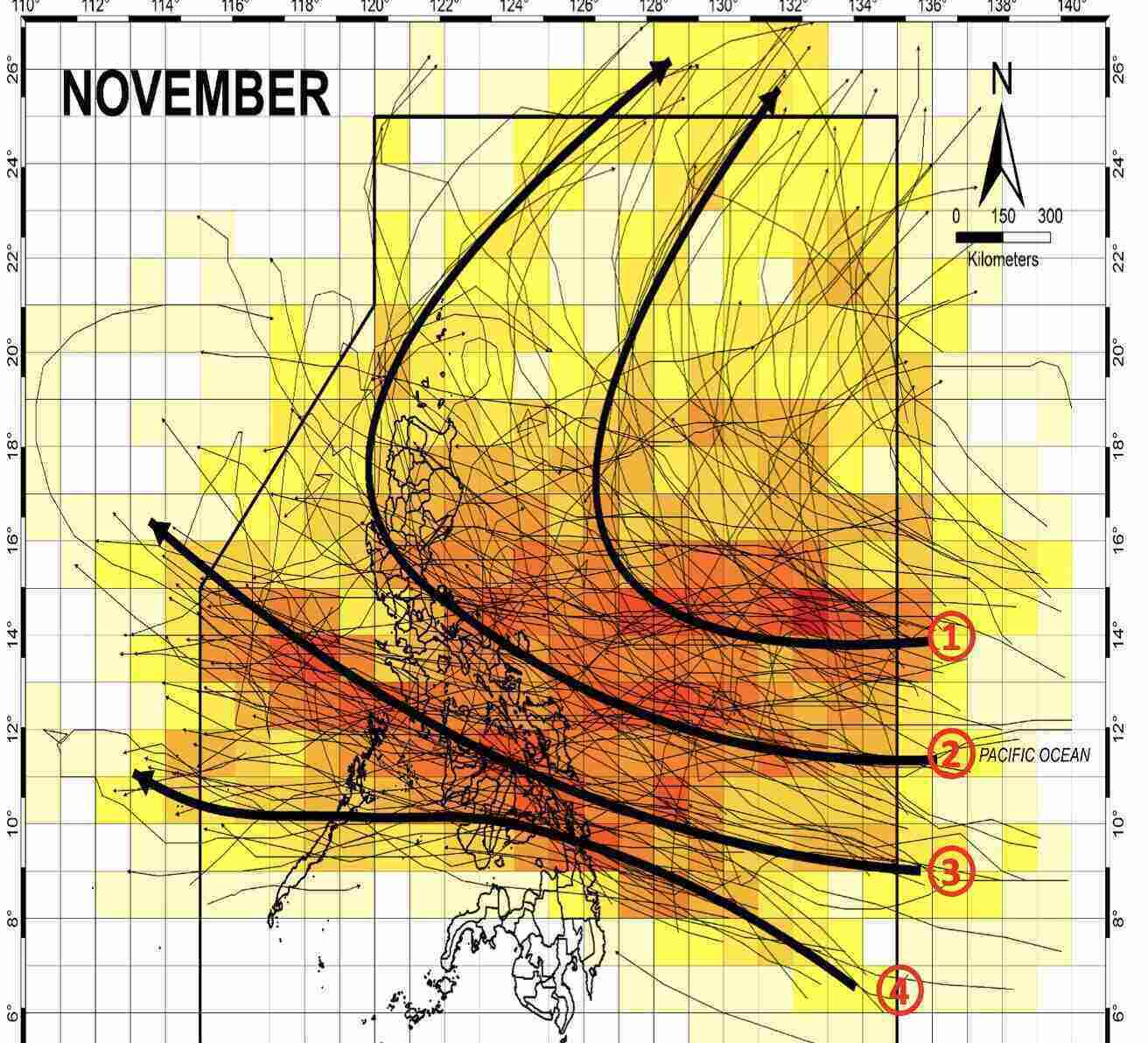
Meanwhile, the November typhoon or low pressure in the Philippines also has 4 moving directions. First, similar to October, storms or depressions form in the western Pacific, entering the northeastern part of the PAR, not making landfall in the Philippines but turning towards Japan or South Korea.
Second, the storm or depression will affect widely in north to south or central Luzon, Philippines, then leave the Philippines, loops towards Japan or South Korea.
Third, the storm or depression makes landfall between the Philippines, enters the East Sea and heads towards Vietnam.
Fourth, the storm or depression passes through the southern Visayas, Philippines then enters the East Sea, heading towards Thailand.