On October 27, the Philippine Atmospheric, Geophysical and Astronomical Services Administration (PAGASA) said that the two low pressure areas are likely to strengthen, possibly affecting the Philippines and neighboring areas of the East Sea in the next 2 weeks.
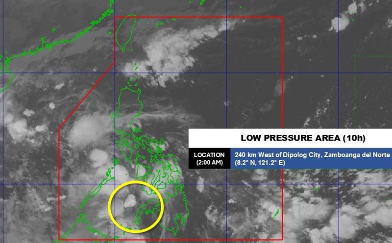
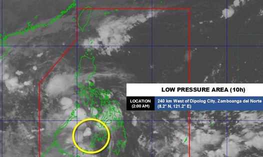
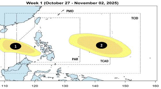
According to PAGASA, during the week of October 27 to November 2, low pressure area 1 (10am) in the Sulu Sea is likely to develop into a tropical depression or storm. This low pressure is forecast to pass Palawan and head towards the coast of Vietnam.
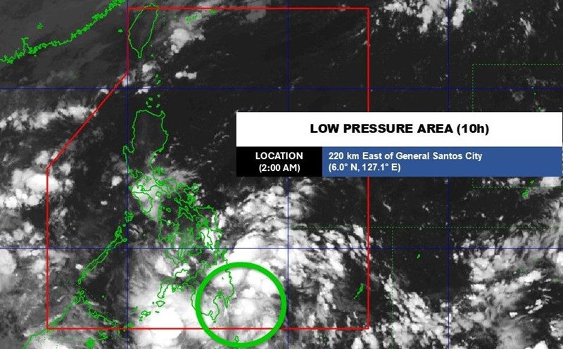
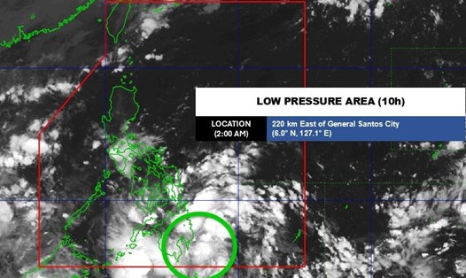
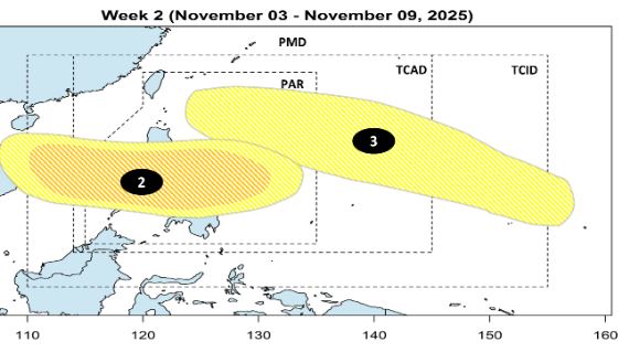
Low pressure 2 may form outside the Philippine Forecast Area (PAR) and move forward next week, with a moderate chance of developing into a tropical depression or storm.
During the week of November 3-9, low pressure 2 will enter PAR, passing through the South Luzon - Visayas area, towards the East Sea. The possibility of strengthening into a storm is low or moderate.
Also this week, a low pressure 3 may appear but the possibility of strengthening into a storm is assessed as low.
The first two storms of November are expected to be named Tino and Uwan. PAGASA said that in November, there are typically two to three typhoons forming or entering the PAR region, mainly affecting the Bicol, Calabarzon, Visayas and sometimes Northern Mindanao regions.
Due to the influence of La Nina and northeasterly winds, rainfall in the Philippines is forecast to double compared to average. In addition to the storm, the weather is also affected by the tropical convergence zone, the northeast monsoon, and the trough - where the cold and hot air masses intersect.
The forecast models of FNV3, GFS, ECMWF show the possibility of two consecutive storms appearing in the first half of November, possibly even reaching strong typhoon level, but PAGASA emphasizes that the scenario can still change.
Meanwhile, according to the Vietnam National Center for Hydro-Meteorological Forecasting, from now until the end of 2025, the East Sea may have 2 more storms or tropical depressions active, in which the possibility of directly affecting the mainland of Vietnam cannot be ruled out.
La Nina is forecast to peak in November and may last until the end of December, even into January 2026. History shows that years with strong La Nina often coincide with the season of active storms that are in full swing and last late.
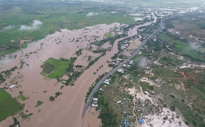
When La Nina reaches its peak in November, there is a high possibility that the East Sea will see more storms in November and December. This is a period of special need to be especially wary of extreme weather patterns such as late storms combined with cold air causing widespread heavy rain, especially in the Central and South Central regions.