The latest storm and low pressure news on the morning of May 22nd from the Philippine Atmospheric, Geophysical and Astronomical Services Administration (PAGASA) said that the low pressure being monitored inside the Philippine forecast area is unlikely to develop into a storm in the next 24 hours.
On the morning of May 22, this low pressure was about 940km southeast of Mindanao Island.
Although not forecast to strengthen into a tropical depression, the low pressure trough of this system may still cause rain in some areas of Mindanao in the next few days.
The Philippine weather agency issued a general flood warning for Davao and Caraga areas on the morning of May 22, and called on people to be cautious of the risk of rain affecting river systems in the area.
Along with the low pressure, easterly winds - i.e., warm winds from the Pacific - will continue to affect the rest of the Philippines.
Cebu province alone is forecast to have weather from light to cloudy, accompanied by showers or localized thunderstorms on May 22.
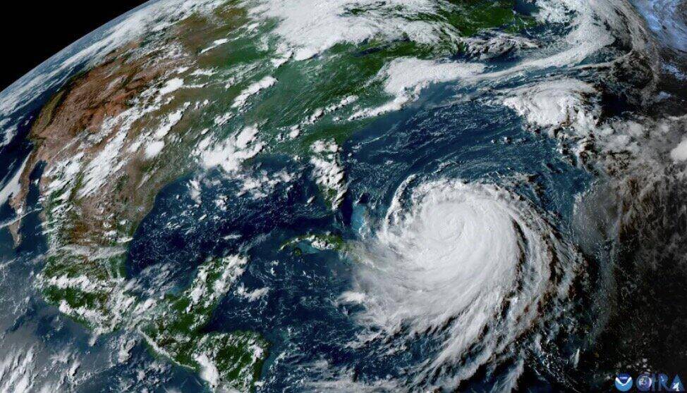
Also related to the storm forecast for the 2026 storm season, the US National Oceanic and Atmospheric Administration (NOAA) has completed the first forecast for this year's storm season. The Atlantic hurricane season will begin on June 1.
NOAA's expert team forecasts that this year's storm season will be lower than average, similar to forecasts by many other experts in recent weeks. One of the main reasons is the possibility of El Nino returning, even possibly unusually strong.
According to NOAA, the 2026 hurricane season has a 55% chance of being lower than average, 35% chance of being average and 10% chance of being higher than average.
From June 1 to November 30, the Atlantic region is forecast to have 8 to 14 named storms, including tropical storms and hurricanes.
Among them, NOAA forecasts that there will be about 3-6 storms developing into typhoons, and a maximum of 3 storms that can reach strong level (level 3 or higher).
Usually, an average Atlantic hurricane season has about 14 named storms, of which 7 become hurricanes and 3 storms reach a strong level.
The last time NOAA forecast the storm season below average was in 2015, when El Nino also appeared. That year, there were 12 named storms active throughout the basin.
El Nino is currently a topic of particular interest to weather forecasters because it can play a major role in the developments of the Atlantic hurricane season.
Currently, El Nino has not officially formed. However, according to the latest forecast from NOAA, the El Nino phenomenon may appear at the beginning of this summer and last at least until the end of the storm season.


