
According to storm news, the latest low pressure from the Philippine Atmospheric, Geophysical and Astronomical Services Administration (PAGASA), tropical storm Pilandok is accelerating northwest and preparing to leave the Philippine Area of Responsibility (PAR). However, the path of the storm in the coming days is forecast to have many notable changes.
At 4:00 AM on September 3rd (Philippines time), the center of Typhoon Pilandok was located at 25 degrees north latitude and 130.8 degrees east longitude, about 1,030km east-northeast of Luzon's northernmost point.
Typhoon Pilandok was officially recorded on September 2 and currently has maximum winds of 75 km/h, gusts up to 90 km/h, central pressure of 992 hPa. The typhoon is moving northwest at a speed of 20 km/h. The area with strong to typhoon-level winds extends up to 600 km from the center.
According to PAGASA forecasts, Pilandok will leave PAR on the morning of September 3rd and continue to move northwest. After that, the storm's diễn biến becomes more noteworthy.
Between September 4-6, Pilandok may be almost stationary before turning south. The forecast path forms a circle at sea, then the storm continues to change direction southeast on September 7 and moves northeast on September 8.
PAGASA forecasts that Typhoon Pilandok will maintain tropical storm intensity throughout the forecast period. The agency also noted that the storm's path may still change in subsequent reports.
Currently, Pilandok has not issued any tropical cyclone warnings. However, strong winds of storm level are still forecast in many areas due to the influence of the southwest monsoon (Habagat).
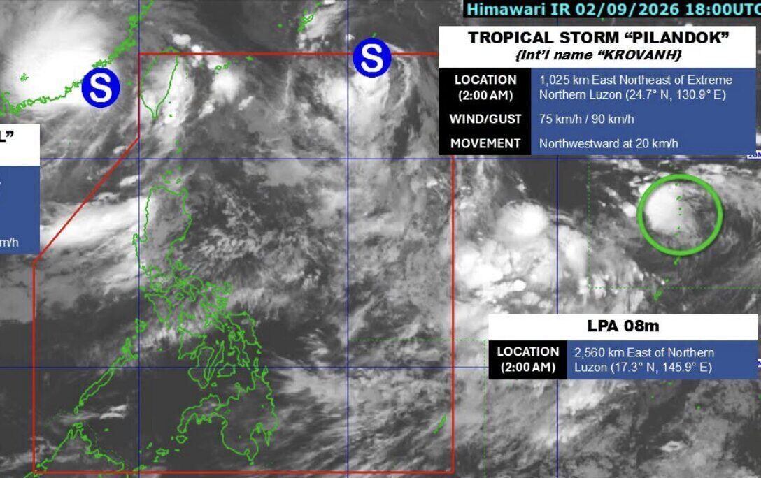
In addition to Pilandok, PAGASA is monitoring tropical storm Saudel. At 2:00 AM on September 3rd, Saudel was about 455km northwest of Itbayat, Batanes, with maximum winds of 75 km/h, gusts of 90 km/h and moving north-northeast at a speed of 15 km/h.
Meanwhile, the 08m low pressure area is located about 2,560km east of the northernmost part of Luzon. This system has not recorded specific wind intensity and PAGASA assesses that it is unlikely to develop into a tropical depression in the next 24 hours.
PAGASA recommends that people continue to follow new news reports, especially in areas at risk of heavy rain, strong winds, floods, flash floods and landslides.


